 Catalogue Shom
Observation de la terre et environnement
Type of resources
Available actions
Topics
Provided by
Years
Formats
Representation types
Update frequencies
status
Scale
Resolution
-
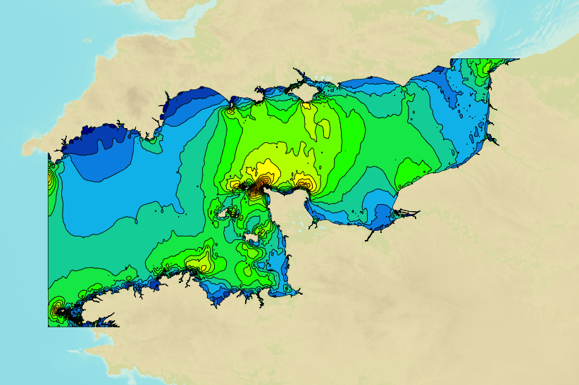
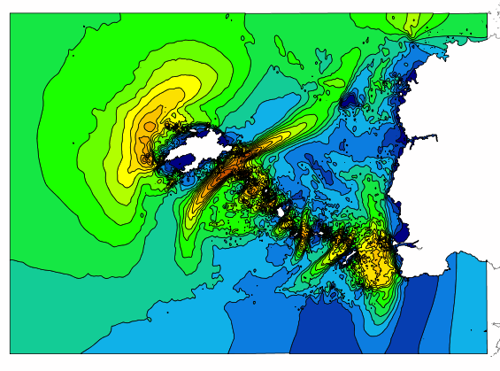
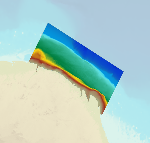
This product includes Shom 3D digital data on tidal currents in the Channel in shapefile and geotiff formats. These digital files provide information on tidal current components (speed and direction) on an hourly basis (6 hours either side of high water for a reference port), and for two typical tidal coefficients (45 and 95). Cherbourg is taken as the reference port. Three layers are available: Surface; mid-depth; and sea-bed.
-

In early 2017, Shom established a near-bottom turbidity observation network to measure turbidity and currents near the seabed continuously, at high frequency and over a long period of time (several years). Seven mooring points with ecological and / or sedimentological interests and impacted by anthropogenic activities (except the control point in the Celtic Sea) have thus been defined. The product "Turbidity Time Series ROEC" contains turbidity level records measured in NTU by optical turbidimeters implanted at each of the 7 wetting points of the monitoring network as well as currents recordings (speed (m/s) and direction (°) measured by a single-point current meter. The data present in the product "ROEC Turbidity Time Series" corresponds to raw data from NTUS sensors (Wetlabs) and Aquadopp (Nortek) deployed on different moorings and transcoded in .CSV format. The time series are provided in their entirety and have not been post-processed. The files can therefore include certain erroneous values related to specific anomalies in the acquisition made by the sensor or intervals without data when the acquisition knows ranges of interruption.
-
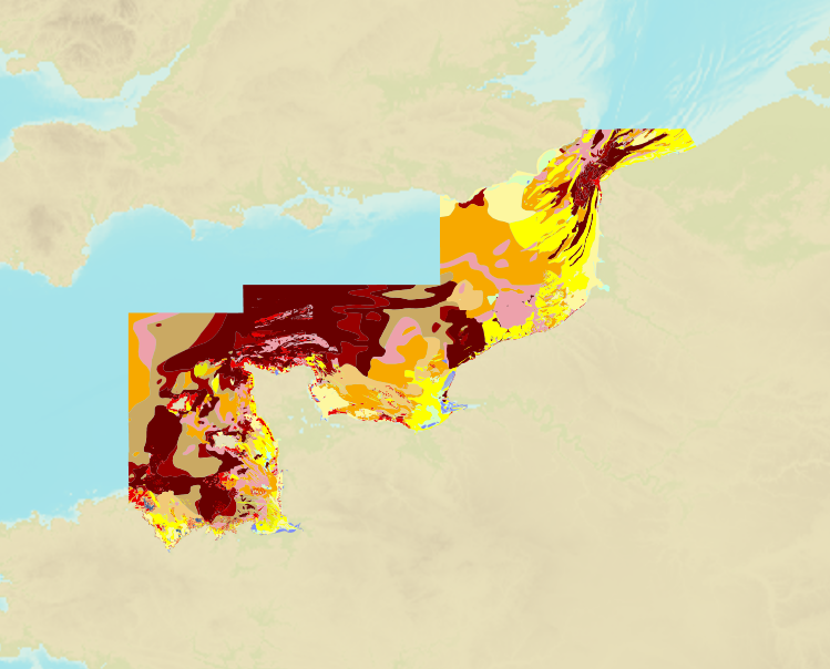
The product is a digital solution showing superficial sediments on the sea floor along coasts in mainland France.
-
The « Maritime Spatial Planning » product contains 2D areas vector objects representing the extent of the maritime spatial plan (« MSP Spatial Plan » layer) and the extent of the corresponding vocation zones (« MSP Zoning Element » layer), defined in each strategic façade document.
-
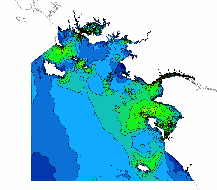
This product includes Shom 3D digital data on tidal currents in the area "Loire" in shapefile and geotiff formats. These digital files provide information on tidal current components (speed and direction) on an hourly basis (6 hours either side of high water for a reference port), and for two typical tidal coefficients (45 and 95). Saint-Nazaire is taken as the reference port. Three layers are available: Surface; mid-depth; and sea-bed.
-
This product includes Shom 3D digital data on tidal currents in the area "Loire" in shapefile and geotiff formats. These digital files provide information on tidal current components (speed and direction) on an hourly basis (6 hours either side of high water for a reference port), and for two typical tidal coefficients (45 and 95). Brest is taken as the reference port. Four layers are available: Surface; mid-depth; - 10 m above the sea bed and sea-bed.
-

The coastal topo- bathymetric DEM of a part of the Norman-Breton gulf with a resolution of 0.0002° (~ 20 m) was prepared as part of the PAPI Saint-Malo. It covers the Minquiers plateau in the north-west to the bay of Mont-Saint-Michel in the south-east. The DEM is designed to be implemented in the hydrodynamic models of the TANDEM project in order to estimate the coastal effects of tsunamis for the Atlantic and English Channel, where French nuclear power plants have been installed for about 30 years. This product is available with the Lowest Astronomic Tide (LAT) or the Mean Sea Level (MSL) as a vertical datum.
-

The bathymetric DEM for the coasts of New-Caledonia with a resolution of 0.001° (~ 100 m) was prepared in the framework of a Shom-IRD partnership as part of the TSUCAL project. The DEM covers the basin from New Caledonia in the west to the Vanuatu archipelago in the east. The DEM is designed to be used in hydrodynamic models in order to improve the pertinence of the Waves-Submersion monitoring programme.
-
The bathymetric DEM for the coasts of French Guiana with a resolution of 0.001° (~ 100 m) was prepared as part of the HOMONIM project. The DEM covers the entire Guyanese coast and part of Surinam to the west and Brazil to the east. Off-shore, the DEM covers the continental shelf and part of the slope. The DEM is designed to be used in hydrodynamic models in order to produce high-precision forecasts for coastal water levels and sea conditions and therefore improve the pertinence of the Waves-Submersion monitoring programme. This product is available with the Lowest Astronomic Tide (LAT) or the Mean Sea Level (MSL) as a vertical datum.
-
The product "Distribution of the submarine dunes of the French continental shelf" contains digital vector data provided as 2D linear objects representing the crest of submarine dunes digitized from bathymetric surveys conducted by the Shom. When several surveys have been carried out on the same area or dune, the product contains the information from all the surveys. However, the data displayed on data.shom.fr is limited to the information from the most recent survey.