 Catalogue Shom
50000
Type of resources
Available actions
Topics
Keywords
Provided by
Years
Formats
Representation types
Update frequencies
status
Scale
-
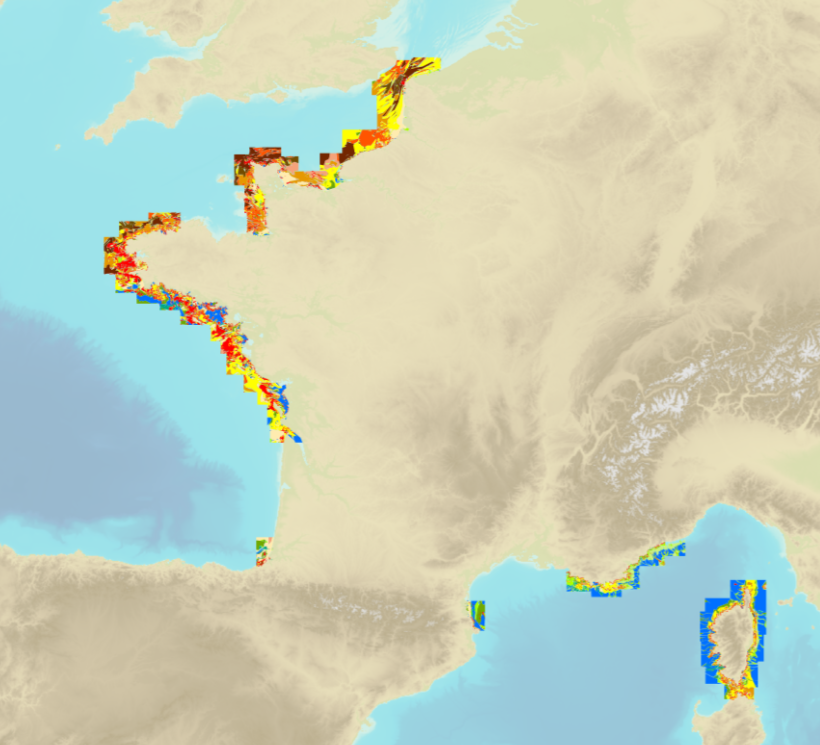
The product "Sea bed sediment 1:50 000" contains 2D surface objects geo-referenced digital data describing the nature of the geological seabed (nature of the sediment, including rock type seabed).
-
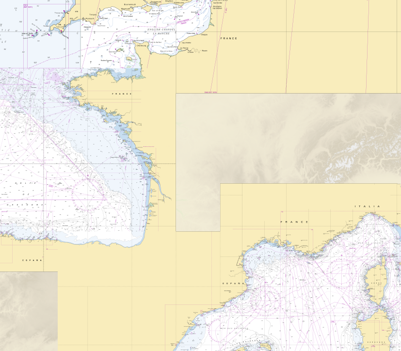
RasterMarine is a series of digital images taken from nautical charts, with no additions, legends or georeferencing information. The RasterMarine range is available at five sets of scales: - RasterMarine 20 1: 20,000 - RasterMarine 50 1: 50,000 - RasterMarine 150 1: 150,000 - RasterMarine 400 1: 400,000 - RasterMarine 1M 1: 1,000,000. Unless exceptional circumstances apply, the RasterMarine range is updated on a weekly basis and the modified grid squares are re-published, replacing the previous versions. All corrections, publications and editions with an effect on the reference nautical charts are taken into consideration. <br /> 27/11/2025 version <br />
-
The product "Sea bed sediment 1:50 000" contains 2D surface objects geo-referenced digital data describing the nature of the geological seabed (nature of the sediment, including rock type seabed).
-
Seamless Shom nautical charts - West Africa is a product composed of digital images taken from Shom nautical charts, with no additions, legends or georeferencing information. At a given scale, it is possible to view only the maps with a scale that allows a correct display. The footprint of all the maps composing this product are shown. Unless exceptional circumstances apply, this product is updated on a monthly basis and the modified grid squares are re-published, replacing the previous versions. All corrections, publications and editions with an effect on the reference nautical charts are taken into consideration.
-
Seamless Shom nautical charts - West Africa - EAtHC is a product composed of digital images taken from Shom nautical charts, with no additions, legends or georeferencing information. At a given scale, it is possible to view only the maps with a scale that allows a correct display. The footprint of all the maps composing this product are shown. Unless exceptional circumstances apply, this product is updated on a monthly basis and the modified grid squares are re-published, replacing the previous versions. All corrections, publications and editions with an effect on the reference nautical charts are taken into consideration.
-
Les produits RasterMarine se composent d'images numériques issues des cartes marines, sans habillage, ni légende, ni indications de géoréférencement. Les produits RasterMarine se déclinent en cinq gammes d'échelles : - RasterMarine20 1: 20 000 ; - RasterMarine50 1: 50 000 ; - RasterMarine150 1: 150 000 ; - RasterMarine400 1: 400 000 ; - RasterMarine1M 1: 1 000 000.