 Catalogue Shom
notPlanned
Type of resources
Available actions
Topics
Keywords
Provided by
Years
Formats
Representation types
Update frequencies
status
Scale
Resolution
-

The update of the coastal topo-bathymetric DEM of the Gironde estuary - downstream with a resolution of 0.0002° (~ 20 m) was carried out in the third phase of the HOMONIM project. This DEM covers the downstream part of the Gironde estuary, from Pauillac to its mouth. It is complementary to the DEM covering the upstream estuary. The DEM is intended to be implemented in hydrodynamic models in order to produce forecasts as accurate as possible of water heights and sea states at the coast to improve the relevance of the Wave-Submergence Vigilance. This product is available with either the Lowest Astronomic Tide (LAT) or the Mean Sea Level (MSL) as a vertical reference.
-
Datasets with homogeneous quality (the meaning of IHO) composed of datasets done by Shom.
-
Datasets with homogeneous quality (the meaning of IHO) composed of datasets done by Shom.
-
Datasets with homogeneous quality (the meaning of IHO) composed of datasets done by Shom.
-
Datasets with homogeneous quality (the meaning of IHO) composed of datasets done by Shom.
-
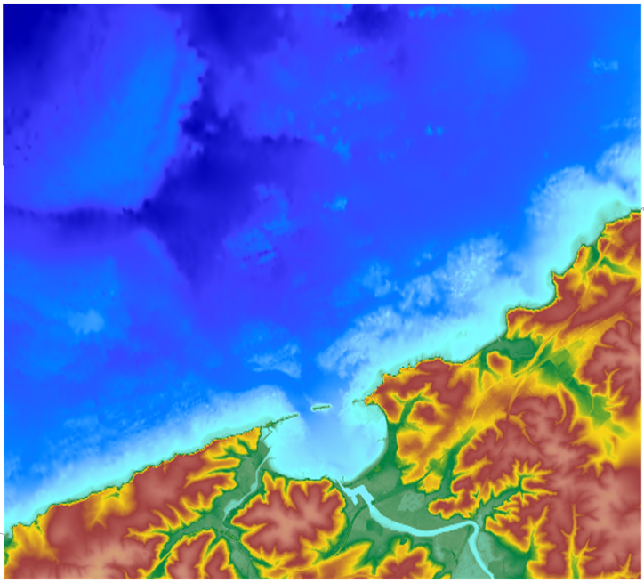
The coastal topo- bathymetric DEM for the coasts of the Saint-Jean-de-Luz bay with a resolution of 0.0002° (~ 20 m) was prepared as part of the TANDEM project. It covers Saint-Jean-de-Luz bay and the surrounding area. The DEM is designed to be implemented in the hydrodynamic models of the TANDEM project in order to estimate the coastal effects of tsunamis for the Atlantic and English Channel, where French nuclear power plants have been installed for about 30 years. This product is available with the Lowest Astronomic Tide (LAT) or the Mean Sea Level (MSL) as a vertical datum.
-
Datasets with homogeneous quality (the meaning of IHO) composed of datasets done by Shom.
-
Datasets with homogeneous quality (the meaning of IHO) composed of datasets done by Shom.
-
Datasets with homogeneous quality (the meaning of IHO) composed of datasets done by Shom.
-
Datasets with homogeneous quality (the meaning of IHO) composed of datasets done by Shom.