 Catalogue Shom
topography
Type of resources
Available actions
Topics
Keywords
Provided by
Representation types
Update frequencies
status
-
The coastal topo- bathymetric DEM for the coasts of Boulogne-Sur-Mer with a resolution of 0.0001° (~ 10 m) was prepared as part of the TANDEM project (Programme Investissements d'Avenir, ANR-11-RSNR-00023-01). The DEM covers the entire Boulogne-sur-Mer port, from north of Wimereux to south of the Boulogne-sur-Mer urban sprawl. The DEM is designed to be implemented in the hydrodynamic models of the TANDEM project in order to estimate the coastal effects of tsunamis for the Atlantic and English Channel, where French nuclear power plants have been installed for about 30 years. This product is available with the Lowest Astronomic Tide (LAT) or the Mean Sea Level (MSL) as a vertical datum.
-
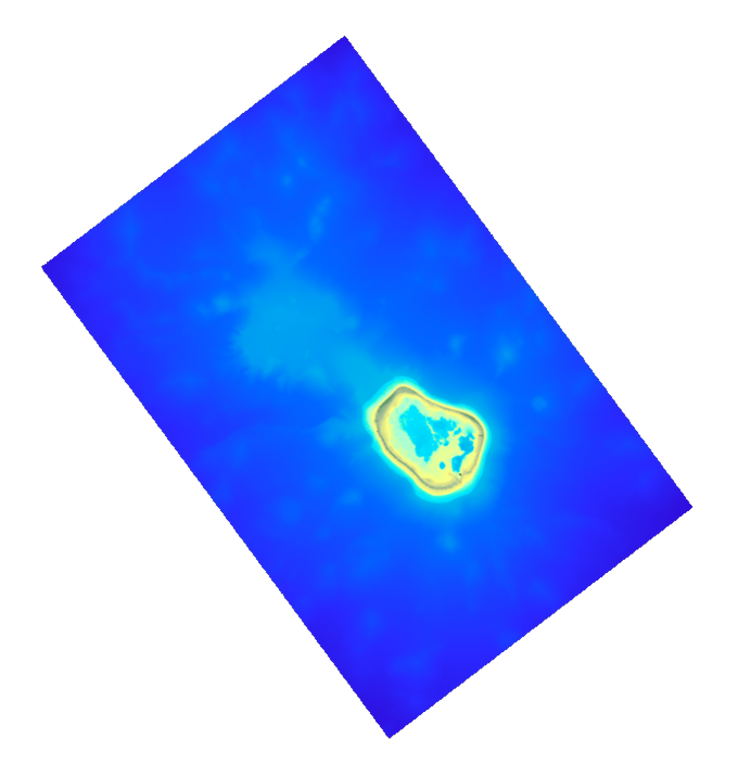
The coastal topo-bathymetric DEM was produced using the bathymetric and topographic data acquired between 2012 and 2015 by Shom and the PASSION programme team. The 20 m coastal grid covers the Passion atoll – Clipperton and the local flanks of the atoll to a depth of 1500 m. Passion island - Clipperton, in the eastern Pacific Ocean, is a remote uninhabited atoll over 5,000 km from Tahiti in French Polynesia and over 1,000 km from the Mexican coasts. Passion island is the highest point on the Clipperton ridge, and the only location above water level. This is the only coral atoll in the eastern Pacific in the northern hemisphere, at a longitude of W 109° and a latitude of N 10°.
-
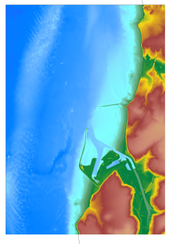
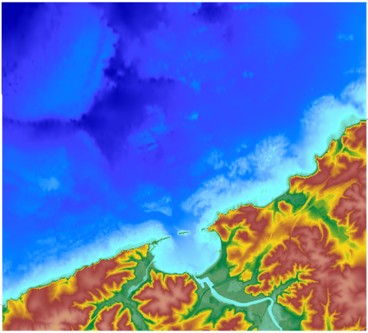
The coastal topo- bathymetric DEM for the coasts of the straight of Pas-de-Calais with a resolution of 0.0002° (~ 20 m) was prepared as part of the TANDEM project. The DEM covers the eastern Channel and southern North Sea, including the French coast of the Nord - Pas-de-Calais administrative department and part of the British coast, in the county of Kent, and the south part of the Thames estuary up to Rye. The DEM is designed to be implemented in the hydrodynamic models of the TANDEM project in order to estimate the coastal effects of tsunamis for the Atlantic and English Channel, where French nuclear power plants have been installed for about 30 years. This product is available with the Lowest Astronomic Tide (LAT) or the Mean Sea Level (MSL) as a vertical datum.
-
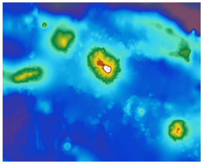
The bathymetric DEM was produced using the bathymetric and topographic data acquired between 2012 and 2015 by Shom and the PASSION programme team. The extent of the 100 m coastal grid covers an extended area around Passion Island – Clipperton, Mount Queiros, Mount Cermeno, and adjacent shallow waters. Passion island - Clipperton, in the eastern Pacific Ocean, is a remote uninhabited atoll over 5,000 km from Tahiti in French Polynesia and over 1,000 km from the Mexican coasts. Passion island is the highest point on the Clipperton ridge, and the only location above water level. This is the only coral atoll in the eastern Pacific in the northern hemisphere, at a longitude of W 109° and a latitude of N 10°.
-
The coastal topo- bathymetric DEM for the coasts of the Saint-Jean-de-Luz bay with a resolution of 0.0002° (~ 20 m) was prepared as part of the TANDEM project. It covers Saint-Jean-de-Luz bay and the surrounding area. The DEM is designed to be implemented in the hydrodynamic models of the TANDEM project in order to estimate the coastal effects of tsunamis for the Atlantic and English Channel, where French nuclear power plants have been installed for about 30 years. This product is available with the Lowest Astronomic Tide (LAT) or the Mean Sea Level (MSL) as a vertical datum.
-
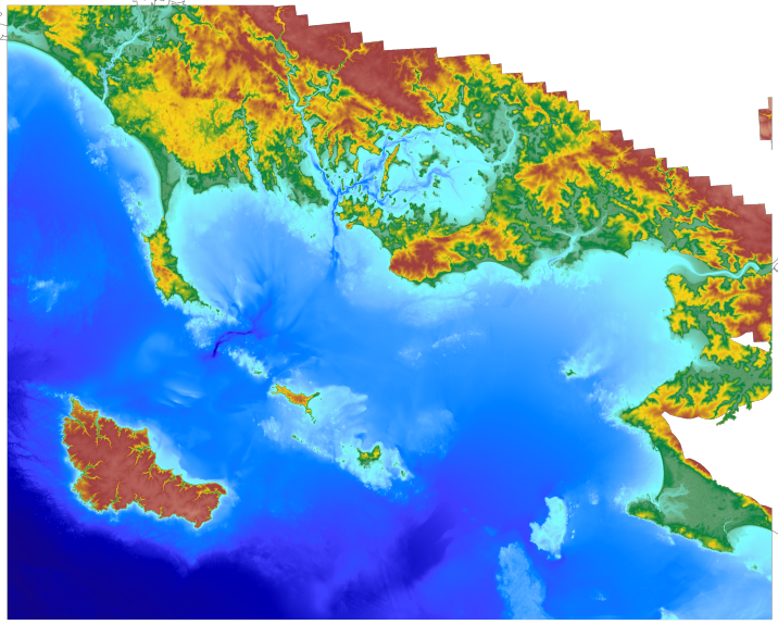
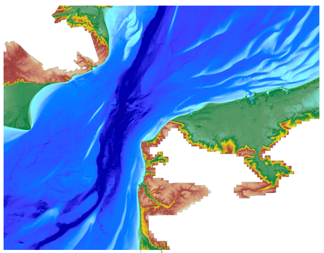
The coastal topo- bathymetric DEM for the coasts of Morbihan with a resolution of 0.0002° (~ 20 m) was prepared as part of the TANDEM project (Programme Investissements d'Avenir, ANR-11-RSNR-00023-01). It covers the French administrative department of Morbihan and part of Loire-Atlantique. This DEM runs from the Gâvres peninsula in the north west to La Baule in the south east and covers the Gulf of Morbihan, the Quiberon bay and peninsula, Houat, Hoëdic and Belle-Ile islands and the Vilaine estuary. The DEM is designed to be implemented in the hydrodynamic models of the TANDEM project in order to estimate the coastal effects of tsunamis for the Atlantic and English Channel, where French nuclear power plants have been installed for about 30 years. This product is available with the Lowest Astronomic Tide (LAT) or the Mean Sea Level (MSL) as a vertical datum.