 Catalogue Shom
Limites
Type of resources
Available actions
Topics
Provided by
Years
Formats
Representation types
Update frequencies
Scale
-
The combined error grid of the SIO V31 gravity anomaly model (D. T. Sandwell, H. Harper, B. Tozer et al., Gravity field recovery from geodetic altimeter missions, Advances in Space Research, https://doi.org/10.1016/j.asr.2019.09.011) is computed with a method described in a paper submitted to Earth and Space Science (AGU). The model’s extension is North Atlantic.
-
Compilation of marine gravity surveys acquired in the Northeast Atlantic by Shom between 2001 and 2016. These surveys were compiled to perform a quantification of the error of the gravity anomaly models derived from satellite altimetry. This dataset represents more than 22,000 measurement points distributed in 9 ascii survey files sampled at 1 kilometer. The file’s format is as follows: longitude latitude Gravity_anomaly error line_label.
-
Limites définissant les classes de navires en fonction des zones maritimes dans lesquelles ils opèrent. Ces limites ont été produites par le CEREMA en application de la directive 2009/45/CE, les classes des zones maritimes sont définies par l'article 223.2 du règlement annexé à l'arrêté du 23 novembre 1987 relatif à la sécurité des navires.
-
In the absence of a maritime boundary agreement with a neighbouring State, the French Republic can unilateraly claim a delimitation. This boundary has indeed a provisional aspect pending the ratification of a boundary agreement. The theme "Maritime limits unilaterally claimed" gathers those limits unilaterally claimed by France. Some of those elkements are published by decree.
-
La catégorie de navigation pour laquelle un navire est autorisé à naviguer est indiquée sur son permis de navigation, ainsi que, le cas échéant, les restrictions dont elle est assortie. Cette limite a été produite par le SHOM en application du paragraphe II.14 de l’article 1 du décret n° 84-810 modifié du 30 août 1984, les catégories de navigation sont définies par l'article 110.10 du règlement annexé à l'arrêté du 23 novembre 1987 relatif à la sécurité des navires.
-
Zones de recherches et secours (SAR)
-
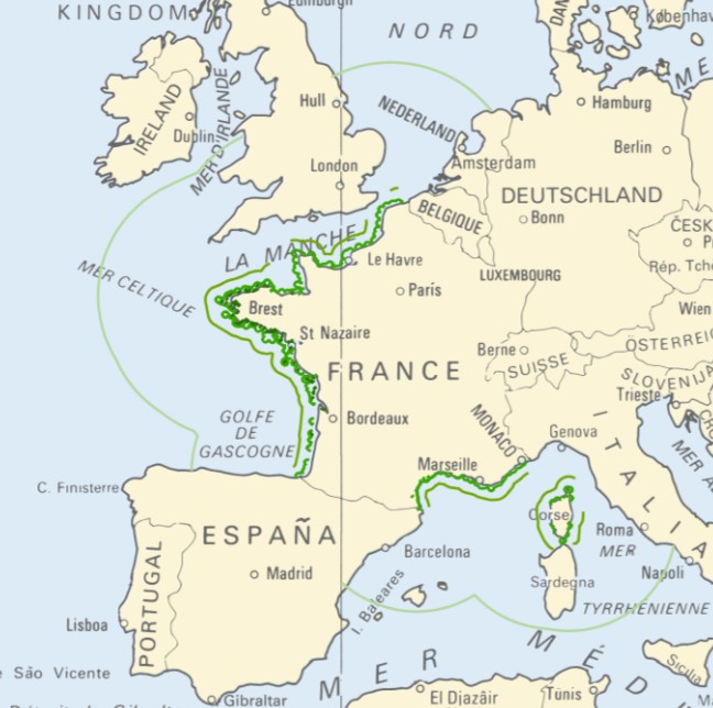
<strong>This data is not up to date with the order dated 30 August 2021 amending the order dated 23 November 1987 on ship safety, which now raises the limit for category 4 ships to 5 miles from the nearest coast.</strong> The navigation category allocated to a ship is indicated on its shipping license, together with any applicable restrictions. This limit was produced by Shom in application of section II.14 of article 1 of decree no. 84-810 amended on 30 August 1984. Navigation categories are defined in article 110.10 of the rules appended to the order of 23 November 1987 on shipping safety.
-
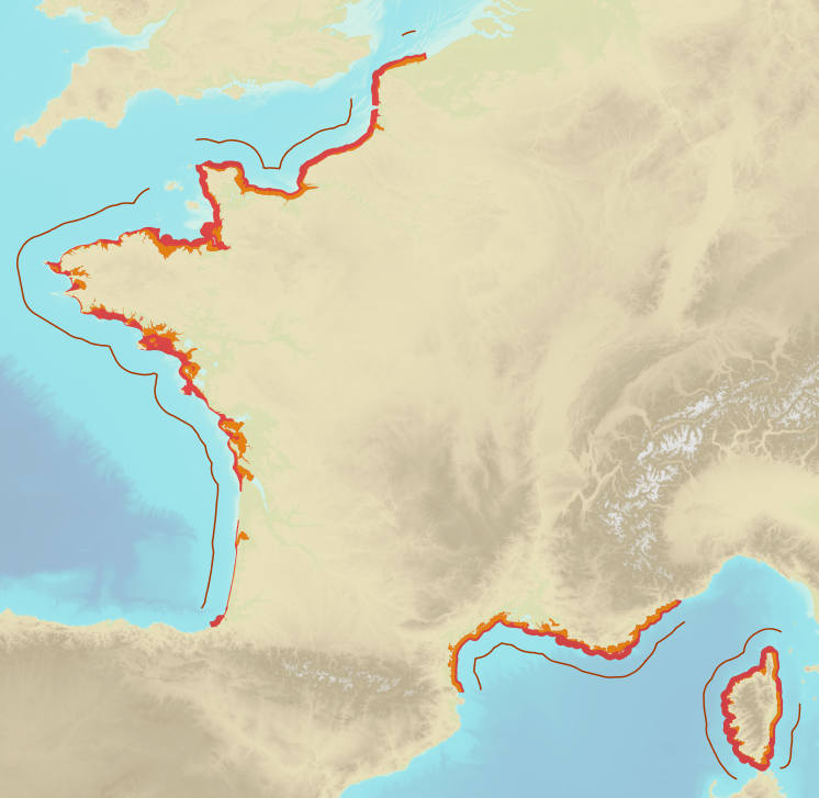
Limits defining ship classes based on their assigned operating maritime zones. These limits were produced by CEREMA in application of section II.14 of article 1 of decree no. 200945 amended on 30 August 1984. Navigation categories are defined in article 223.2 of the rules appended to the order of 23 November 1987 on shipping safety.