 Catalogue Shom
boundaries
Type of resources
Available actions
Topics
Keywords
Contact for the resource
Provided by
Years
Formats
Representation types
Update frequencies
Scale
-
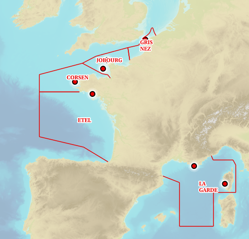
The Regulation (EU) No 1380/2013 of European Parliament and Council of 11 December 2013, in its second paragraph of Article 5, authorises Member States to establish coastal waters along its coasts. Those areas enable member States to restrain fisheries to specific species to specific Member States following precise rules (quotas, limited fishery season). The description of the French coastal waters is established in Part 6 of Appendix 1. The coastal waters extend from 6 nautical miles from in force baselines to 12 nautical miles from in force baselines. Only portions of the French coasts are concerned.
-
In compliance with Article 33 of UNCLOS, the outer limit of the contiguous zone is located at 24 nautical miles from the baselines. The objects of the theme "Outer limit of the contiguous zone" result from Shom computations and are compliant with Article 10 of the French Order No 2016-1687 of 8 December 2016.
-
Information layer containing the SAR Zones (Search and Rescue). This layer contains a description of the French search and rescue (SAR) areas and the location of the associated Maritime Rescue Coordination Center (MRCC). it covers the areas of responsibility of France. The layer was produced by the Shom pursuant to the Circular Circular of the International Maritime Organization (IMO No. SAR.8 / Circ.4 of 1 December 2012).
-
In the absence of a maritime boundary agreement with a neighbouring State, the French Republic can unilateraly claim a delimitation. This boundary has indeed a provisional aspect pending the ratification of a boundary agreement. The theme "Maritime limits unilaterally claimed" gathers those limits unilaterally claimed by France. Some of those elkements are published by decree.
-
The combined error grid of the SIO V31 gravity anomaly model (D. T. Sandwell, H. Harper, B. Tozer et al., Gravity field recovery from geodetic altimeter missions, Advances in Space Research, https://doi.org/10.1016/j.asr.2019.09.011) is computed with a method described in a paper submitted to Earth and Space Science (AGU). The model’s extension is North Atlantic.
-
The contiguous zone is adjacent to the territorial sea and may not extend beyond 24 nautical miles from the baselines from which the breadth of the territorial sea is measured. The coastal State may exercise the control necessary to: - prevent infringement of its customs, fiscal, immigration or sanitary laws and regulations within its territory or territorial sea; - punish infringement of the above laws and regulations committed within its territory or territorial sea.
-
The United Nations Convention on the law of the sea (UNCLOS) introduced a new definition of the continental shelf which can extend “to the outer edge of the continental margin, or to a distance of 200 nautical miles from the baselines from which the breadth of the territorial sea is measured where the outer edge of the continental margin does not extend up to that distance.” Coastal States can thus have a continental shelf of 200 nautical miles even in the absence of a geomorphological continental shelf, and a continental shelf extending beyond that limit where the presence of certain geomorphological and sedimentary criteria have been recognized by the Commission on the Limits of the Continental Shelf (CLCS). The rights coastal State can exercise over the continental shelf are specified in Part VI of the UNCLOS. These rights are sovereign and exclusive over the seabed and subsoil, for exploration and exploitation of natural mineral, fossil and biological resources. The French authorities also hold competence recognized by the UNCLOS for: - construction, operation and use of artificial islands and installations; - marine scientific research; - issuing consent for the course of any pipeline; - issuing consent for the course of cables installed or used for exploitation of the continental shelf or of its resources.
-
French Ministry of Culture / DRASSM - Shom The product "Limit of preventive archeology licence fee" contains the limits for the preventive archeology licence fee (1 nautical mile) as defined in the French Heritage Code. This limit is managed by the Department of Underwater Archeological Research (DRASSM) of the Ministry of Culture. This limit, defined by the Heritage Code at 1 nautical mile from the low-water line, permits to delineate the areas where the licence fee for preventive archeology at sea is applied. The product "Limit of preventive archeology licence fee" is to use in addition to the digital product “Maritime Limits and Boundaries” of Shom (French: “Délimitations maritimes”) which represents the limits of the French maritime spaces of sovereignty or jurisdiction through the World. The product “Maritime Limits and Boundaries” (French: “Délimitations maritimes”) can be viewed and downloaded on the French national portal of maritime limits (https://maritimelimits.gouv.fr).
-
In compliance with Article 57 of UNCLOS, the outer limit of the exclusive economic zone (EEZ) is located at 24 nautical miles from the baselines. This limit distinguishes the EEZ from the High Sea. Beyond this limit, an extension of the continental shelf is possible subject to the criterias of Article 76 of UNCLOS. The objects of the theme "Outer limit of the exclusive economic zone" result from Shom computations and are compliant with Article 10 of the French Order No 2016-1687 of 8 December 2016. They are published by decree of the French Republic.
-
The territorial sea extends from the baselines to a maximum distance of 12 nautical miles, calculated from the baselines. The State has full sovereignty over the bed and subsoil, surface and underlying water column and air space. Sovereignty shall not, however, hinder the right of innocent passage of which the ships of all States benefit in the territorial sea.