 Catalogue Shom
150000
Type of resources
Available actions
Topics
Keywords
Provided by
Years
Formats
Representation types
Update frequencies
status
Scale
-
Seamless Shom nautical charts - West Africa is a product composed of digital images taken from Shom nautical charts, with no additions, legends or georeferencing information. At a given scale, it is possible to view only the maps with a scale that allows a correct display. The footprint of all the maps composing this product are shown. Unless exceptional circumstances apply, this product is updated on a monthly basis and the modified grid squares are re-published, replacing the previous versions. All corrections, publications and editions with an effect on the reference nautical charts are taken into consideration.
-
Seamless Shom nautical charts - West Africa - EAtHC is a product composed of digital images taken from Shom nautical charts, with no additions, legends or georeferencing information. At a given scale, it is possible to view only the maps with a scale that allows a correct display. The footprint of all the maps composing this product are shown. Unless exceptional circumstances apply, this product is updated on a monthly basis and the modified grid squares are re-published, replacing the previous versions. All corrections, publications and editions with an effect on the reference nautical charts are taken into consideration.
-
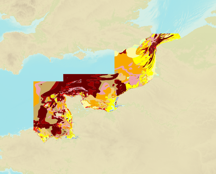
The product is a digital solution showing superficial sediments on the sea floor along coasts in mainland France.
-
DW Routes to Ijmuiden and Texel; North Sea - Netherlands; Routiers et planisphères; Édition 6 du 26/12/2024
-
Le produit Image numérique géoréférencée de carte marine est un fichier numérique, image de la carte marine imprimée correspondante du Shom ou de son (ses) cartouche(s), avec indications de géoréférencement et comprenant les mentions hors cadre.
-
Carte marine imprimée N°7708 De Oued Tensifte à Cap Ghir
-
Le produit Image numérique géoréférencée de carte marine est un fichier numérique, image de la carte marine imprimée correspondante du Shom ou de son (ses) cartouche(s), avec indications de géoréférencement et comprenant les mentions hors cadre.
-
Le produit Image numérique géoréférencée de carte marine est un fichier numérique, image de la carte marine imprimée correspondante du Shom ou de son (ses) cartouche(s), avec indications de géoréférencement et comprenant les mentions hors cadre.
-
Borkum to Neuwerk and Helgoland; North Sea, Netherlands and Germany; Cartes de cabotage; Édition 1 du 21/03/2019
-
Juzur Ashrafi Islands to Safaga (Bur Safajah) and Strait of Tiran; Red Sea - Egypt and Saudi Arabia; Cartes de cabotage; Édition 6 du 04/09/2025