 Catalogue Shom
irregular
Type of resources
Available actions
Topics
Keywords
Provided by
Years
Formats
Representation types
Update frequencies
status
Scale
Resolution
-
The Tidal stream atlas netcdf product – Northern Brittany provides tidal current data for an area stretching from Tregastel at the east of the area to Porsguen at the west. The product consists of two gridded files with different spatial resolutions covering the Northern Brittany area (overall view at 500 m) and the geographical area of the port of Roscoff (250 m). The U and V velocities of the tidal currents depend on the tidal conditions considered at mean neap and spring tidal rates. The data are provided in m/s for the surface layer. The times are given in relation to high tide at the reference port chosen in the area and are provided from 6 hours before to 6 hours after that reference.
-
The Tidal stream atlas netcdf product – Northern Brittany provides tidal current data for an area stretching from Tregastel at the east of the area to Porsguen at the west. The product consists of two gridded files with different spatial resolutions covering the Northern Brittany area (overall view at 500 m) and the geographical area of the port of Roscoff (250 m). The U and V velocities of the tidal currents depend on the tidal conditions considered at mean neap and spring tidal rates. The data are provided in m/s for the surface layer. The times are given in relation to high tide at the reference port chosen in the area and are provided from 6 hours before to 6 hours after that reference.
-
"Aids ton navigation" product contains a description of landmarks, beaconage or buoyage, in the French Exclusive Economic Zone (EEZ). <br /> June 17 2026 version
-
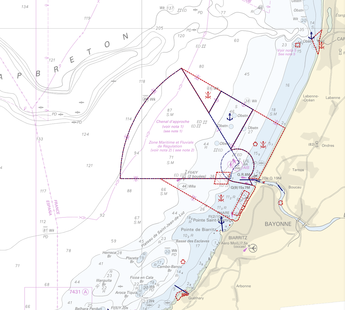
"Regulation - Navigation" product contains 18 object classes, the acronyms used are those of IHO standard S-57 - International Hydrographic Organization – (https://iho.int/): - Anchorage area (ACHARE): an area in which vessels anchor or may anchor. - Anchor berth (ACHBRT): a designated area of water where a single vessel, sea plane, etc. may anchor. - Administration Area (Named) (ADMARE) - Cable area (CBLARE) - Coastguard station (CGUSTA) - Cargo transhipment area (CTSARE) - Distance mark (DISMAR): mark indicating the distance on canals or rivers. - Dumping ground (DMPGRD): sea area where dredged material or other potentially more harmful material e.g. explosives, chemical waste, is deliberately deposited. - Fairway (FAIRWY): part of a river, harbour etc. where the main navigable channel for vessels of larger size lies. It is also the usual course followed by vessels entering or leaving harbours and sometimes called "ship channel". - Ice area (over land or water) (ICEARE) - Local magnetic anomaly (LOCMAG): anomaly of the magnetic field of the earth, extending over a relatively small area, due to local magnetic influences. - Marine farm/culture (MARCUL) - Navigation line (NAVLNE): a line generally passing through two clearly defined charted landmarks, and along part of which a vessel can approach safely. - Pipeline area (PIPARE) - Recommended track (RECTRC): track of undefined width, recommended to all or only certain vessels. - Restricted area (RESARE): specified area designated by an appropriate authority within which navigation is restricted in accordance with certain specified conditions. - Sea-plane landing area (SPLARE) Detailed definitions of each of these object classes can be found in the S-57 standard (https://iho.int/en/standards-and-specifications). An online catalog is available at http://www.s-57.com/. Some of the symbols used for display on data.shom.fr portal have been adapted from icons from the OpenSeaMap open library (https://github.com/OpenNauticalChart/). For reasons of readability, not all the characteristics of the objects are systematically displayed. All available information can be consulted by querying this layer.
-
This service allows users to view surface tidal current predictions calculated from the analysis of a high-resolution hydrodynamic simulation projected onto a 250 m grid. This service was built by Shom and funded by French CCI Métropolitaine Bretagne Ouest in the frame of the Atlantic Blue Port project of <a href="https://www.atlanticarea.eu" target="_blank">Interreg Atlantic Area</a> european program.
-
This service allows users to view surface tidal current predictions calculated from the analysis of a high-resolution hydrodynamic simulation projected onto a 500 m grid.
-
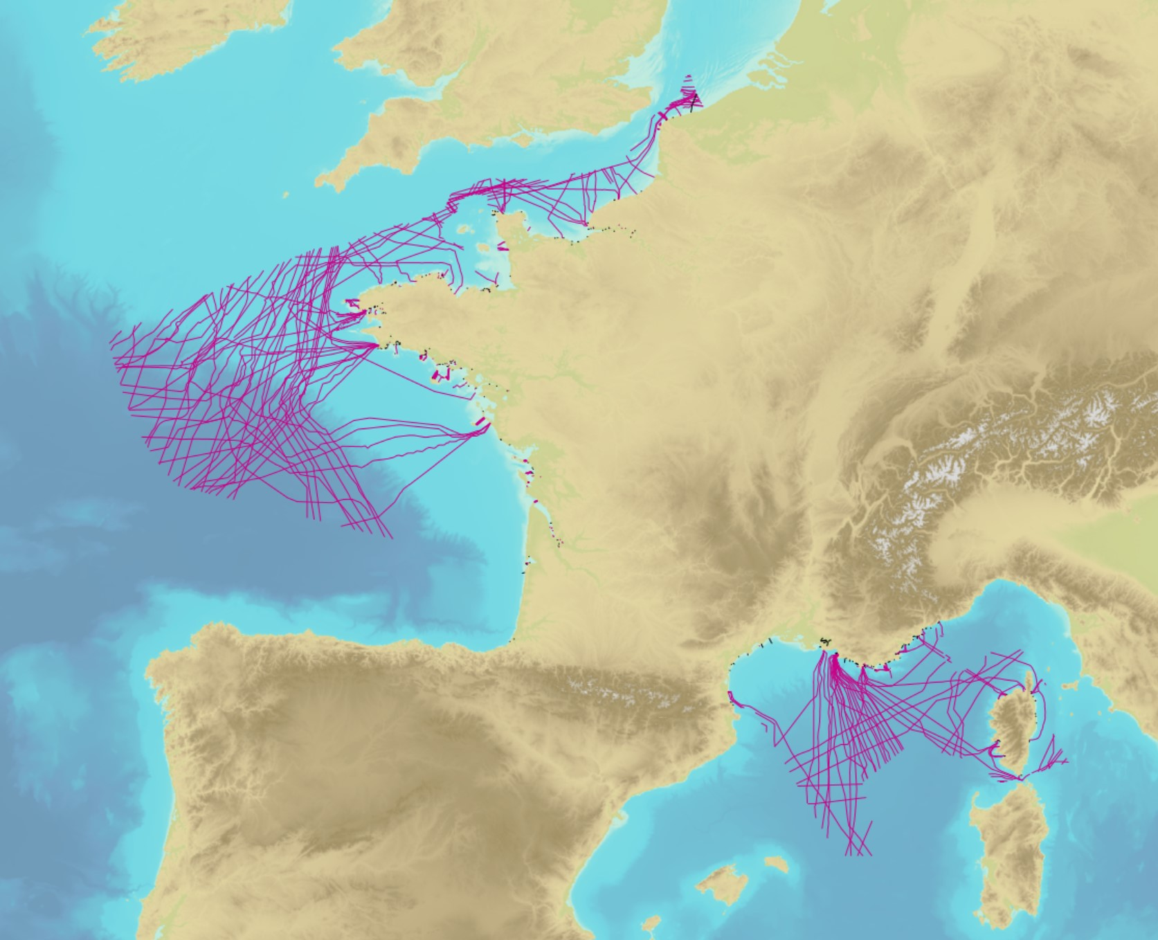
The product contains a description of submarine cables and pipelines brought to the attention of Shom on French areas of responsibility. These are 2D linear objects of the seabed that divide into two categories: • The submarine cables: these are cables placed on the seabed where electricity or information (telecommunication) flows. They represent the vast majority of objects (more than 90%); • Emissaries and submarine pipes: these are pipes that allow the discharge, sampling or circulation of fluids.
-
The Tidal stream atlas netcdf product – Normand-Breton Gulf provides tidal current data for an area stretching from Cherbourg at the east of the area to Tregastel at the west. The product consists of a unique gridded file with 500 m spatial resolution covering the Normand-Breton Gulf, including The Channel Islands. The U and V velocities of the tidal currents depend on the tidal conditions considered at mean neap and spring tidal rates. The data are provided in m/s for the surface layer. The times are given in relation to high tide at the reference port chosen in the area and are provided from 6 hours before to 6 hours after that reference.
-
The Tidal stream atlas netcdf product – The Channel provides tidal current data for an area stretching from the coast of Flanders east of Dunkirk to Brest. The product consists of a unique gridded file with 2 km spatial resolution covering the Channel. The U and V velocities of the tidal currents depend on the tidal conditions considered at mean neap and spring tidal rates. The data are provided in m/s for the surface layer. The times are given in relation to high tide at the reference port chosen in the area and are provided from 6 hours before to 6 hours after that reference.
-
This service allows users to view surface tidal current predictions calculated from the analysis of a high-resolution hydrodynamic simulation projected onto a 100 m grid. This service was built by Shom and funded by French CCI Métropolitaine Bretagne Ouest in the frame of the Atlantic Blue Port project of <a href="https://www.atlanticarea.eu" target="_blank">Interreg Atlantic Area</a> european program.