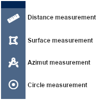
It is possible to measure distances, areas and azimuth distances on the map.
To do this, in the "Drawing and measurements" menu, check "Measurement tools" to make them appear on the map. Then choose the type of measurement.

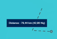
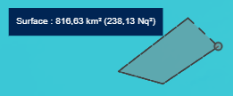
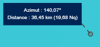
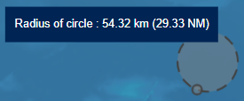
Cliquez ensuite sur la carte pour positionner les points de votre mesure. Le résultat est dynamique et s’affiche à côté du curseur de la souris en kilomètres (km) et milles nautiques (nq).
|
 |
 |
|
The measurement continues to update until you end the shape with a double-click.
To make another measurement, end the current one with a double-click and click on the map again to start a new one. Or change the type of measurement.
Uncheck "Measurement Tools" to remove the tool pop-up from the map.
Note: the calculation method used is the Vincenty algorithm, which measures the distance between 2 points at the surface of a spheroid. This algorithm gives more precise results than the great circle route, which assumes that the Earth is spherical.