 Catalogue Shom
http://www.shom.fr/BDML/PORTS
Type of resources
Available actions
Topics
Provided by
Years
Formats
Representation types
-
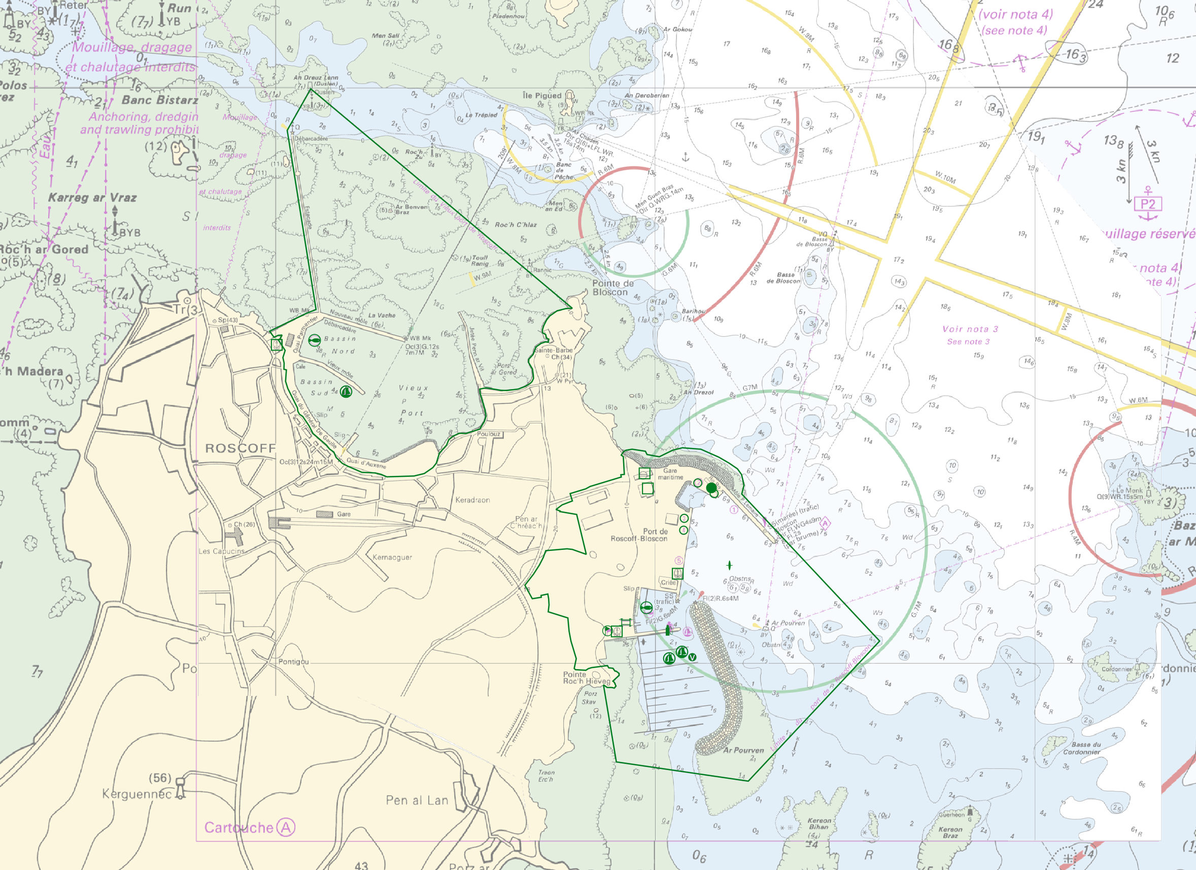
"Harbour Information" product contains 13 object classes, the acronyms used are those of IHO standard S-57 - International Hydrographic Organization – (https://iho.int/): - Berth (BERTHS): place in which a ship is moored at wharf - Isolated building localizing a harbour office (BUISGL) - Checkpoint (CHKPNT) - Crane (CRANES) - Floating dock (FLODOC): floating structure of one or more sections which can be partly submerged by controlled flooding to receive a vessel, then raised by pumping out the water so that the vessel's bottom can be exposed for maintenance. - Gridiron (GRIDRN): structure in the intertidal zone serving as a support for vessels at low tide to permit work on the exposed portion of the vessel's hull. - Harbour area (HRBARE) : administrative area of a port, including all docking and handling facilities, as well as short-term storage facilities. - Harbour facility (HRBFAC) - Hulk (HULKES) : hull of a wrecked or condemned ship, from which the fittings and superstructure have usually been removed, which is moored in a permanent position or grounded. - Oil barrier (OILBAR) - Pilot boarding place (PILBOP) - Rescue station (RSCSTA) - Small craft facility (SMCFAC) Detailed definitions of each of these object classes can be found in the S-57 standard (https://iho.int/en/standards-and-specifications). An online catalog is available at http://www.s-57.com/. Some of the symbols used for display on data.shom.fr portal have been adapted from icons from the OpenSeaMap open library (https://github.com/OpenNauticalChart/).