 Catalogue Shom
150000
Type of resources
Available actions
Topics
Keywords
Provided by
Years
Formats
Representation types
Update frequencies
status
Scale
-
Seamless Shom nautical charts - West Africa - EAtHC is a product composed of digital images taken from Shom nautical charts, with no additions, legends or georeferencing information. At a given scale, it is possible to view only the maps with a scale that allows a correct display. The footprint of all the maps composing this product are shown. Unless exceptional circumstances apply, this product is updated on a monthly basis and the modified grid squares are re-published, replacing the previous versions. All corrections, publications and editions with an effect on the reference nautical charts are taken into consideration.
-
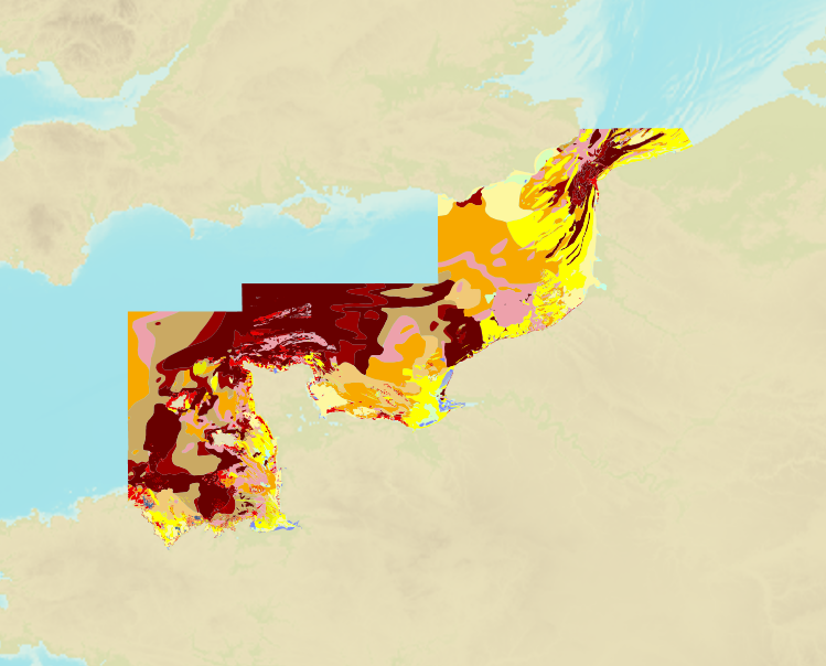
The product is a digital solution showing superficial sediments on the sea floor along coasts in mainland France.
-
Seamless Shom nautical charts - West Africa is a product composed of digital images taken from Shom nautical charts, with no additions, legends or georeferencing information. At a given scale, it is possible to view only the maps with a scale that allows a correct display. The footprint of all the maps composing this product are shown. Unless exceptional circumstances apply, this product is updated on a monthly basis and the modified grid squares are re-published, replacing the previous versions. All corrections, publications and editions with an effect on the reference nautical charts are taken into consideration.
-
Nísoi Voreioi Sporades; Aegean Sea - Greece; Cartes de cabotage; Édition 2 du 18/04/2012
-
Western Approaches to Torres Strait; Australia - North Coast - Queensland; Routiers et planisphères; Édition 4 du 19/12/2013
-
Juzur Ashrafi Islands to Safaga (Bur Safajah) and Strait of Tiran; Red Sea - Egypt and Saudi Arabia; Cartes de cabotage; Édition 6 du 04/09/2025
-
Carte marine imprimée N°6735 Pas de Calais - De Boulogne-sur-Mer à Zeebrugge - Estuaire de la Tamise (Thames)
-
DW Routes and TSS North Friesland to Vlieland; North Sea - Netherlands; Cartes de cabotage; Édition 5 du 22/08/2018
-
Outer Dowsing to Smiths Knoll including Indefatigable Banks; England - East Coast; Cartes de cabotage; Édition 13 du 24/08/2016
-
Mizen Head to Dingle Bay; Ireland - South West Coast; Routiers et planisphères; Édition 3 du 13/09/2021