 Catalogue Shom
GRD
Type of resources
Available actions
Topics
Provided by
Years
Formats
Representation types
Update frequencies
status
Resolution
-
Le produit bathymétrie de façade golfe du Lion – Côte d’Azur d'une résolution de 0.001° (~ 111 m) a été réalisé dans le cadre du projet HOMONIM. Il couvre l’intégralité de la façade métropolitaine méditerranéenne, du littoral jusqu’à environ 2800 m de profondeur. Le MNT est destiné à être implémenté dans les modèles hydrodynamiques afin de produire des prévisions aussi précises que possible des hauteurs d’eau et d’états de mer à la côte et donc d’améliorer la pertinence de la Vigilance Vagues-Submersion. La référence verticale de ce produit est le niveau moyen des mers.
-
Le MNT bathymétrique de façade de La Réunion à une résolution de 0.001° (~ 111 m) a été réalisé dans le cadre du projet HOMONIM. Il couvre intégralement l'île de La Réunion et s'étend vers le large jusqu'à plus de 4000 m de profondeur. Le MNT est destiné à être implémenté dans les modèles hydrodynamiques afin de produire des prévisions aussi précises que possible des hauteurs d’eau et d’états de mer à la côte et donc d’améliorer la pertinence de la Vigilance Vagues-Submersion.
-
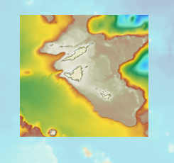
The bathymetric DEM for the coasts of Guadeloupe and Martinique with a resolution of 0.001° (~ 100 m) was prepared as part of the HOMONIM project. The DEM covers some of the Lesser Antilles islands, from Anguilla in the north to Saba in the south. The model ranges off-shore to a depth of 3275 m. The DEM is designed to be used in hydrodynamic models in order to produce high-precision forecasts for coastal water levels and sea conditions and therefore improve the pertinence of the Waves-Submersion monitoring programme.
-
Le MNT topo-bathymétrique côtier d'une partie du golfe normand-breton à une résolution de 0.0002° (~ 20 m) a été réalisé dans le cadre du PAPI Saint-Malo. Le MNT englobe le plateau des Minquiers au Nord-Ouest jusqu'à la baie du Mont-Saint-Michel au Sud-Est. Le MNT est destiné à être implémenté dans les modèles hydrodynamiques afin de produire des prévisions aussi précises que possible des hauteurs d’eau et d’états de mer à la côte et donc d’améliorer la gestion du risque de submersion marine.
-
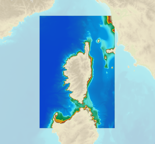
The bathymetric DEM for the coasts of Corsica with a resolution of 0.001° (~ 100 m) was prepared as part of the HOMONIM project. It covers the entire Corsican margin. The model ranges off-shore to a depth of 3000 m. The DEM is designed to be used in hydrodynamic models in order to produce high-precision forecasts for coastal water levels and sea conditions and therefore improve the pertinence of the Waves-Submersion monitoring programme. This product is available with the Lowest Astronomic Tide (LAT) or the Mean Sea Level (MSL) as a vertical datum.
-

Le MNT bathymétrique de façade de Saint-Martin et Saint-Barthélemy à une résolution de 0.001° (~ 100 m) a été réalisé dans le cadre du projet HOMONIM. Le MNT englobe une partie des îles des petites Antilles, depuis Anguilla au nord jusqu’à Saba au sud. Il s’étend au large jusqu’à 3275 m de profondeur. Le MNT est destiné à être implémenté dans les modèles hydrodynamiques afin de produire des prévisions aussi précises que possible des hauteurs d’eau et d’états de mer à la côte et donc d’améliorer la pertinence de la Vigilance Vagues-Submersion.
-
Le produit topo-bathymétrique côtier de la zone "Morbihan" à une résolution de 0.0002° (~20 m) a été réalisé dans le cadre du projet TANDEM (Programme Investissements d'Avenir, ANR-11-RSNR-00023-01). Il couvre un secteur en-globant majoritairement le département du Morbihan et une partie de celui de la Loire-Atlantique. Ce MNT s’étend de la presqu'île de Gâvres au nord-ouest jusqu'à La Baule au sud-est, il englobe le golfe du Morbihan, la baie et la presqu'île de Quiberon, les îles d'Houat, Hoëdic et Belle-Ile, l'estuaire de la Vilaine… Ce MNT est destiné à être implémenté dans les modèles hydrodynamiques du projet TANDEM afin d'estimer les effets côtiers des tsunamis pour l’Atlantique et la Manche, où sont installées les centrales nucléaires françaises depuis environ 30 ans. La référence verticale de ce produit est le niveau des plus basses mers astronomiques.
-
Le MNT bathymétrique de façade de Mayotte à une résolution de 0.001° (~ 111 m) a été réalisé dans le cadre du projet HOMONIM. Il couvre intégralement l'île de Mayotte et s'étend à l'Ouest sur l'île d'Anjouan. Le MNT s'étend au large jusqu'à 3700 m de profondeur. Le MNT est destiné à être implémenté dans les modèles hydrodynamiques afin de produire des prévisions aussi précises que possible des hauteurs d’eau et d’états de mer à la côte et donc d’améliorer la pertinence de la Vigilance Vagues-Submersion.
-
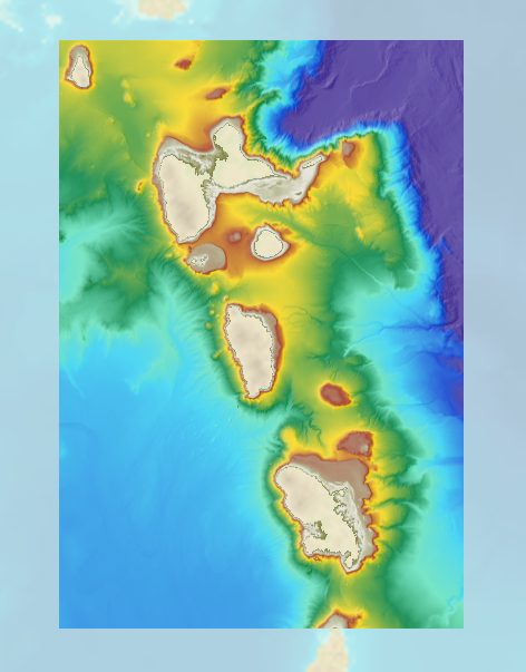
The bathymetric DEM for the coasts of Guadeloupe and Martinique with a resolution of 0.001° (~ 100 m) was prepared as part of the HOMONIM project. The DEM covers some of the Lesser Antilles islands, from Montserrat in the north to Sainte-Lucie in the south. The model ranges off-shore to a depth of 5800 m. The DEM is designed to be used in hydrodynamic models in order to produce high-precision forecasts for coastal water levels and sea conditions and therefore improve the pertinence of the Waves-Submersion monitoring programme.
-
Le MNT bathymétrique de façade de Mayotte à une résolution de 0.001° (~ 111 m) a été réalisé dans le cadre du projet HOMONIM. Il couvre intégralement l'île de Mayotte et s'étend à l'Ouest sur l'île d'Anjouan. Le MNT s'étend au large jusqu'à 3700 m de profondeur. Le MNT est destiné à être implémenté dans les modèles hydrodynamiques afin de produire des prévisions aussi précises que possible des hauteurs d’eau et d’états de mer à la côte et donc d’améliorer la pertinence de la Vigilance Vagues-Submersion.