Catalogue Shom
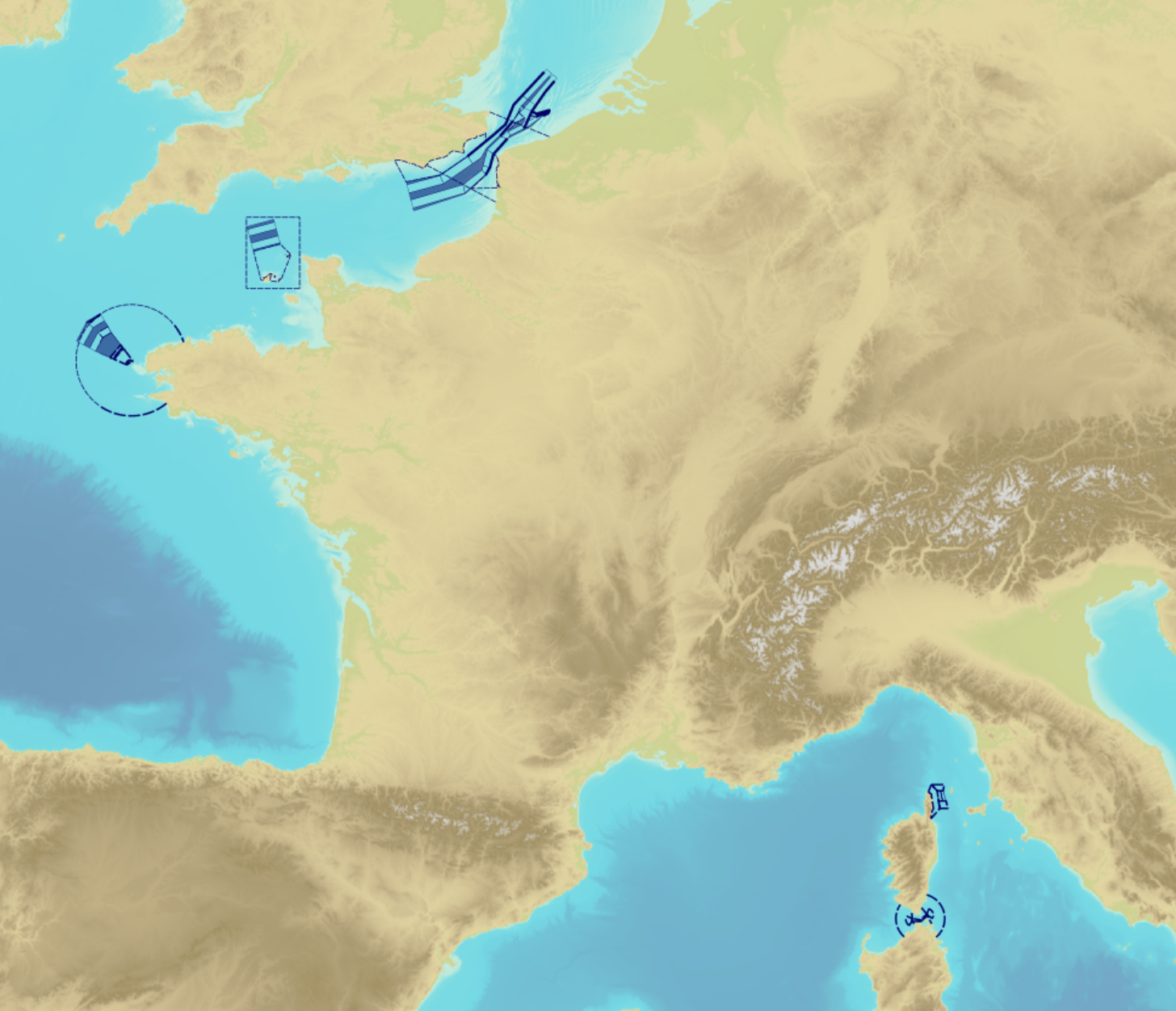
Traffic separation schemes
"Traffic Separation Schemes" product contains a description of TSS in French maritime spaces. A TSS is a routeing measure aimed at the separation of opposing streams of traffic by appropriate means and notably by the establishment of traffic lanes. The measures taken aim at improving navigation safety in areas where navigation is threatened by the density of traffic associated with various natural difficulties.
Several classes of objects constitute this product, the acronyms used are those of IHO standard S-57:
- Traffic separation scheme lane part (TSSLPT): area of a traffic lane in which the direction of flow of traffic is uniform;
- Traffic separation scheme boundary (TSSBND): outer limit of a traffic lane part or a traffic separation scheme roundabout;
- Traffic separation line (TSELNE): common boundary between two traffic lanes, or between one traffic lane and one inshore traffic zone;
- Traffic separation zone (TSEZNE): separation areas between two traffic lanes, or between one traffic lane and one inshore traffic zone, or to the central area of a roundabout;
- Inshore traffic zone (ISTZNE): area between the landward boundary of a traffic separation scheme and the adjacent coast;
- Precautionary area (PRCARE): area, within defined limits, where ships must navigate with particular caution, and within which the direction of traffic flow may be recommended;
- Deep water route part (DWRTPT): sections within which the flow of traffic either follows one defined direction for one-way traffic, or follows one defined direction and its reciprocal for two-way traffic. A deep-water route is a route in a designated area within defined limits which has been accurately surveyed for clearance of sea bottom and submerged obstacles to a minimum indicated depth of water;
- Two-way route part (TWRTPT): sections within which traffic flows in two directions along one bearing and its reciprocal. These route parts are generally two-way, but some may be restricted to one-way traffic flow;
- Radio calling-in line (RDOCAL_lne) : positions at which vessels are required to report to a traffic control centre.
|
|
Citation proposal
Shom. Traffic separation schemes. https://services.data.shom.fr:/geonetwork/WS/api/records/BDML_DST.xml |
Simple
- Date ( Creation )
- 1995-01-01
- Date ( Revision )
- 2021-05-18
- Identifier
- Credit
-
©Shom. With the contribution of the European Maritime and Fisheries Fund (EMFF) of the European Union.
Author
- Keywords ( Theme )
-
-
Traffic separation schemes
-
TSS
-
TSSLPT
-
TSSBND
-
TSELNE
-
TSEZNE
-
ISTZNE
-
PRCARE
-
DWRTPT
-
TWRTPT
-
RDOCAL
-
Open data
-
Product
-
- GEMET - INSPIRE themes, version 1.0 ( Theme )
- INSPIRE Spatial scope
- High-value dataset categories
- Use limitation
-
Data may be freely used providing that the source is mentioned as follows "Shom, 2021. Traffic separation schemes"
- Use limitation
-
Do not use for navigation
- Use limitation
-
Data may be freely used providing that the source is mentioned as follows "Shom, 2021. Traffic separation schemes"
- Access constraints
- License
- Use constraints
- Other restrictions
- Other constraints
-
Open licence Etalab v. 2.0 avril 2017.
- Access constraints
- Other restrictions
- Other constraints
- Pas de restriction d'accès public. No public access restrictions.
- Classification
- Unclassified
- Spatial representation type
- Vector
- Metadata language
- fre French
- Character set
- utf8 UTF8
- Topic category
-
- Transportation
))
- Distribution format
-
-
SHP
(inapplicable
) -
GML
(3.2
)
-
Distributor
- OnLine resource
-
Shom Geoportal
Shom Geoportal
- OnLine resource
- DST_BDD_WMSV
- OnLine resource
- DST_PYR_PNG_3857_WMSR
- OnLine resource
- DST_BDD_WFS:dwrtpt
- OnLine resource
- DST_BDD_WFS:istzne
- OnLine resource
- DST_BDD_WFS:prcare
- OnLine resource
- DST_BDD_WFS:tsslpt
- OnLine resource
- DST_BDD_WFS:tssbnd
- OnLine resource
- DST_BDD_WFS:rdocal_lne
- OnLine resource
- DST_BDD_WFS:tselne
- OnLine resource
- DST_BDD_WFS:tsezne
- OnLine resource
- DST_BDD_WFS:twrtpt
- OnLine resource
-
Shom marketplace
Shom marketplace
- Hierarchy level
- Dataset
Conformance result
- Date ( Publication )
- 2014-04-17
- Explanation
-
Information sur la conformité de la ressource à une spécification (INSPIRE).
- Pass
- true
Conformance result
- Date ( Publication )
- 2010-11-23
- Explanation
-
Information sur la conformité au règlement d'interopérabilité des séries et des services de données géographiques.
- Pass
- true
- Statement
-
The information used in the elaboration of this product comes from the transcription of resolutions and circulars adopted by the IMO (International Maritime Organization), possibly supplemented in French law by orders issued by "préfectures maritimes" (Navy regional headquarters).
gmd:MD_Metadata
- File identifier
- BDML_DST.xml XML
- Metadata language
- fre French
- Character set
- UTF8
- Hierarchy level
- Dataset
- Hierarchy level name
-
Produit
- Date stamp
- 2021-09-01T15:52:05
- Metadata standard name
-
ISO 19115:2003/19139
- Metadata standard version
-
1.0
Point of contact
Overviews
Provided by