 Catalogue Shom
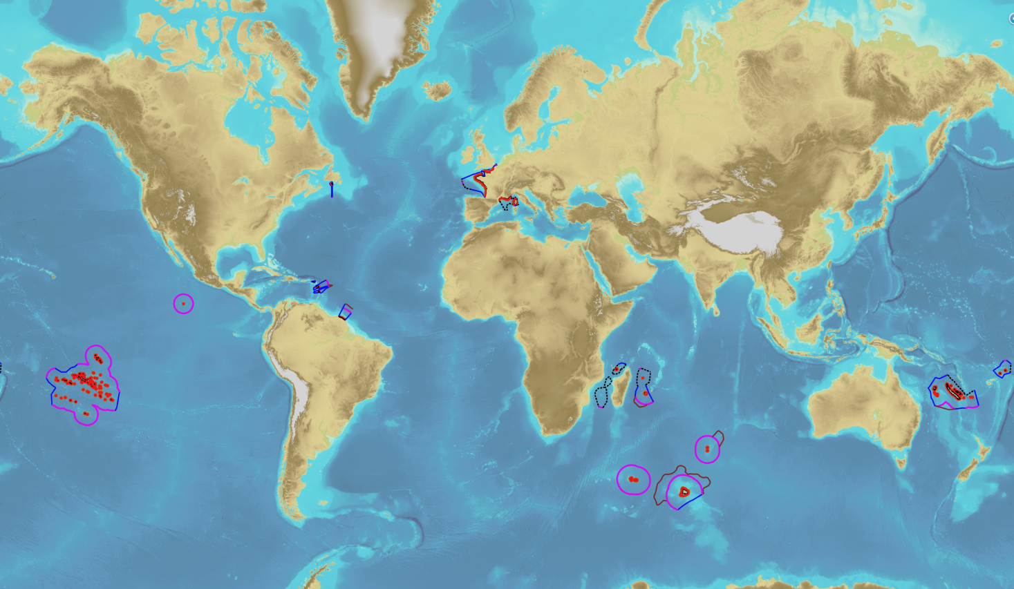
Maritime limits and boundaries
The product “Maritime limits and boundaries” (French: “Délimitations maritimes”) gathers all the elements used for the definition of the maritime spaces under the French sovereignty or jurisdiction through the world. Those spaces are defined by the Ordonnance n° 2016-1687 of 8 December 2016 relating to maritime spaces under sovereignty or jurisdiction of the French Republic. This ordonnance is the transcription in the French legislation of the United Nations Convention on the Law of the Sea (UNCLOS) which was signed in Montego Bay (Jamaica) on 10 December 1982 end ratified by France on 11 April 1996.
These elements of maritime limits and boundaries come from the limits computed by Shom on the basis of International Law, from the international agreements relating to maritime boundary and the technical conventions ratified between France and other States, from the decisions of international juridical bodies, from the recommendations of the Commission of the Limits of the Continental Shelf (UNO) or from unilateral claims from France in the absence of agreement.
The elements are divided into seven themes:
1- Straight baselines
2- Outer limits of the territorial sea (12 nautical miles)
3- Outer limits of the contiguous zone (24 nautical miles)
4- Outer limits of the exclusive economic zone (200 nautical miles)
5- Maritime boundaries established by a bilateral agreement or decided by an international juridical body
6- Maritime boundaries unilaterally claimed by France in the absence of agreement
7- Outer limit of the continental shelf beyond 200 nautical miles
December 2022 version
|
|
Citation proposal
Shom. Maritime limits and boundaries. https://services.data.shom.fr:/geonetwork/srv/api/records/BDML_DELMAR.xml |
Simple
- Date ( Revision )
- 2023-01-10
- Identifier
Author
- Keywords ( Theme )
-
-
maritime limits
-
regulation
-
law of the sea
-
maritime space
-
jurisdiction
-
open data
-
Product
-
- GEMET - INSPIRE themes, version 1.0 ( Theme )
- INSPIRE Spatial scope
- High-value dataset categories
- Use limitation
-
Data free of use by acknowledging its source. Open licence Etalab v. 2.0 avril 2017.
- Use limitation
-
Product not certified for navigation
- Use limitation
-
Data free of use by acknowledging its source. Open licence Etalab v. 2.0 avril 2017.
- Access constraints
- License
- Use constraints
- Other restrictions
- Other constraints
-
Open licence Etalab v. 2.0 avril 2017.
- Access constraints
- Other restrictions
- Other constraints
- Pas de restriction d'accès public. No public access restrictions.
- Classification
- Unclassified
- Spatial representation type
- Vector
- Metadata language
- fre French
- Character set
- utf8 UTF8
- Topic category
-
- Boundaries
))
- Distribution format
-
-
SHP
(inapplicable
) -
GML
(3.2
)
-
Point of contact
- OnLine resource
-
French national portal of maritime limits
French national portal of maritime limits
- OnLine resource
- DELMAR_BDD_WMSV
- OnLine resource
- DELMAR_PYR-PNG_WLD_3857_WMSR
- OnLine resource
- Download service
- OnLine resource
- DELMAR_BDD_WFS:au_maritimeboundary_agreedmaritimeboundary
- OnLine resource
- DELMAR_BDD_WFS:au_baseline
- OnLine resource
- DELMAR_BDD_WFS:au_maritimeboundary_nonagreedmaritimeboundary
- OnLine resource
- DELMAR_BDD_WFS:au_maritimeboundary_territorialsea
- OnLine resource
- DELMAR_BDD_WFS:au_maritimeboundary_contiguouszone
- OnLine resource
- DELMAR_BDD_WFS:au_maritimeboundary_economicexclusivezone
- OnLine resource
- DELMAR_BDD_WFS:au_maritimeboundary_continentalshelf
- OnLine resource
-
Shom geoportal
Shom geoportal
- Hierarchy level
- Dataset
Conformance result
- Date ( Publication )
- 2014-04-17
- Explanation
-
Information sur la conformité de la ressource à une spécification (INSPIRE).
- Pass
- true
Conformance result
- Date ( Publication )
- 2010-11-23
- Explanation
-
Information sur la conformité au règlement d'interopérabilité des séries et des services de données géographiques.
- Pass
- true
- Statement
-
Digital transcription of the limits and boundaries described in the official legal documents.
The limits of maritime spaces under French sovereignty or jurisdiction are composed of : the 12NM, 24NM and 200NM outer limits, the straight baselines, the maritime boundaries established by bilateral agreements or decisions of international juridical bodies, the claimed limits without agreement and the outer limits of the continental shelf beyond 200 NM.
gmd:MD_Metadata
- File identifier
- BDML_DELMAR.xml XML
- Metadata language
- French
- Character set
- UTF8
- Hierarchy level
- Dataset
- Hierarchy level name
-
Produit
- Date stamp
- 2023-01-10T14:35:56
- Metadata standard name
-
ISO 19115:2003/19139
- Metadata standard version
-
1.0
Point of contact
Overviews
Provided by
