 Catalogue Shom
SCAN Littoral®
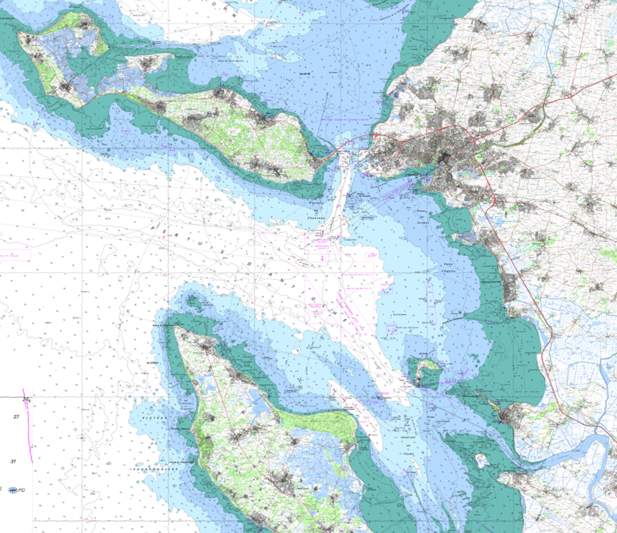
The product SCAN Littoral® is a collection of continuous colour digital map images of the coast, obtained via georeferenced assembling with grid squares of raster data from Shom nautical charts and IGN 1:25,000 land maps. The SCAN Littoral® solution includes a series of digital images with no additions, legends or georeferencing information.
|
|
Citation proposal
(2009) . SCAN Littoral®. https://services.data.shom.fr:/geonetwork/srv/api/records/CARTO_SCAN_LITTO.xml |
Simple
- Alternate title
-
SCAN Littoral® topographique, SCAN Littoral® touristique
- Date ( Publication )
- 2009-06-24
- Edition
-
4.0
- Identifier
- Purpose
-
SCAN Littoral® is a georeferenced digital image, available for immediate and easy use to locate your information, and model and enrich your data.
Point of contact
Point of contact
IGN - Service Clients
73 avenue de Paris
SAINT-MANDE cedex
94165
FRANCE
- Maintenance and update frequency
- Not planned
- Keywords ( Theme )
-
-
geography
-
ecosystems
-
energy
-
resources
-
politique environnementale
-
natural zones
-
transport
-
public service
-
Product
-
- Specific usage
-
Echelles d'affichage
- User determined limitations
-
Echelles comprises entre le 1:10 000ième et le 1:50 000ième
Point of contact
- Use limitation
-
Do not use for navigation.
- Use limitation
-
Database subject to the general conditions of use of Shom-IGN co-publishing files.
- Use limitation
-
Database subject to the general conditions of use of Shom-IGN co-publishing files.
- Access constraints
- Restricted
- Use constraints
- Restricted
- Other constraints
-
Decree No. 2016-1617 of 29 November 2016 on the categories of public information of the State and its public administrative institutions liable to be subject to the payment of a reuse fee (Art D. 324-5-1 ).
- Classification
- Unclassified
- Spatial representation type
- Grid
- Denominator
- 25000
- Metadata language
- fre French
- Character set
- utf8 UTF8
- Topic category
-
- Imagery base maps earth cover
- Description
-
France métropolitaine
))
- Begin date
- 1978-01-01T16:09:00
- End date
- 2011-12-31T16:09:00
- Description
-
Guadeloupe
))
- Description
-
Martinique
))
- Description
-
Guyane
))
- Description
-
La Réunion
))
- Supplemental Information
-
SCAN Littoral® breaks down into several sub-sections: - SCAN Littoral® Topographical, which excludes any tourist information, - SCAN Littoral® Tourism which is identical to SCAN Littoral® Topographical, but shows tourist information (exhaustive information is added to the Top25 map grid squares and partial information is added to GR for Blue series map zones only).
- Reference system identifier
-
EPSG
/RGF93 / Lambert-93 (EPSG:2154)
/7.4
- Reference system identifier
-
EPSG
/RGR92 / UTM zone 40S (EPSG:2975)
/7.4
- Reference system identifier
-
EPSG
/WGS 84 / UTM zone 20N (EPSG:32620)
/7.4
- Reference system identifier
-
EPSG
/RGFG95 / UTM zone 22N (EPSG:2972)
/7.4
- Distribution format
-
-
TIF
(6.0
)
-
Distributor
- Units of distribution
-
Dalle de 100 kilomètres carrés
- Transfer size
- 16.0
- OnLine resource
-
Shom Geoportal
Shom Geoportal
- OnLine resource
-
Shom marketplace
Shom marketplace
- Hierarchy level
- Series
- Statement
-
The sea floor: The sea map base layer is an image of printed nautical charts, contoured by the frame and the coast line. 1:50,000 charts are generally used for the mainland France coast. 1:20,000 charts are also used for estuaries, bays and gulfs and two 1:150,000 charts are used along the Aquitaine coast. 1:50,000 charts will be used for Reunion island, Martinique and Guadeloupe. 1:300,000 charts will be completed by detailed 1:50,000 charts for French Guiana. Assembly tables for maps to be incorporated in the SCAN Littoral® solution can be found in Appendix B.
Land maps: The land map is an image version of the IGN map (raster data from 1: 25,000) contoured at the same coast line, except coastal toponymy, which may appear at sea. The coast line Coast line data (for the highest tide with a tidal coefficient of 120 and in normal weather conditions) were obtained from the HistoLitt® database. These data were prepared jointly by Shom and IGN. Shom larger scale charts were converted to digital format for the required geographic scope (from 1: 5,000 to 1: 50,000 or even 1: 150,000), and updated using the IGN ORTHO® database. This line is now used to match terrestrial data and marine data for our reference materials. On the other hand, this coast line is not defined for the entire length of the French Guyanese coast due to clouds on airborne photographs. Pending the definition of this coast line, the French Guyanese map was compiled using digitally converted terrestrial and marine maps. The technical specifications for the French Guyanese solution are therefore slightly different.
Overviews
Provided by
