 Catalogue Shom
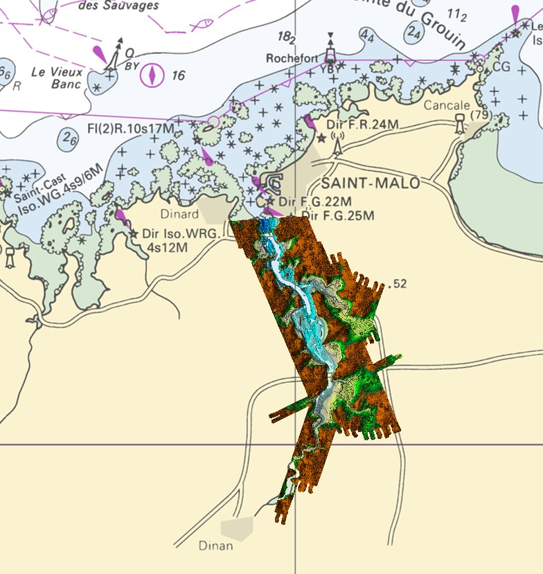
Lidar - Rance 2019
Lidar marine product is a unique and continuous land-sea database which can provide 3D models of the shape and location of french coastal terrain. Surveys are carried out by airborne lidar bathymetry over the sea side and airborne lidar topography over the land side up to 400m inland. This marine product is available in two formats: a set of 3D points and a qualified terrain mesh.
|
|
Citation proposal
Shom. Lidar - Rance 2019. https://services.data.shom.fr:/geonetwork/srv/api/records/BATHYMETRIE_LIDAR_RANCE_2019.xml |
Simple
- Alternate title
-
Land-sea altimetric database
- Date ( Creation )
- 2019-09-03
- Presentation form
- Digital map
- Purpose
-
The main aim is to produce precise digital data with unrivalled resolution (decimetric precision, metric resolution) for french coastal terrain. This solution provides the basic data required to implement many applications and public policies, such as:
• risk prevention (tsunamis, cyclone swell, rising sea level due to global warming, coastal flooding, flooding, erosion, etc.),
• coastal planning studies (roads, ports, etc.),
• improved knowledge of the public maritime territory, tracking coastal withdrawal,
• mapping terrestrial and marine habitats,
• creating current models and related applications (tidal and swell current energy, waste dispersal at sea, sedimentary movements, etc.),
• Integrated Coastal Zone Management (ICZM).
- Credit
-
A geographic package known as the "marine product" comprises data acquired using airborne topo-bathymetric and bathymetric lidar systems as part of the operation "Lidar Rance". This operation was led by Shom and co-financed by French State and the Brittany Region.
Author
- Maintenance and update frequency
- Irregular
- Keywords ( Theme )
-
-
Product
-
open data
-
- Use limitation
-
Data may be freely used providing that the source is mentioned as follows "Shom, 2022. http://dx.doi.org/10.17183/LIDAR_RANCE_2019".
- Use limitation
-
Open licence Etalab v. 2.0 avril 2017.
- Use limitation
-
Do not use for navigation
- Use limitation
-
The product is distributed under an Opendata license (version 2.0, April 2017), defined by the Etalab mission.
- Access constraints
- License
- Use constraints
- Other restrictions
- Other constraints
-
Open licence Etalab v. 2.0 avril 2017.
- Access constraints
- Other restrictions
- Other constraints
- Pas de restriction d'accès public. No public access restrictions.
- Classification
- Unclassified
- Spatial representation type
- Grid
- Spatial representation type
- Vector
- Distance
- 1 m
- Distance
- 5 m
- Metadata language
- fre French
- Character set
- utf8 UTF8
- Topic category
-
- Elevation
- Description
-
France, Barrage de la Rance au Nord de Dinan
))
- Distribution format
-
-
ASC
(inapplicable
) -
XYZ
(inapplicable
)
-
Distributor
- OnLine resource
-
Shom geoportal
Shom geoportal
- OnLine resource
- L3D_LIDAR_RANCE_2019_WMSR_3857
- OnLine resource
-
Shom distribution space to download data
Shom distribution space to download tiles
- Hierarchy level
- Series
Conformance result
- Date ( Publication )
- 2013-12-10
- Explanation
-
Information sur la conformité aux spécifications INSPIRE du thème Altitude.
- Pass
- false
Conformance result
- Date ( Publication )
- 2010-11-23
- Explanation
-
Information sur la conformité au règlement d'interopérabilité des séries et des services de données géographiques.
- Pass
- true
- Statement
-
These data were acquired by airborne lidars during acquisition campaigns conducted 27th June 2019, 28th June 2019 ant 3rd September 2019. The topo-bathymetric data lidar come from a HawkEye 3 sensor in double trap configuration (Chiroptera + Deep Channel).
gmd:MD_Metadata
- File identifier
- BATHYMETRIE_LIDAR_RANCE_2019.xml XML
- Metadata language
- fre French
- Character set
- utf8 UTF8
- Hierarchy level
- Series
- Hierarchy level name
-
Collection de données
- Date stamp
- 2022-04-07T15:33:40
- Metadata standard name
-
ISO 19115:2003/19139
- Metadata standard version
-
1.0
Point of contact
Overviews
Provided by
