 Catalogue Shom
regulation
Type of resources
Available actions
Topics
Keywords
Provided by
Representation types
Update frequencies
Scale
-
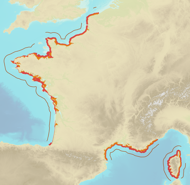
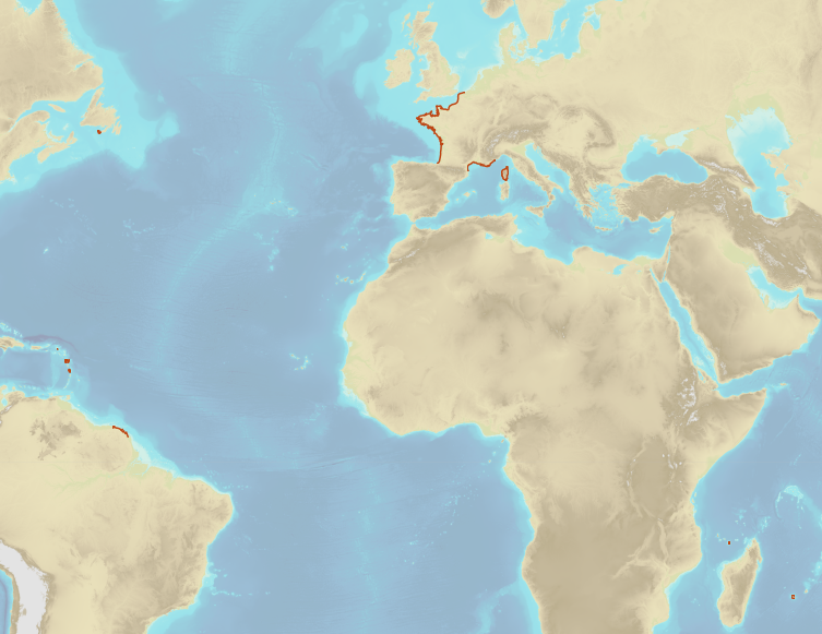
In the Law of the Sea, a straight baseline is composed by a loxodrome connecting two points of the low-water line or low-tide elevations if there is a lighthouse or similar permanent infrastructure on them. The conditions to draw such lines are defined in Article 7 of UNCLOS. The straight baselines are part of the baselines of a coastal State below which the internal waters are defined. Those straight baselines, in addition with the normal baseline, compose the inner limit of the territorial sea and are the basis of the computations of the outer limits of other maritime spaces defined by UNCLOS. They are also composed of the closure line for bays and rivers in compliance with Aricles 9 and 10 of UNCLOS. The objects of the theme "Straight baselines" result from Shom computations and are published by decree of the French Republic.
-
Limits defining ship classes based on their assigned operating maritime zones. These limits were produced by CEREMA in application of section II.14 of article 1 of decree no. 200945 amended on 30 August 1984. Navigation categories are defined in article 223.2 of the rules appended to the order of 23 November 1987 on shipping safety.
-
In compliance with Article 33 of UNCLOS, the outer limit of the contiguous zone is located at 24 nautical miles from the baselines. The objects of the theme "Outer limit of the contiguous zone" result from Shom computations and are compliant with Article 10 of the French Order No 2016-1687 of 8 December 2016.
-
In compliance with Article 3 of UNCLOS, the outer limit of the territorial sea is located at 12 nautical miles from the baselines. It corresponds to the inner limit of the contiguous and exclusive economic zones. The objects of the theme "Outer limit of the territorial sea" result from Shom computations and are published by decree of the French Republic. Some of those limits are note published by decree yet.
-
French Ministry of Culture / DRASSM - Shom The product "Limit of preventive archeology licence fee" contains the limits for the preventive archeology licence fee (1 nautical mile) as defined in the French Heritage Code. This limit is managed by the Department of Underwater Archeological Research (DRASSM) of the Ministry of Culture. This limit, defined by the Heritage Code at 1 nautical mile from the low-water line, permits to delineate the areas where the licence fee for preventive archeology at sea is applied. The product "Limit of preventive archeology licence fee" is to use in addition to the digital product “Maritime Limits and Boundaries” of Shom (French: “Délimitations maritimes”) which represents the limits of the French maritime spaces of sovereignty or jurisdiction through the World. The product “Maritime Limits and Boundaries” (French: “Délimitations maritimes”) can be viewed and downloaded on the French national portal of maritime limits (https://maritimelimits.gouv.fr).
-
The theme "Agreed maritime boundaries" contains the delineation limits between maritime spaces under sovereignty or jurisdiction of France et neighbouring States which are established by ratification of a boundary agreement or by a decision of an arbitral tribunal or an international legal body entitled to deal with cases relating to the Law of the Sea.
-
<strong>This data is not up to date with the order dated 30 August 2021 amending the order dated 23 November 1987 on ship safety, which now raises the limit for category 4 ships to 5 miles from the nearest coast.</strong> The navigation category allocated to a ship is indicated on its shipping license, together with any applicable restrictions. This limit was produced by Shom in application of section II.14 of article 1 of decree no. 84-810 amended on 30 August 1984. Navigation categories are defined in article 110.10 of the rules appended to the order of 23 November 1987 on shipping safety.
-
French Ministry of Culture / DRASSM – Shom The product "Limit of preventive archeology licence fee" contains the limits for the preventive archeology licence fee (1 nautical mile) as defined in the French Heritage Code. This limit is managed by the Department of Underwater Archeological Research (DRASSM) of the Ministry of Culture. This limit, defined by the Heritage Code at 1 nautical mile from the low-water line, permits to delineate the areas where the licence fee for preventive archeology at sea is applied. In Mainland France in the Gironde estuary, the limit for the preventive archeology licence fee is stopped by the crosswise limit of the sea as defined by the decree of 26 August 1857. In French Guiana, the limit for the preventive archeology licence fee is stopped in Maroni and Oyapock rivers by the crosswise limits of the sea respectively defined the order of 30 January 1991 and the order No 863 of 26 May 1986, until meeting the land boundary which delineates the rivers with the neighbouring States. The product "Limit of preventive archeology licence fee" is to use in addition to the digital product “Maritime Limits and Boundaries” of Shom (French: “Délimitations maritimes”) which represents the limits of the French maritime spaces of sovereignty or jurisdiction through the World. The product “Maritime Limits and Boundaries” (French: “Délimitations maritimes”) can be viewed on data.shom.fr (Maritime boundaries Category) and downloaded on the French national portal of maritime limits (https://maritimelimits.gouv.fr).
-
The contiguous zone is adjacent to the territorial sea and may not extend beyond 24 nautical miles from the baselines from which the breadth of the territorial sea is measured. The coastal State may exercise the control necessary to: - prevent infringement of its customs, fiscal, immigration or sanitary laws and regulations within its territory or territorial sea; - punish infringement of the above laws and regulations committed within its territory or territorial sea.
-
In compliance with Article 57 of UNCLOS, the outer limit of the exclusive economic zone (EEZ) is located at 24 nautical miles from the baselines. This limit distinguishes the EEZ from the High Sea. Beyond this limit, an extension of the continental shelf is possible subject to the criterias of Article 76 of UNCLOS. The objects of the theme "Outer limit of the exclusive economic zone" result from Shom computations and are compliant with Article 10 of the French Order No 2016-1687 of 8 December 2016. They are published by decree of the French Republic.