 Catalogue Shom
500000
Type of resources
Available actions
Topics
Keywords
Provided by
Years
Formats
Representation types
status
Scale
-

Sea bed sediment maps for the 4 marine sub-regions prepared as part of the initial evaluation of the MSFD (Marine Strategy Framework Directive).
-
The “World Seabed Sediment Map” product contains geo-referenced digital data, describing the nature of the sediment encountered in different seas and oceans of the world. The objects are all surface areas and the description of an object includes in particular the nature of the sediment including rock-type bottoms.
-
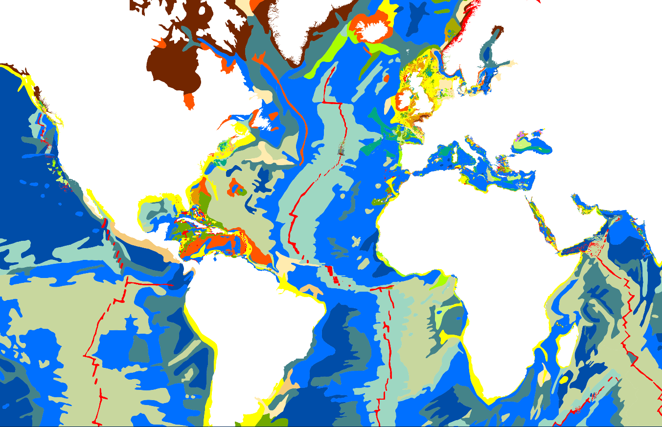
Little Andaman to Great Nicobar; Bay of Bengal - Andaman and Nicobar Islands; Cartes d'atterrissage; Édition 2 du 05/07/2006
-
Ko Kut to Hon Khoai; Gulf of Thailand; Cartes d'atterrissage; Édition 2 du 27/09/2017
-
Tanjung Jamboaye to Permatang Sedepa (One Fathom Bank); Indonesia and Malaysia - Malacca Strait; Cartes d'atterrissage; Édition 2 du 19/12/2018
-
Carte marine imprimée N°7203 Des Îles Baléares (Islas Baleares) à Marseille
-
Nicobar Islands; Bay of Bengal and Andaman Sea, India - Andaman and Nicobar Islands,; Cartes d'atterrissage; Édition 2 du 16/10/2020
-
Approaches to Rio Pará and Rio Amazonas; Brazil - North Coast; Cartes d'atterrissage; Édition 5 du 30/01/2025
-
Carte marine imprimée N°7049 Des îles Loyauté à l'île Hunter