 Catalogue Shom
elevation
Type of resources
Available actions
Topics
Keywords
Provided by
Years
Formats
Representation types
Update frequencies
status
Scale
Resolution
-
Litto3D is a unique and continuous land-sea database which can provide 3D models of the shape and location of French coastal terrain. A line separates sea and land data acquisition zones, and the associated survey readings obtained using bathymetric lidar technologies or multibeam echosounders for sea readings and airborne lidar topographical surveys for land readings, with 300 m overlap. Litto3D digital models are available in two formats: a set of 3D points and a qualified terrain mesh.
-
The Histolitt® coastline corresponds to the high tide line with an astronomic tidal coefficient of 120 and in normal weather conditions (no sea breeze and no low pressure systems likely to raise sea level). The Histolitt® coastline models this theoretical input as a series of 2D polylines. In mainland France, it is recommended to use the land-sea limit product which replaces this Histolitt® coastline. There is no land-sea limit in the French overseas areas for the moment.
-
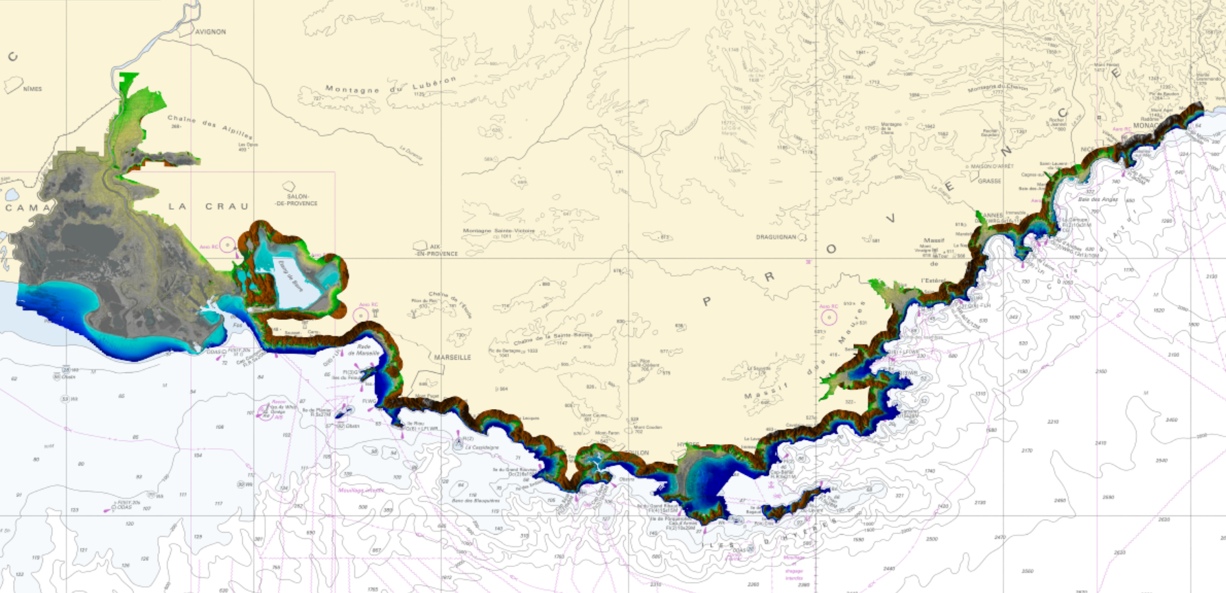
For more than 200 years, Shom has maintained a bathymetric knowledge base enriched by surveys and campaigns over time. They are composed of point clouds which have a density higher than those shown on nautical charts. Datasets are stored in the Shom Bathymetric Database (BDBS) which is a source to describe seabed reliefs. These data are useful for many applications as oceanographic modeling or seabed exploitations. The bathymetric datasets have been granted a distribution agreement. Data are not modeled. This modeling is left to the initiative of the customers. In other terms, they are point clouds data on the field, treated to the hydrographic standards in force at the time of their acquisition and validated. The product is composed of bathymetric datasets which cover the entire French Exclusive Economic Zone (EEZ) as well as international waters. The cover and its cutting are available on the Shom portals (data.shom.fr). Data positions are provided in geographic coordinates reported to the World Reference Geodetic System WGS84. They are vertically referenced to the zero of the soundings reduction which is usually associated to the hydrographic Chart Datum of the corresponding area. For depths up to 50m, the data vertical accuracy varies from 30cm to 1m and the planimetric accuracy varies from 1 to 20m. Beyond, in deep seas, the vertical accuracy is mainly of the order of 1 to 2% of the bottom depth. Sometimes, it is higher depending on the technology used.
-
Bathymetric datasets, collected between 1990 and 2005, are digital data controlled and qualified. They are acquired with single-beam echosounders and the first generations of multi-beam echosounders.
-
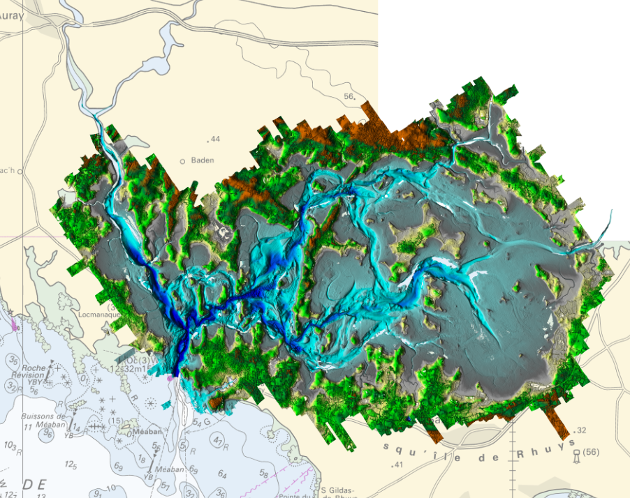
Litto3D Marine Part is an intermediate product of the Litto3D product containing only marine data.Litto3D is a unique and continuous land-sea database which can provide 3D models of the shape and location of French coastal terrain. A line separates sea and land data acquisition zones, and the associated survey readings obtained using bathymetric lidar technologies or multibeam echosounders for sea readings and airborne lidar topographical surveys for land readings, with 300 m overlap. Litto3D digital models are available in two formats: a set of 3D points and a qualified terrain mesh.
-
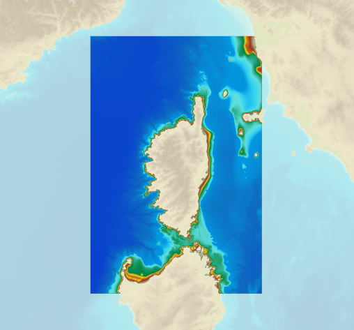
The bathymetric DEM for the coasts of Corsica with a resolution of 0.001° (~ 100 m) was prepared as part of the HOMONIM project. It covers the entire Corsican margin. The model ranges off-shore to a depth of 3000 m. The DEM is designed to be used in hydrodynamic models in order to produce high-precision forecasts for coastal water levels and sea conditions and therefore improve the pertinence of the Waves-Submersion monitoring programme. This product is available with the Lowest Astronomic Tide (LAT) or the Mean Sea Level (MSL) as a vertical datum.
-
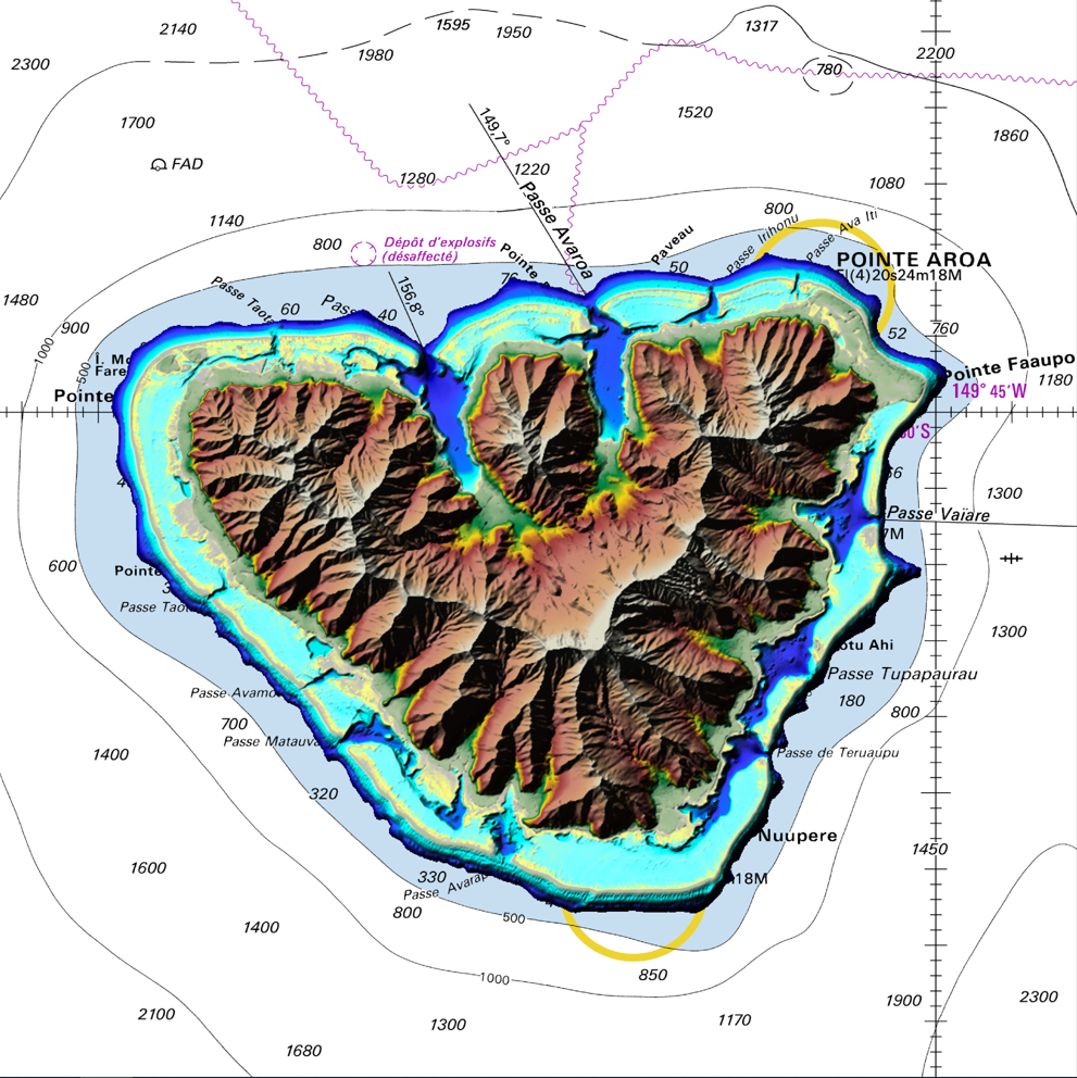
The coastal topo-bathymetric DEM of Moorea with a resolution of 0.0002° (~ 20 m) was produced by the Shom for Météo-France (Inter-regional Direction in French Polynesia). This DEM covers the Moorea lagoons down to the 100 m isobath, in order to meet the need for modeling marine submersions in French Polynesia. It complements the bathymetric DEM of Tahiti and Moorea, with a resolution of 0.001° (~ 100 m). This product is available at different vertical references, either the lowest astronomical tide (LAT) or the mean sea level (MSL).
-
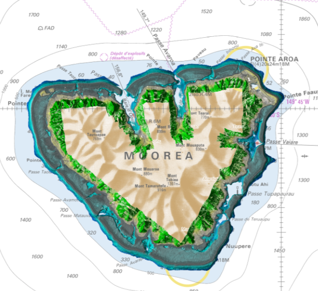
Lidar marine part is a unique and continuous land-sea database which can provide 3D models of the shape and location of French coastal terrain. A line separates sea and land data acquisition zones, and the associated survey readings obtained using bathymetric lidar technologies or multibeam echosounders for sea readings and airborne lidar topographical surveys for land readings, with 300 m overlap. Litto3D digital models are available in two formats: a set of 3D points and a qualified terrain mesh. The product Moorea 2015 v.20171015 covers the whole of Moorea.
-

Lidar marine part is a unique and continuous land-sea database which can provide 3D models of the shape and location of French coastal terrain. A line separates sea and land data acquisition zones, and the associated survey readings obtained using bathymetric lidar technologies or multibeam echosounders for sea readings and airborne lidar topographical surveys for land readings, with 300 m overlap. Litto3D digital models are available in two formats: a set of 3D points and a qualified terrain mesh.
-

Bathymetric datasets are an extraction of surveys belonging to the Shom public database. For depth up to 50m, the vertical precision of soundings varies from 30cm to 1m and the horizontal precision varies from 1 to 20m. In deep ocean, the vertical precision is mainly around 1 or 2% of the bottom depth. It is sometimes more, it depends on the technology used. The data are referenced to ZH which is assimilated to LAT. Data are corrected for sound velocity variations.