 Catalogue Shom
GRD
Type of resources
Available actions
Topics
Provided by
Years
Formats
Representation types
Update frequencies
status
Resolution
-
The coastal topo-bathymetric DTM of the Arcachon basin and its surroundings at a resolution of 0.0002° (~ 20 m) was produced as part of the HOMONIM project. The DTM covers the coastline of a part of the Gironde department, from the Carcans and Hourtin ponds in the North, to the Cazaux and Sanguinet lakes in the South. It covers the entire Arcachon basin and extends offshore to about 40 m depth. The DTM is intended to be implemented in hydrodynamic models in order to produce accurate forecasts of water heights and sea states at the coast and to improve the French storm surge warning system.
-
The bathymetric DEM for the coasts of Mayotte with a resolution of 0.001° (~ 100 m) was prepared as part of the HOMONIM project. It covers the entire island of Mayotte and extends to Anjouan island in the west. The model ranges off-shore to a depth of 3700 m. The DEM is designed to be used in hydrodynamic models in order to produce high-precision forecasts for coastal water levels and sea conditions and therefore improve the pertinence of the Waves-Submersion monitoring programme. This product is available with the Lowest Astronomic Tide (LAT) or the Mean Sea Level (MSL) as a vertical datum.
-
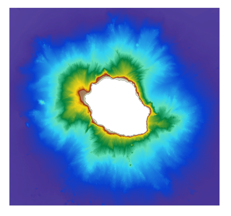
The bathymetric DEM for the coasts of La Réunion with a resolution of 0.001° (~ 100 m) was prepared as part of the HOMONIM project. The DEM covers the entire Reunion island. The model ranges off-shore to a depth of 4000 m. The DEM is designed to be used in hydrodynamic models in order to produce high-precision forecasts for coastal water levels and sea conditions and therefore improve the pertinence of the Waves-Submersion monitoring programme.
-
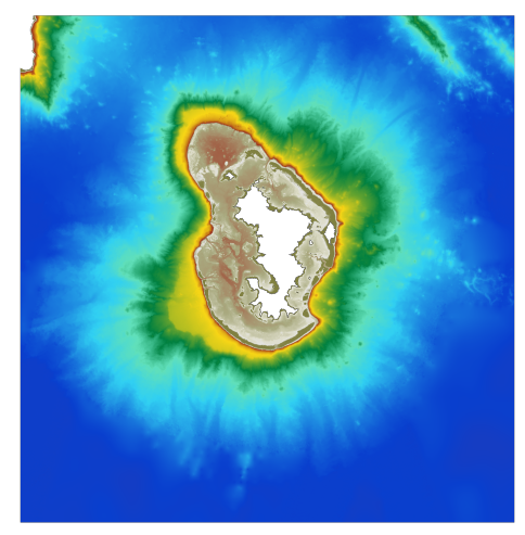
The coastal topo-bathymetric DEM was produced using the bathymetric and topographic data acquired between 2012 and 2015 by Shom and the PASSION programme team. The 20 m coastal grid covers the Passion atoll – Clipperton and the local flanks of the atoll to a depth of 1500 m. Passion island - Clipperton, in the eastern Pacific Ocean, is a remote uninhabited atoll over 5,000 km from Tahiti in French Polynesia and over 1,000 km from the Mexican coasts. Passion island is the highest point on the Clipperton ridge, and the only location above water level. This is the only coral atoll in the eastern Pacific in the northern hemisphere, at a longitude of W 109° and a latitude of N 10°.
-
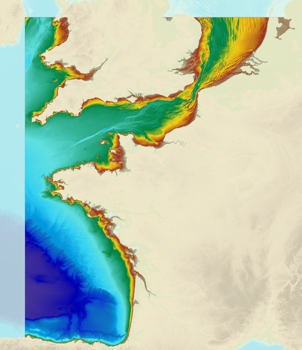
The bathymetric DEM of the atlantic facade with a resolution of 0.001° (~ 100 m) was prepared as part of the HOMONIM project. It encompasses part of the North Sea, the Channel and the Bay of Biscay. Offshore, this DTM extends beyond the slope to approximately 4800 m depth. The DEM is designed to be used in hydrodynamic models in order to produce high-precision forecasts for coastal water levels and sea conditions and therefore improve the pertinence of the Waves-Submersion monitoring programme. This product is available with the Lowest Astronomic Tide (LAT) or the Mean Sea Level (MSL) as a vertical datum.
-

The bathymetric DEM for the coasts of New-Caledonia with a resolution of 0.001° (~ 100 m) was prepared in the framework of a Shom-IRD partnership as part of the TSUCAL project. The DEM covers the basin from New Caledonia in the west to the Vanuatu archipelago in the east. The DEM is designed to be used in hydrodynamic models in order to improve the pertinence of the Waves-Submersion monitoring programme.
-
Le MNT topo-bathymétrique côtier de l'Île de La Passion – Clipperton à une résolution de 20 m a été réalisé en valorisant les données bathymétriques et topographiques acquises entre 2012 et 2015 par le Shom et l'équipe du programme PASSION. La grille côtière à 20 m comprend l'atoll de La Passion – Clipperton et ses flancs immédiats jusqu'à environ 1500 m de profondeur. L'Île de La Passion - Clipperton, située dans l'Océan pacifique Est, est un atoll inhabité isolé à plus de 5000 km de Tahiti en Polynésie Française et plus de 1000 km des côtes mexicaines. L'île est le point culminant, et le seul émergé, de la dorsale de Clipperton. Il s'agit du seul atoll corallien du Pacifique oriental situé dans l'hémisphère nord, par 109°de longitude Ouest et 10° de latitude Nord.
-

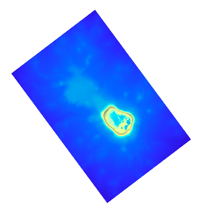
The coastal topo-bathymetric DEM of Tahiti with a resolution of 0.0002° (~ 20 m) was produced by the Shom for Météo-France (Inter-regional Direction in French Polynesia). This DEM covers the Tahiti lagoons down to the 100 m isobath, in order to meet the need for modeling marine submersions in French Polynesia. It complements the bathymetric DEM of Tahiti and Moorea, with a resolution of 0.001° (~ 100 m). This product is available at different vertical references, either the lowest astronomical tide (LAT) or the mean sea level (MSL).
-
Le MNT bathymétrique de façade de la Guyane, à une résolution de 0.001° (~ 111 m), a été réalisé dans le cadre du projet HOMONIM. Il couvre intégralement la côte Guyanaise et s'étend en partie sur le Suriname à l'Ouest et le Bresil à l'Est. Au large, le MNT englobe le plateau continental ainsi qu'une partie du talus. Le MNT est destiné à être implémenté dans les modèles hydrodynamiques afin de produire des prévisions aussi précises que possible des hauteurs d’eau. La référence verticale de ce produit est le niveau des plus basses mers astronomiques.
-
Le produit topo-bathymétrique côtier de la baie de Saint-Jean-de-Luz et ses abords, à une resolution de 0.0002° (~20 m), a été réalisé dans le cadre du projet TANDEM. Il couvre un territoire comprenant la baie de Saint-Jean-de-Luz et ses abords immediats. Ce MNT est destiné à être implémenté dans les modèles hydrodynamiques du projet TANDEM afin d'estimer les effets côtiers des tsunamis pour l’Atlantique et la Manche, où sont installées les centrales nucléaires françaises depuis environ 30 ans. La référence verticale de ce produit est le niveau des plus basses mers astronomiques.