 Catalogue Shom
tide
Type of resources
Available actions
Topics
Keywords
Provided by
Representation types
Update frequencies
-
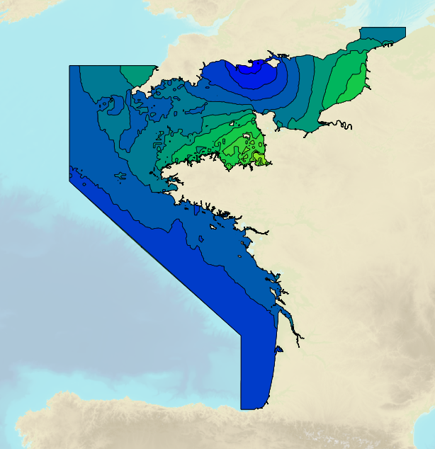
Tidal ranges on the French coasts of the Channel and the Atlantic for a coefficient of 95 : tidal range for mean neap tides for average atmospheric conditions. The tidal range is the difference in height between consecutive low tides and high tides.
-
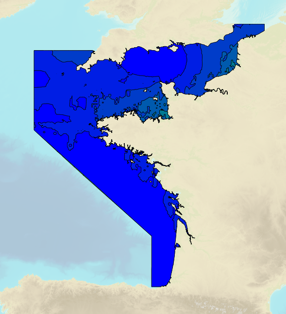
Tidal ranges on the French coasts of the Channel and the Atlantic for a coefficient of 20 : minimum tidal range for average atmospheric conditions. The tidal range is the difference in height between consecutive low tides and high tides.
-
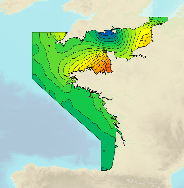
Tidal ranges on the French coasts of the Channel and the Atlantic for a coefficient of 95 : tidal range for mean spring tides for average atmospheric conditions. The tidal range is the difference in height between consecutive low tides and high tides.
-
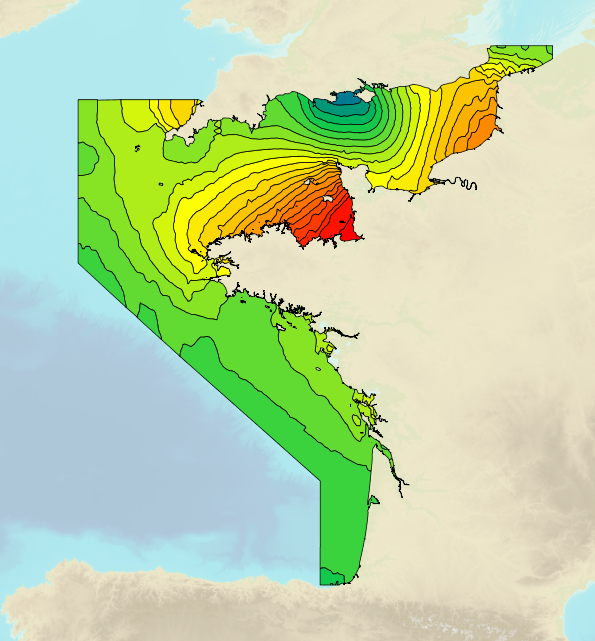
Tidal ranges on the French coasts of the Channel and the Atlantic for a coefficient of 95 : maximal tidal range for average atmospheric conditions. The tidal range is the difference in height between consecutive low tides and high tides.
-
This service allows users to view surface tidal current predictions calculated from the analysis of a high-resolution hydrodynamic simulation projected onto a 250 m grid. This service was built by Shom and funded by French CCI Métropolitaine Bretagne Ouest in the frame of the Atlantic Blue Port project of <a href="https://www.atlanticarea.eu" target="_blank">Interreg Atlantic Area</a> european program.
-
This service allows users to view surface tidal current predictions calculated from the analysis of a high-resolution hydrodynamic simulation projected onto a 2 km grid.
-
This service allows users to view surface tidal current predictions calculated from the analysis of a high-resolution hydrodynamic simulation projected onto a 30 m grid. This service was built by Shom and funded by French CCI Métropolitaine Bretagne Ouest in the frame of the Atlantic Blue Port project of <a href="https://www.atlanticarea.eu" target="_blank">Interreg Atlantic Area</a> european program.
-
The Tidal stream atlas netcdf product – The Channel provides tidal current data for an area stretching from the coast of Flanders east of Dunkirk to Brest. The product consists of a unique gridded file with 2 km spatial resolution covering the Channel. The U and V velocities of the tidal currents depend on the tidal conditions considered at mean neap and spring tidal rates. The data are provided in m/s for the surface layer. The times are given in relation to high tide at the reference port chosen in the area and are provided from 6 hours before to 6 hours after that reference.
-
This service allows users to view surface tidal current predictions calculated from the analysis of a high-resolution hydrodynamic simulation projected onto a 500 m grid.
-
This service allows users to view surface tidal current predictions calculated from the analysis of a high-resolution hydrodynamic simulation projected onto a 500 m grid.