 Catalogue Shom
open data
Type of resources
Available actions
Topics
Keywords
Contact for the resource
Provided by
Representation types
Update frequencies
status
Scale
-
This product includes Shom 3D digital data on tidal currents in the area "Loire" in shapefile and geotiff formats. These digital files provide information on tidal current components (speed and direction) on an hourly basis (6 hours either side of high water for a reference port), and for two typical tidal coefficients (45 and 95). Brest is taken as the reference port. Four layers are available: Surface; mid-depth; - 10 m above the sea bed and sea-bed.
-
This product includes Shom 3D digital data on tidal currents in the area "Loire" in shapefile and geotiff formats. These digital files provide information on tidal current components (speed and direction) on an hourly basis (6 hours either side of high water for a reference port), and for two typical tidal coefficients (45 and 95). Saint-Nazaire is taken as the reference port. Three layers are available: Surface; mid-depth; and sea-bed.
-
Compilation of marine gravity surveys acquired in the Northeast Atlantic by Shom between 2001 and 2016. These surveys were compiled to perform a quantification of the error of the gravity anomaly models derived from satellite altimetry. This dataset represents more than 22,000 measurement points distributed in 9 ascii survey files sampled at 1 kilometer. The file’s format is as follows: longitude latitude Gravity_anomaly error line_label.
-
The "Magnetic Stations" product contains measurements from magnetic reference stations deployed by the French Hydrographic and Oceanographic Service (SHOM) near marine magnetic survey areas. Measurement files are available by station and by year. These magnetic reference measurements correct marine measurements for diurnal and high-frequency variations in the Earth's magnetic field.
-
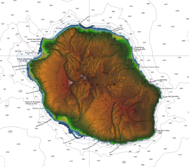
Litto3D is a unique and continuous land-sea database which can provide 3D models of the shape and location of French coastal terrain. A line separates sea and land data acquisition zones, and the associated survey readings obtained using bathymetric lidar technologies or multibeam echosounders for sea readings and airborne lidar topographical surveys for land readings, with 300 m overlap. Litto3D digital models are available in two formats: a set of 3D points and a qualified terrain mesh.
-
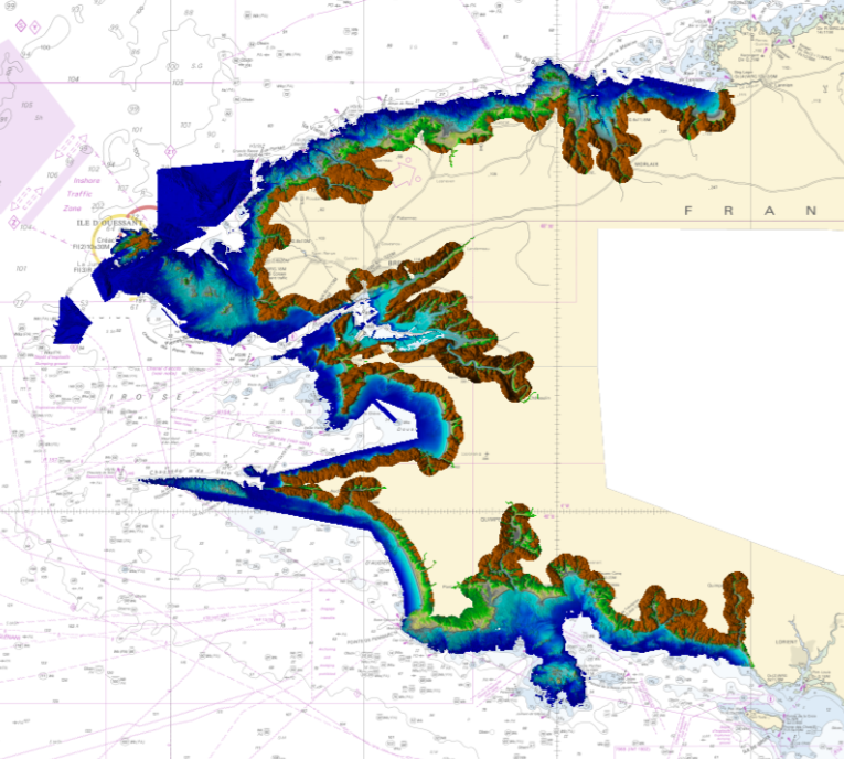
Litto3D is a unique and continuous land-sea database which can provide 3D models of the shape and location of French coastal terrain. A line separates sea and land data acquisition zones, and the associated survey readings obtained using bathymetric lidar technologies or multibeam echosounders for sea readings and airborne lidar topographical surveys for land readings, with 300 m overlap. Litto3D digital models are available in two formats: a set of 3D points and a qualified terrain mesh.
-
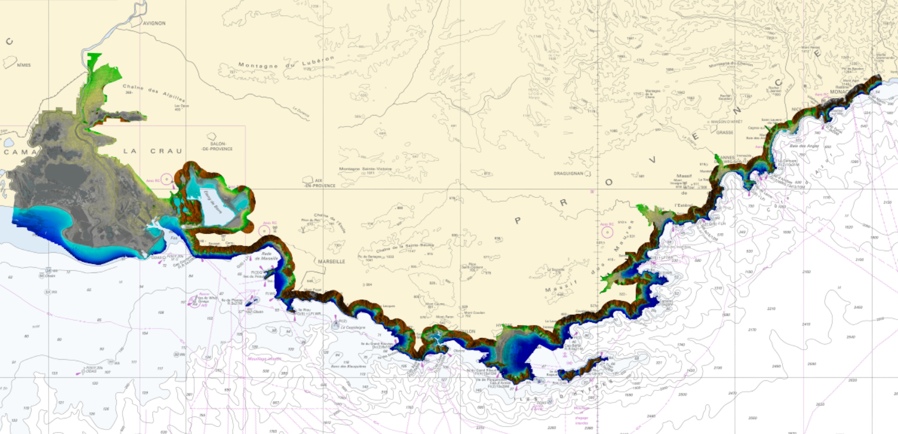
Litto3D is a unique and continuous land-sea database which can provide 3D models of the shape and location of French coastal terrain. A line separates sea and land data acquisition zones, and the associated survey readings obtained using bathymetric lidar technologies or multibeam echosounders for sea readings and airborne lidar topographical surveys for land readings, with 300 m overlap. Litto3D digital models are available in two formats: a set of 3D points and a qualified terrain mesh.
-
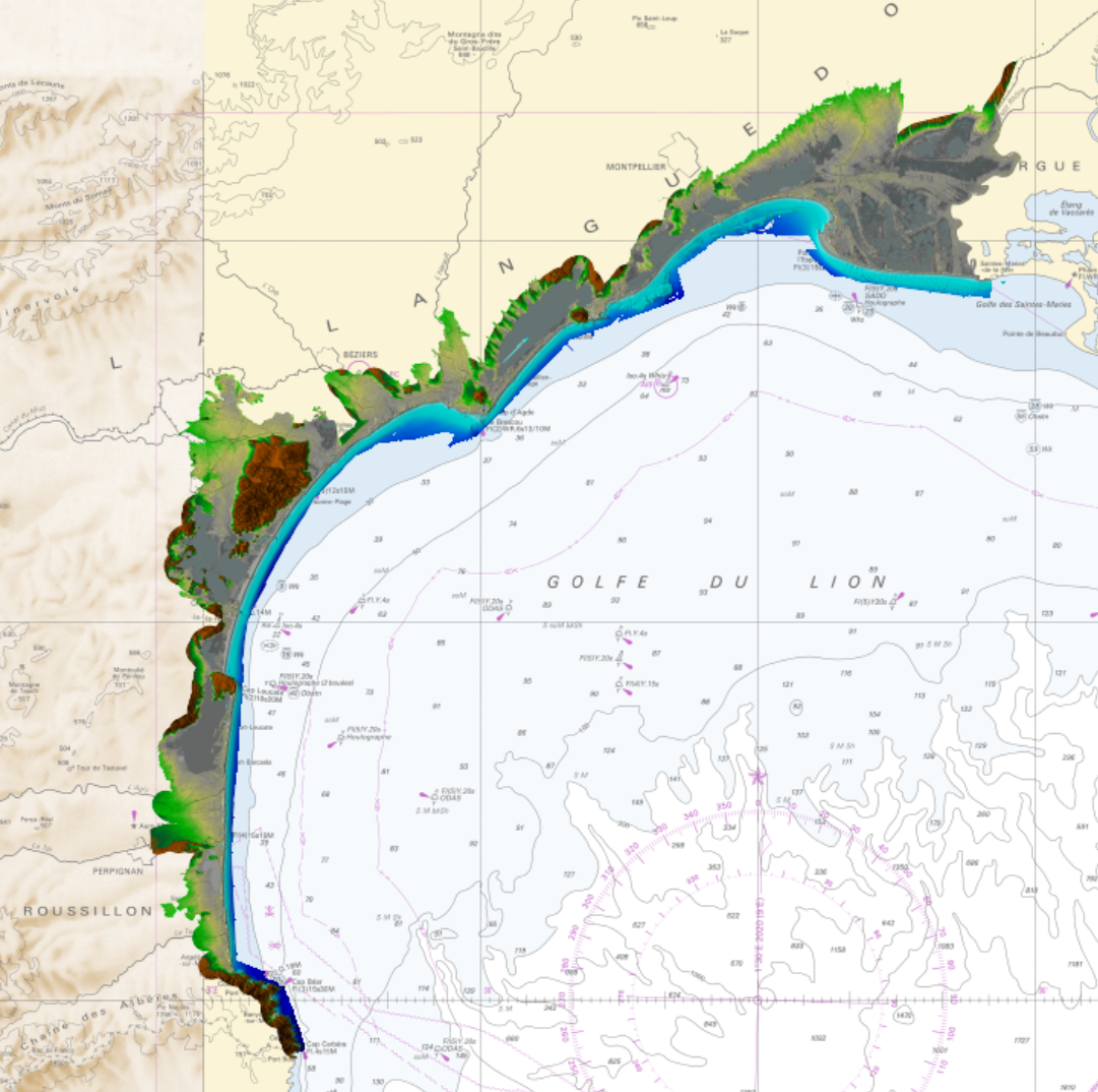
Litto3D is a unique and continuous land-sea database which can provide 3D models of the shape and location of French coastal terrain. A line separates sea and land data acquisition zones, and the associated survey readings obtained using bathymetric lidar technologies or multibeam echosounders for sea readings and airborne lidar topographical surveys for land readings, with 300 m overlap. Litto3D digital models are available in two formats: a set of 3D points and a qualified terrain mesh.
-

Litto3D Marine Part is an intermediate product of the Litto3D product containing only marine data.Litto3D is a unique and continuous land-sea database which can provide 3D models of the shape and location of French coastal terrain. A line separates sea and land data acquisition zones, and the associated survey readings obtained using bathymetric lidar technologies or multibeam echosounders for sea readings and airborne lidar topographical surveys for land readings, with 300 m overlap. Litto3D digital models are available in two formats: a set of 3D points and a qualified terrain mesh.
-
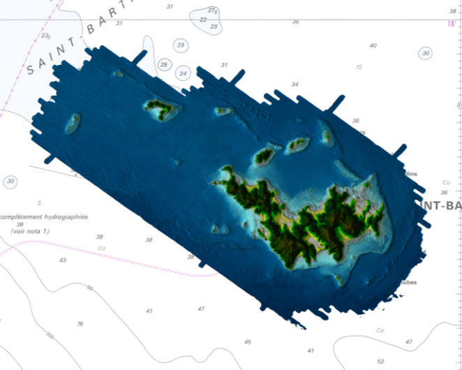
Litto3D is a unique and continuous land-sea database which can provide 3D models of the shape and location of French coastal terrain. Litto3D digital models are available in two formats: a set of 3D points and a qualified terrain mesh.