 Catalogue Shom
http://www.shom.fr/MAREE_COURANTS/NIV_EXTR
Type of resources
Available actions
Topics
Provided by
Years
Formats
Representation types
status
-
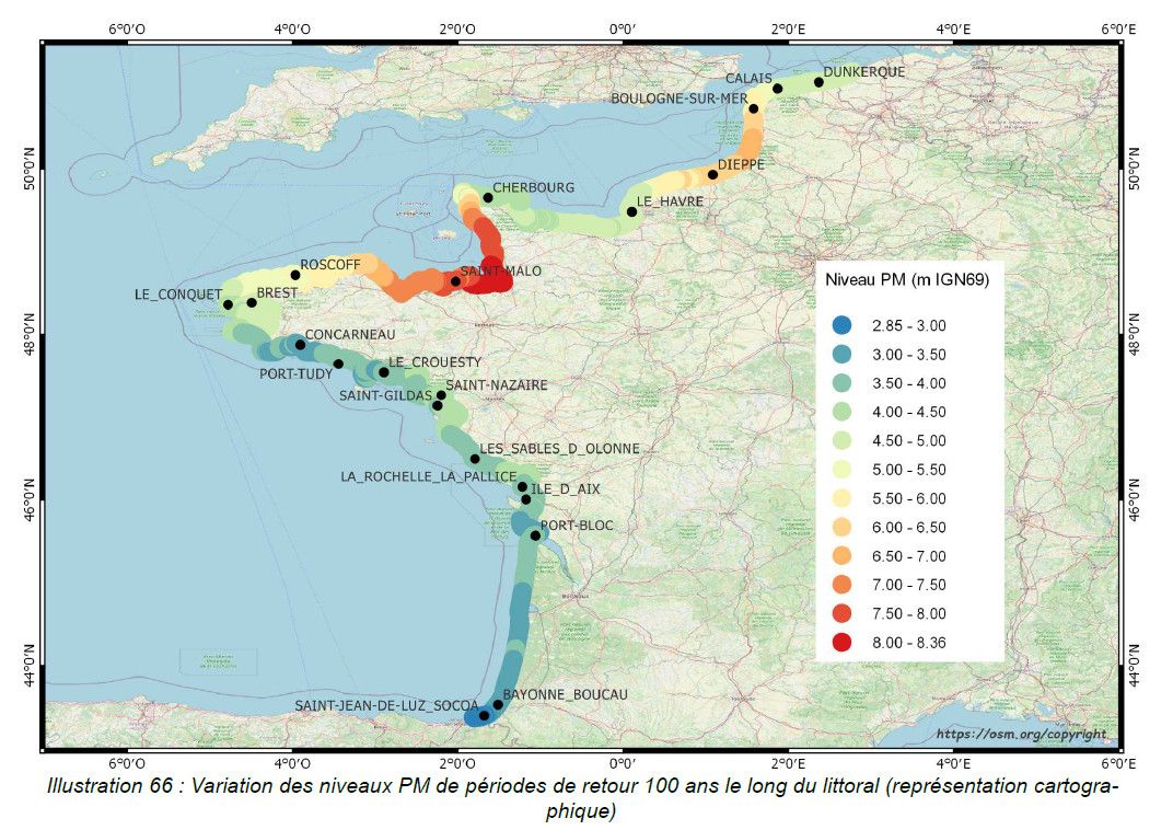
This study provides an initial global estimate of the extreme water level values along the French metropolitan coastline. These results are to be refined locally with all available data and knowledge. The method used is based on a statistical analysis of the tide gauge observations available in the ports. It does not take into account wave observations. The results between ports are obtained by an interpolation method. The study produces at the reference ports the statistical estimates: - extreme values of high water surge in the Channel and Atlantic; - extreme values of water level for the whole of Metropolitan France. And a set of statistical estimation maps of extreme water level values along the coastline. The estimates provided go up to the 1,000-year return period. In view of the duration of observations used at the ports, the user must check whether estimates with a return period of more than 50 or 100 years are still valid 50 or 100 years still make sense.