 Catalogue Shom
http://www.shom.fr/BATHYMETRIE/MNT_COTIER_DETROIT_PDC_TANDEM_20m_WGS84
Type of resources
Available actions
Topics
Provided by
Years
Formats
Representation types
Update frequencies
status
Resolution
-
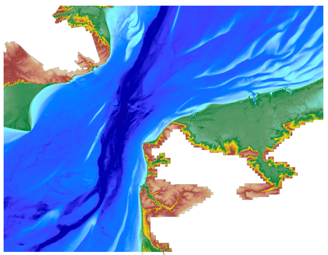
The coastal topo- bathymetric DEM for the coasts of the straight of Pas-de-Calais with a resolution of 0.0002° (~ 20 m) was prepared as part of the TANDEM project. The DEM covers the eastern Channel and southern North Sea, including the French coast of the Nord - Pas-de-Calais administrative department and part of the British coast, in the county of Kent, and the south part of the Thames estuary up to Rye. The DEM is designed to be implemented in the hydrodynamic models of the TANDEM project in order to estimate the coastal effects of tsunamis for the Atlantic and English Channel, where French nuclear power plants have been installed for about 30 years. This product is available with the Lowest Astronomic Tide (LAT) or the Mean Sea Level (MSL) as a vertical datum.