 Catalogue Shom
_uuid_OR_identifier
http://www.shom.fr/BATHYMETRIE/MNT_ANTS100m_HOMONIM_WGS84
Type of resources
Available actions
Topics
Provided by
Years
Formats
Representation types
Update frequencies
status
Resolution
From
1
-
1
/
1
-
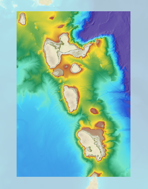
The bathymetric DEM for the coasts of Guadeloupe and Martinique with a resolution of 0.001° (~ 100 m) was prepared as part of the HOMONIM project. The DEM covers some of the Lesser Antilles islands, from Montserrat in the north to Sainte-Lucie in the south. The model ranges off-shore to a depth of 5800 m. The DEM is designed to be used in hydrodynamic models in order to produce high-precision forecasts for coastal water levels and sea conditions and therefore improve the pertinence of the Waves-Submersion monitoring programme.