Maximum tidal current speeds for mean spring tides (English Channel/Atlantic)
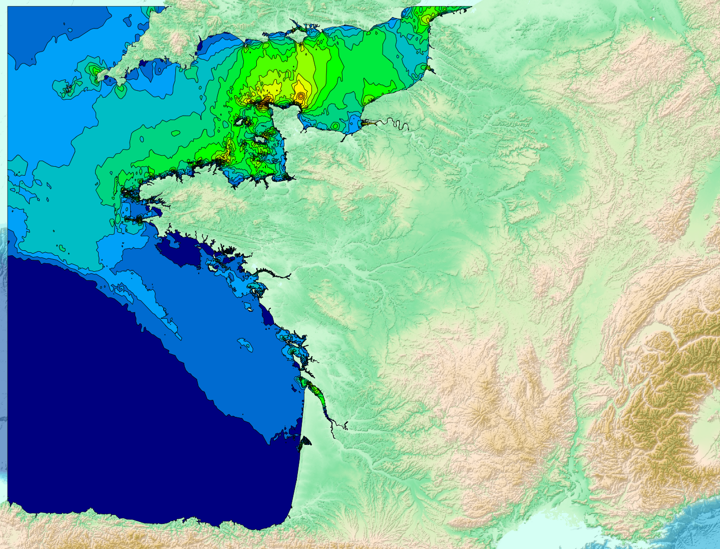
The “Maximum tidal current speeds for mean spring tides” product provides information on the maximum speeds reached by tidal currents on mainland French coasts (English Channel and the Atlantic). These data can be used to identify areas subject to the strongest surface tidal currents and to characterize the maximum current intensity reached during a tidal cycle under mean spring tide conditions. The data are provided in shapefile format, with polygons associated with maximum current speed values, without any temporal or directional information. The values are expressed in knots.
|
|
Citation proposal
. Maximum tidal current speeds for mean spring tides (English Channel/Atlantic). https://services.data.shom.fr:/geonetwork/srv/api/records/MAREE_COURANTS2D_VMAX.xml |
Simple
- Date ( Creation )
- 2014-05-14
- Date ( Revision )
- 2026-08-26
- Presentation form
- Digital map
- Credit
-
©Shom
Owner
- Maintenance and update frequency
- Not planned
- Keywords ( Theme )
-
-
Maximum tidal current speeds
-
Tidal currents
-
Mean spring tides
-
open data
-
Product
-
- Use limitation
-
Data free of use by acknowledging its source. Open licence Etalab v. 2.0 avril 2017.
- Use limitation
-
Do not use for navigation.
- Use limitation
-
Data free of use by acknowledging its source. Open licence Etalab v. 2.0 avril 2017.
- Use limitation
-
Do not use for navigation.
- Access constraints
- License
- Use constraints
- Other restrictions
- Other constraints
- Licence Ouverte version 2.0 Open Licence version 2.0
- Access constraints
- Other restrictions
- Other constraints
- Pas de restriction d'accès public. No public access restrictions.
- Classification
- Unclassified
- Spatial representation type
- Vector
- Metadata language
- fre French
- Character set
- utf8 UTF8
- Topic category
-
- Oceans
))
- Distribution format
-
-
SHP
(inapplicable
)
-
Distributor
- OnLine resource
-
Shom Geoportal
Shom Geoportal
- OnLine resource
- Download service - Maximum tidal current speeds for mean spring tides (English Channel/Atlantic)
- OnLine resource
-
COURANTS2D_WMSV_VMAX
Access point / WMS Maximum tidal current speeds for mean spring tides (English Channel/Atlantic)
- Hierarchy level
- Series
Conformance result
- Date ( Publication )
- 2010-11-23
- Explanation
-
Information sur la conformité au règlement d'interopérabilité des séries et des services de données géographiques.
- Pass
- true
- Statement
-
Source: The product was developed by compiling information on the maximum surface tidal current speeds reached during a tidal cycle. These data are derived from the results of several simulations of the propagation of the barotropic tidal wave within different maritime domains covering the entire coastline of mainland France, including the English Channel and the Atlantic coast. This dataset does not represent an absolute or extreme maximum current speed. Rather, it corresponds to the maximum speed obtained under mean spring tide conditions (tidal coefficient 95).
Metadata
- File identifier
- MAREE_COURANTS2D_VMAX.xml XML
- Metadata language
- fre French
- Character set
- utf8 UTF8
- Hierarchy level
- Series
- Hierarchy level name
-
Collection de données
- Date stamp
- 2026-08-26T16:30:45
- Metadata standard name
-
ISO 19115:2003/19139
- Metadata standard version
-
1.0
Point of contact
Overviews
Provided by