2D hydrodynamic model (water level and surge)
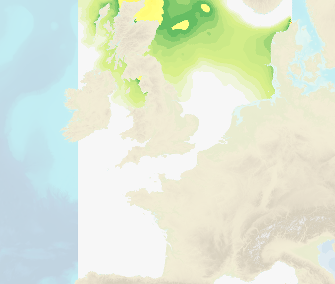
Hourly water level forecasts (Sea surface levelabove mean se level and meteorological surges) are computed by 2D barotropic hydrodynamic models (HYCOM 2D and Tolosa-SW).
The data cover French coastal areas: Atlantic/English Channel/North Sea, Mediterranean, Antilles-Guyane and Indian Ocean (Mayotte, Reunion Island).
Spatial resolution ranges from several kilometers offshore to up to 100 m near the coasts.
|
|
Citation proposal
. 2D hydrodynamic model (water level and surge). https://services.data.shom.fr:/geonetwork/zip/api/records/OCEANO_MODELE_NIVEAUX.xml |
Simple
- Date ( Creation )
- 2017-02-21
- Identifier
- Purpose
-
Scientific studies and technical developments are carried out within the framework of the HOMONIM project conducted in partnership between Météo-France and Shom with grant from the Ministry of Ecological Transition. The main objective of the project is to continuously improve storm tide and coastal waves forecast capabilities to help better determine which areas may be affected and hazardous.
The models developed, whose results are displayed on this portal, are then primarily operated by Météo-France to feed the French national waves and storm-tide awareness system.
- Credit
-
©Shom et Météo-France
Owner
- Maintenance and update frequency
- Daily
- Keywords ( Theme )
-
-
model
-
oceanography
-
tide
-
surge
-
water level
-
wave/coastal flood vigilance
-
open data
-
Product
-
- GEMET - INSPIRE themes, version 1.0 ( Theme )
- INSPIRE Spatial scope
- High-value dataset categories
- Use limitation
-
Data may be freely used providing that the source is mentioned as follows: "Météo France-Shom. 2D hydrodynamic model (water level / surge). https://dx.doi.org/10.17183/OCEANO_MODELE_NIVEAUX ". Open licence Etalab v. 2.0 avril 2017.
- Use limitation
-
The forecasts provided are the raw results of numerical simulations and, as such, have not been reviewed or validated by oceanographic or meteorological forecasters. They should therefore be used with an awareness of the errors inherent in raw model forecasts, and their use remains the responsibility of the user. In particular, they are not a substitute for Météo-France’s weather warning services.
- Use limitation
-
Data may be freely used providing that the source is mentioned as follows: "Météo France-Shom. 2D hydrodynamic model (water level / surge). https://dx.doi.org/10.17183/OCEANO_MODELE_NIVEAUX ". Open licence Etalab v. 2.0 avril 2017.
- Use limitation
-
The forecasts provided are the raw results of numerical simulations and, as such, have not been reviewed or validated by oceanographic or meteorological forecasters. They should therefore be used with an awareness of the errors inherent in raw model forecasts, and their use remains the responsibility of the user. In particular, they are not a substitute for Météo-France’s weather warning services.
- Access constraints
- License
- Use constraints
- Other restrictions
- Other constraints
- Licence Ouverte version 2.0 Open Licence version 2.0
- Access constraints
- Other restrictions
- Other constraints
- Pas de restriction d'accès public. No public access restrictions.
- Classification
- Unclassified
- Spatial representation type
- Grid
- Metadata language
- fre French
- Character set
- utf8 UTF8
- Topic category
-
- Oceans
))
))
))
))
- Supplemental Information
-
Water level/surge forecasts availableare daily updated in metropolitain France (1h steps until D+3 (23h00UTC), and updated twice a day in overseas territories (1h steps until D+2).
Glossary:
- Mean sea level: average level of the sea at rest, in the absence of variations caused by tides and wind, and under an average atmospheric pressure of 1013 hPa. It should not be confused with the chart datum or hydrographic zero.
- Storm surge / positive sea-level anomaly: In the presence of meteorological phenomena (low-pressure systems, wind, etc.) or oceanographic phenomena (waves, swell, currents, etc.), the sea level may deviate significantly from the expected value in the absence of these disturbances, i.e. under the sole influence of the tide. When the observed sea level is higher than predicted, this is referred to as a storm surge; when it is lower, it is referred to as a negative sea-level anomaly. The magnitude of these positive and negative anomalies depends primarily on weather conditions (wind and atmospheric pressure), but also on the location in question (seabed topography, currents, exposure to waves and swell, etc.).
When a storm surge occurs near high tide during a spring tide, there is a significant risk of flooding of vulnerable coastal areas.
- Hierarchy level
- Series
Conformance result
- Date ( Publication )
- 2010-11-23
- Explanation
-
Information sur la conformité au règlement d'interopérabilité des séries et des services de données géographiques.
- Pass
- true
Conformance result
- Date ( Publication )
- 2013-12-10
- Explanation
-
Information on the compliance of the resource with a specification (INSPIRE).
- Pass
- true
- Statement
-
In order to compute water level /storm surge forecasts, the Shom uses the Shom uses two numerical codes: a barotropic (2D) version of the HYCOM code ( https://hycom.org/ ) configured for the 3 Mediterranean, Antilles-Guyane and Indian Ocean domains, and Tolosa's Shallow Water code ( https://tolosa-project.com/ , SHOM/INSA Toulouse), Tolosa-SW, configured for the Atlantic/Channel/North Sea domain.
These models have been adapted by Shom to address coastal issues by taking into account, the tide forcing, optimized parameterizations and dedicated high resolution bathymetry (from 500 m for regional coverage to 100 m for coastal DTMs) using Litto3D surveys by airborne LIDAR.
HYCOM configurations use curvilinear grids with variable resolution, enabling coastal resolutions of 1.5 km on the French mediterranean coasts and on the Antilles-Guyane coast; downscaling by embedded grids enables resolution from 200 m to 800 m over the Indian domain. The Tolosa-SW configuration on the Atlantic coast uses an unstructured grid with a coastal resolution of 100 to 200 m.
Meteorological forcing: (i) ARPEGE model (EURAT01 grid) from Météo-France for French mainland area, (ii) AROME models (CARAIB0025, GUYANE0025, INDIEN0025 grids) from Météo-France and (ii) CEP-IFS model (GLOB0125 grid) from ECMWF for overseas areas.
Open boundary forcing: NEA tidal atlas or LEGOS FES according to the considered area.
The models are operated by Météo-France, with support from Shom, as part of the french waves and storm-tide awareness system.
Version of configurations setup depending on the considered area:
- Configuration TOLOSA-ATL: Version 1, october 2024.
- Configuration HYCOM-MED: Version 2, january 2015.
- Configuration HYCOM ANT-GUY: Version 2, may 2020.
- Configuration HYCOM-IND: Version 2, december 2019.
Metadata
- File identifier
- OCEANO_MODELE_NIVEAUX.xml XML
- Metadata language
- fre French
- Character set
- utf8 UTF8
- Hierarchy level
- Series
- Hierarchy level name
-
Collection de données
- Date stamp
- 2026-07-01T17:17:21
- Metadata standard name
-
ISO 19115:2003/19139
- Metadata standard version
-
1.0
Point of contact
Overviews
Provided by