 Catalogue Shom
irregular
Type of resources
Available actions
Topics
Keywords
Provided by
Years
Formats
Representation types
Update frequencies
status
Scale
Resolution
-
<em>Surface current predictions computed from statistical values obtained from the IROISE 3D 2011 Telemac hydrodynamic model gridded with a regular 30m spatial resolution.</em><br /> <br /> This service offers a visualization of surface current predictions computed from statistical values obtained from a high resolution hydrodynamic simulation at mean Neap and Spring corresponding to a tide coefficient of respectively 45 and 95. Those statistics are then interpolated/extrapolated every 15 minutes (cubic spline), and for each tide coefficient from 20 to 120 (linear). The statistical currents, initially referenced to Brest high tide, are then referenced to the hour requested by the user using the tide prediction service <a href="http://maree.shom.fr" target="_blank">http://maree.shom.fr</a>. This service was built by Shom and funded by French CCI Métropolitaine Bretagne Ouest (<a href="https://www.bretagne-ouest.cci.bzh/" target="_blank">CCIMBO</a>) in the frame of the <a href="https://www.atlanticblueports.com" target="_blank">Atlantic Blue Port</a> project of <a href="http://www.atlanticarea.eu" target="_blank">Interreg Atlantic Area</a> european program.<br />
-
<em>Surface current predictions computed from statistical values obtained from the IROISE 3D 2011 Telemac hydrodynamic model gridded with a regular 100m spatial resolution.</em><br /> <br /> This service offers a visualization of surface current predictions computed from statistical values obtained from a high resolution hydrodynamic simulation at mean Neap and Spring corresponding to a tide coefficient of respectively 45 and 95. Those statistics are then interpolated/extrapolated every 15 minutes (cubic spline), and for each tide coefficient from 20 to 120 (linear). The statistical currents, initially referenced to Brest high tide, are then referenced to the hour requested by the user using the tide prediction service <a href="http://maree.shom.fr" target="_blank">http://maree.shom.fr</a>. This service was built by Shom and funded by French CCI Métropolitaine Bretagne Ouest (<a href="https://www.bretagne-ouest.cci.bzh/" target="_blank">CCIMBO</a>) in the frame of the <a href="https://www.atlanticblueports.com" target="_blank">Atlantic Blue Port</a> project of <a href="http://www.atlanticarea.eu" target="_blank">Interreg Atlantic Area</a> european program.<br />
-

Litto3D is a unique and continuous land-sea database which provide 3D models of french coastal areas. Surveys are carried out by airborne lidar bathymetry over the sea side and airborne lidar topography over the land up to 2km inland. Litto3D digital models are available in two formats: a set of 3D points and a digital terrain model. The product "Litto3D - Brittany 2018-2021" covers the coastline and islands of Côtes d'Armor, Ille-et-Vilaine and Morbihan departments.
-
The land-sea limit corresponds to the Highest Astronomical Tide (HAT) in the case of a tide of coefficient 120 and under normal meteorological conditions (no offshore wind and mean atmospheric pressure of 1013 hPa). This geometric line is naturally defined as the intersection of a HAT model (extended to the coast and the top end of the upper estuary) based on the available Bathyelli surfaces, and a high-resolution digital terrain model of the coastal area. It corresponds to the highest limit of the intertidal area and takes into account, when they exist, the 3 administrative maritime limits which are: the transversal limit of the sea (LTM), the salt water limit (LSE) and the limit of maritime jurisdiction (LAM). This limit is measured (quoted) in relation to the local hydrographic chart datum and to the levels of reference for France (IGN69 and IGN78 for Corsica). Relations to other levels of reference (mean sea level and ellipsoid) are known. The land-sea limit product, mainly results from the exploitation of the two products Litto3D®/RGEALTI® and Bathyelli, and represents, with a metric resolution (1 to 5 metres), this theoretical entity by a set of 2D polylines describing the nature of the coast (artificial or natural, rocky or sandy, steep or flat, etc.). The method used for calculating the land-sea limit makes it possible to produce a continuous, homogeneous and spatially coherent limit on the entire French metropolitan coastal area.
-
The product "Wrecks and obstructions" contains a description of wrecks and obstructions in the French Exclusive Economic Zone (EEZ) as 2D point objects. Objects of the product "Wrecks and obstructions" are divided into 2 classes: - Wrecks (WRECKS): all or part of a stranded or sunken ship or aircraft; - Obstructions (OBSTRN): object of an artificial nature other than a wreck (for example: container, lost anchor). This product does not concern floating or drifting objects (containers, debris, buoys out of position, ...) which position changes rapidly. <br /> February 17 2026 version
-
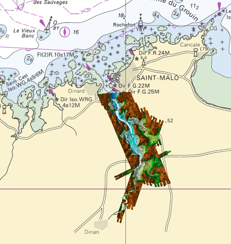
Lidar marine product is a unique and continuous land-sea database which can provide 3D models of the shape and location of french coastal terrain. Surveys are carried out by airborne lidar bathymetry over the sea side and airborne lidar topography over the land side up to 400m inland. This marine product is available in two formats: a set of 3D points and a qualified terrain mesh.
-
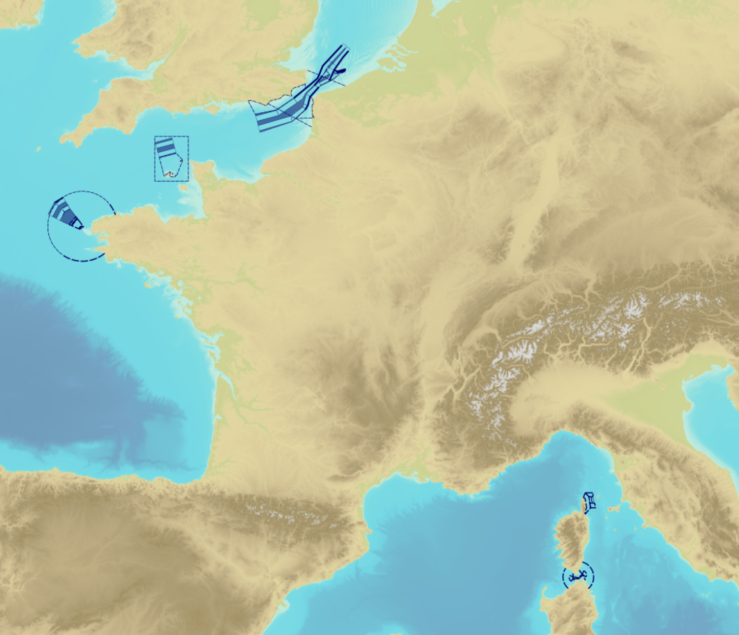
"Traffic Separation Schemes" product contains a description of TSS in French maritime spaces. A TSS is a routeing measure aimed at the separation of opposing streams of traffic by appropriate means and notably by the establishment of traffic lanes. The measures taken aim at improving navigation safety in areas where navigation is threatened by the density of traffic associated with various natural difficulties. Several classes of objects constitute this product, the acronyms used are those of IHO standard S-57: - Traffic separation scheme lane part (TSSLPT): area of a traffic lane in which the direction of flow of traffic is uniform; - Traffic separation scheme boundary (TSSBND): outer limit of a traffic lane part or a traffic separation scheme roundabout; - Traffic separation line (TSELNE): common boundary between two traffic lanes, or between one traffic lane and one inshore traffic zone; - Traffic separation zone (TSEZNE): separation areas between two traffic lanes, or between one traffic lane and one inshore traffic zone, or to the central area of a roundabout; - Inshore traffic zone (ISTZNE): area between the landward boundary of a traffic separation scheme and the adjacent coast; - Precautionary area (PRCARE): area, within defined limits, where ships must navigate with particular caution, and within which the direction of traffic flow may be recommended; - Deep water route part (DWRTPT): sections within which the flow of traffic either follows one defined direction for one-way traffic, or follows one defined direction and its reciprocal for two-way traffic. A deep-water route is a route in a designated area within defined limits which has been accurately surveyed for clearance of sea bottom and submerged obstacles to a minimum indicated depth of water; - Two-way route part (TWRTPT): sections within which traffic flows in two directions along one bearing and its reciprocal. These route parts are generally two-way, but some may be restricted to one-way traffic flow; - Radio calling-in line (RDOCAL_lne) : positions at which vessels are required to report to a traffic control centre.
-
Shom is the national referent for the level of the sea in situ on all areas under French jurisdiction. In this capacity, he assures under the acronym REFMAR different coordination functions in the collection and dissemination of public data related to water level observations, in order to promote their use in multiple applications within the framework of international recommendations.
-
"Aids ton navigation" product contains a description of landmarks, beaconage or buoyage, in the French Exclusive Economic Zone (EEZ).
-
Information layer containing the SAR Zones (Search and Rescue). This layer contains a description of the French search and rescue (SAR) areas and the location of the associated Maritime Rescue Coordination Center (MRCC). it covers the areas of responsibility of France. The layer was produced by the Shom pursuant to the Circular Circular of the International Maritime Organization (IMO No. SAR.8 / Circ.4 of 1 December 2012).