 Catalogue Shom
irregular
Type of resources
Available actions
Topics
Keywords
Provided by
Years
Formats
Representation types
Update frequencies
status
Scale
Resolution
-
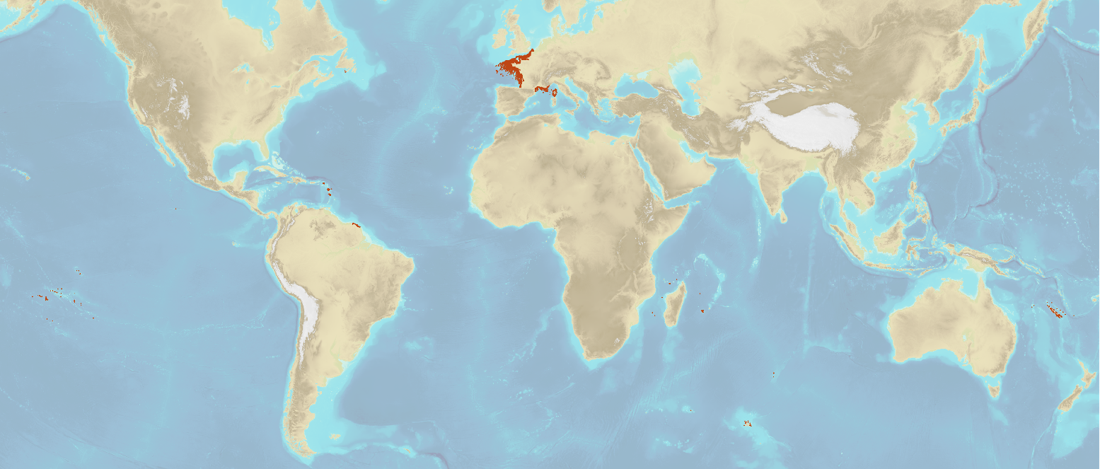
The “World Seabed Sediment Map” product contains geo-referenced digital data, describing the nature of the sediment encountered in different seas and oceans of the world. The objects are all surface areas and the description of an object includes in particular the nature of the sediment including rock-type bottoms.
-
<em>Surface current predictions computed from statistical values obtained from the IROISE 3D 2011 Telemac hydrodynamic model gridded with a regular 250m spatial resolution.</em><br /> <br /> This service offers a visualization of surface current predictions computed from statistical values obtained from a high resolution hydrodynamic simulation at mean Neap and Spring corresponding to a tide coefficient of respectively 45 and 95. Those statistics are then interpolated/extrapolated every 15 minutes (cubic spline), and for each tide coefficient from 20 to 120 (linear). The statistical currents, initially referenced to Brest high tide, are then referenced to the hour requested by the user using the tide prediction service <a href="http://maree.shom.fr" target="_blank">http://maree.shom.fr</a>. This service was built by Shom and funded by French CCI Métropolitaine Bretagne Ouest (<a href="https://www.bretagne-ouest.cci.bzh/" target="_blank">CCIMBO</a>) in the frame of the <a href="https://www.atlanticblueports.com" target="_blank">Atlantic Blue Port</a> project of <a href="http://www.atlanticarea.eu" target="_blank">Interreg Atlantic Area</a> european program.<br />
-
The product "Wrecks and obstructions" contains a description of wrecks and obstructions in the French Exclusive Economic Zone (EEZ) as 2D point objects. Objects of the product "Wrecks and obstructions" are divided into 2 classes: - Wrecks (WRECKS): all or part of a stranded or sunken ship or aircraft; - Obstructions (OBSTRN): object of an artificial nature other than a wreck (for example: container, lost anchor). This product does not concern floating or drifting objects (containers, debris, buoys out of position, ...) which position changes rapidly. <br /> February 17 2026 version
-
<em>Surface current predictions computed from statistical values obtained from the IROISE 3D 2011 Telemac hydrodynamic model gridded with a regular 30m spatial resolution.</em><br /> <br /> This service offers a visualization of surface current predictions computed from statistical values obtained from a high resolution hydrodynamic simulation at mean Neap and Spring corresponding to a tide coefficient of respectively 45 and 95. Those statistics are then interpolated/extrapolated every 15 minutes (cubic spline), and for each tide coefficient from 20 to 120 (linear). The statistical currents, initially referenced to Brest high tide, are then referenced to the hour requested by the user using the tide prediction service <a href="http://maree.shom.fr" target="_blank">http://maree.shom.fr</a>. This service was built by Shom and funded by French CCI Métropolitaine Bretagne Ouest (<a href="https://www.bretagne-ouest.cci.bzh/" target="_blank">CCIMBO</a>) in the frame of the <a href="https://www.atlanticblueports.com" target="_blank">Atlantic Blue Port</a> project of <a href="http://www.atlanticarea.eu" target="_blank">Interreg Atlantic Area</a> european program.<br />
-
<em>Surface current predictions computed from statistical values obtained from the IROISE 3D 2011 Telemac hydrodynamic model gridded with a regular 100m spatial resolution.</em><br /> <br /> This service offers a visualization of surface current predictions computed from statistical values obtained from a high resolution hydrodynamic simulation at mean Neap and Spring corresponding to a tide coefficient of respectively 45 and 95. Those statistics are then interpolated/extrapolated every 15 minutes (cubic spline), and for each tide coefficient from 20 to 120 (linear). The statistical currents, initially referenced to Brest high tide, are then referenced to the hour requested by the user using the tide prediction service <a href="http://maree.shom.fr" target="_blank">http://maree.shom.fr</a>. This service was built by Shom and funded by French CCI Métropolitaine Bretagne Ouest (<a href="https://www.bretagne-ouest.cci.bzh/" target="_blank">CCIMBO</a>) in the frame of the <a href="https://www.atlanticblueports.com" target="_blank">Atlantic Blue Port</a> project of <a href="http://www.atlanticarea.eu" target="_blank">Interreg Atlantic Area</a> european program.<br />
-
"Aids ton navigation" product contains a description of landmarks, beaconage or buoyage, in the French Exclusive Economic Zone (EEZ).
-
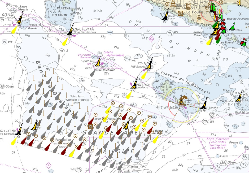
"Aids ton navigation" product contains a description of landmarks, beaconage or buoyage, in the French Exclusive Economic Zone (EEZ). <br /> February 17 2026 version
-
The product "Wrecks and obstructions" contains a description of wrecks and obstructions in the French Exclusive Economic Zone (EEZ) as 2D point objects. Objects of the product "Wrecks and obstructions" are divided into 2 classes: - Wrecks (WRECKS): all or part of a stranded or sunken ship or aircraft; - Obstructions (OBSTRN): object of an artificial nature other than a wreck (for example: container, lost anchor). This product does not concern floating or drifting objects (containers, debris, buoys out of position, ...) which position changes rapidly. <br /> February 17 2026 version
-
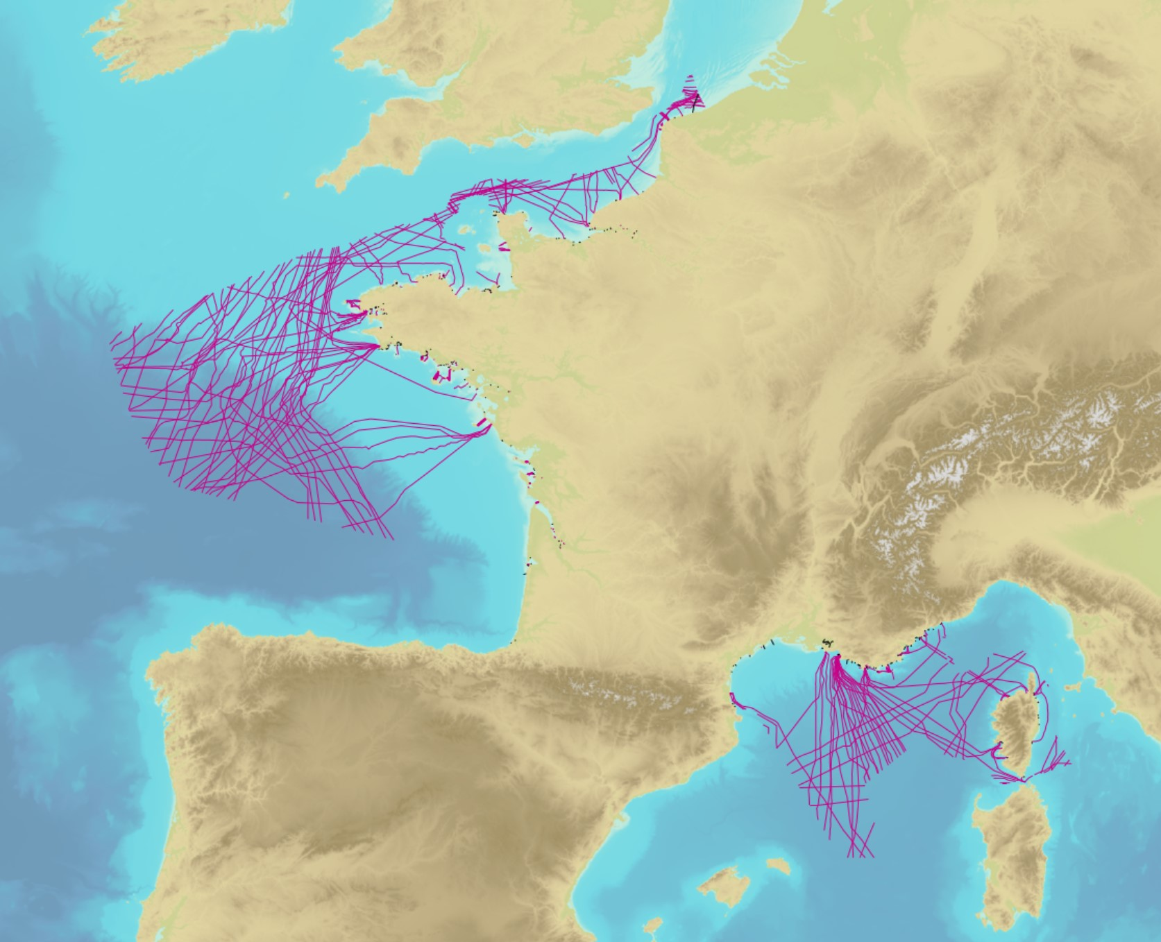
The product contains a description of submarine cables and pipelines brought to the attention of Shom on French areas of responsibility. These are 2D linear objects of the seabed that divide into two categories: • The submarine cables: these are cables placed on the seabed where electricity or information (telecommunication) flows. They represent the vast majority of objects (more than 90%); • Emissaries and submarine pipes: these are pipes that allow the discharge, sampling or circulation of fluids.
-
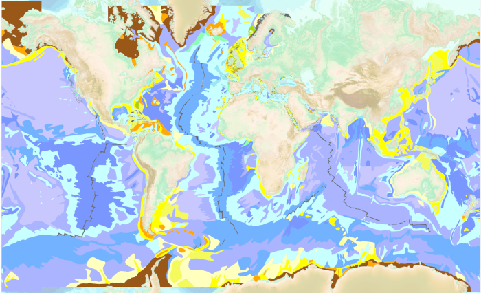
The “World Seabed Sediment Map” product contains geo-referenced digital data, describing the nature of the sediment encountered in different seas and oceans of the world. The objects are all surface areas and the description of an object includes in particular the nature of the sediment including rock-type bottoms.