 Catalogue Shom
150000
Type of resources
Available actions
Topics
Keywords
Provided by
Years
Formats
Representation types
Update frequencies
status
Scale
-
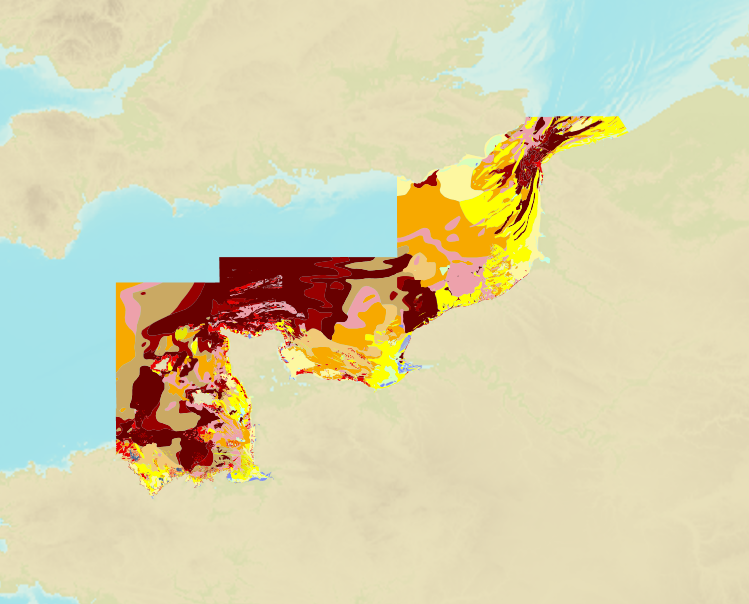
The product is a digital solution showing superficial sediments on the sea floor along coasts in mainland France.
-
Seamless Shom nautical charts - West Africa is a product composed of digital images taken from Shom nautical charts, with no additions, legends or georeferencing information. At a given scale, it is possible to view only the maps with a scale that allows a correct display. The footprint of all the maps composing this product are shown. Unless exceptional circumstances apply, this product is updated on a monthly basis and the modified grid squares are re-published, replacing the previous versions. All corrections, publications and editions with an effect on the reference nautical charts are taken into consideration.
-
Seamless Shom nautical charts - West Africa - EAtHC is a product composed of digital images taken from Shom nautical charts, with no additions, legends or georeferencing information. At a given scale, it is possible to view only the maps with a scale that allows a correct display. The footprint of all the maps composing this product are shown. Unless exceptional circumstances apply, this product is updated on a monthly basis and the modified grid squares are re-published, replacing the previous versions. All corrections, publications and editions with an effect on the reference nautical charts are taken into consideration.
-
Image numérique scannée non géoréférencée de la 3664 Date de publication : 1878 Date de révision : 1906 Support de l'original: papier Dimensions : 1079mm x 765mm Description : D'après le levé exécuté en 1874 par le capitaine H. C. Saint John de la Marine Royale anglaise. Les longitudes sont rapportées à celle de Yokohama(Mole de la douane japonaise) pour laquelle on adopte 137° 20' 18" Est. La longitude du même point est d'après le sanglais de 137° 18' 37.45". Nota : La partie de côte au Nord de la Baie Tamabé est empruntée à la carte de la Mer Intérieure. Par L. Manen, ingénieur hydrographe. Août 1887 : La longitude adoptée pour Yokohama Naval Hôpital Square étant 137° 19' 5" E, celle du Môle de la douane japonaise devient 137° 18' 35" E au lieu de 137° 20' 18" E, toutes les longitudes de cette carte doivent être diminuées de 0° 1' 43".
-
Carte marine imprimée N°6735 Pas de Calais - De Boulogne-sur-Mer à Zeebrugge - Estuaire de la Tamise (Thames)
-
Image numérique scannée non géoréférencée de la Spatiocarte 1997_11_01 Date de création : 1997 Support de l'original: Film polyester Dimensions : 743mm x 1040mm Description : BTI 150, rapport particulier 3/97 n° 262 EPSHOM/CH/GG/NP du 12/02/1997.
-
Nisos Chios and Izmir Körfezi; Aegean Sea - Greece and Türkiye; Cartes de cabotage; Édition 6 du 05/03/2026
-
Le produit Image numérique géoréférencée de carte marine est un fichier numérique, image de la carte marine imprimée correspondante du Shom ou de son (ses) cartouche(s), avec indications de géoréférencement et comprenant les mentions hors cadre.
-
Nísos Ios to Vrachonisída Kandelioússa; Aegean Sea - Greece; Cartes de cabotage; Édition 4 du 17/10/2024
-
Bristol Channel; England and Wales; Cartes de cabotage; Édition 6 du 14/09/2012