 Catalogue Shom
irregular
Type of resources
Available actions
Topics
Keywords
Provided by
Years
Formats
Representation types
Update frequencies
status
Scale
Resolution
-
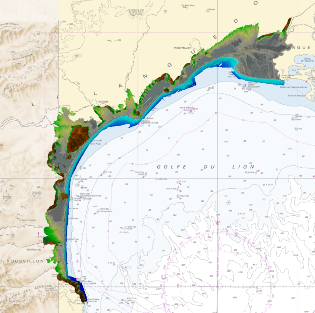
Litto3D is a unique and continuous land-sea database which can provide 3D models of the shape and location of French coastal terrain. A line separates sea and land data acquisition zones, and the associated survey readings obtained using bathymetric lidar technologies or multibeam echosounders for sea readings and airborne lidar topographical surveys for land readings, with 300 m overlap. Litto3D digital models are available in two formats: a set of 3D points and a qualified terrain mesh.
-

Litto3D is a unique and continuous land-sea database which provide 3D models of french coastal areas. Surveys are carried out by airborne lidar bathymetry over the sea side and airborne lidar topography over the land up to 2km inland. Litto3D digital models are available in two formats: a set of 3D points and a digital terrain model. The product "Litto3D - Brittany 2018-2021" covers the coastline and islands of Côtes d'Armor, Ille-et-Vilaine and Morbihan departments.
-
Litto3D is a unique and continuous land-sea database which can provide 3D models of the shape and location of French coastal terrain. A line separates sea and land data acquisition zones, and the associated survey readings obtained using bathymetric lidar technologies or multibeam echosounders for sea readings and airborne lidar topographical surveys for land readings, with 300 m overlap. Litto3D digital models are available in two formats: a set of 3D points and a qualified terrain mesh.
-

The « Maritime Spatial Planning » product contains 2D areas vector objects representing the extent of the maritime spatial plan (« MSP Spatial Plan » layer) and the extent of the corresponding vocation zones (« MSP Zoning Element » layer), defined in each strategic façade document.
-
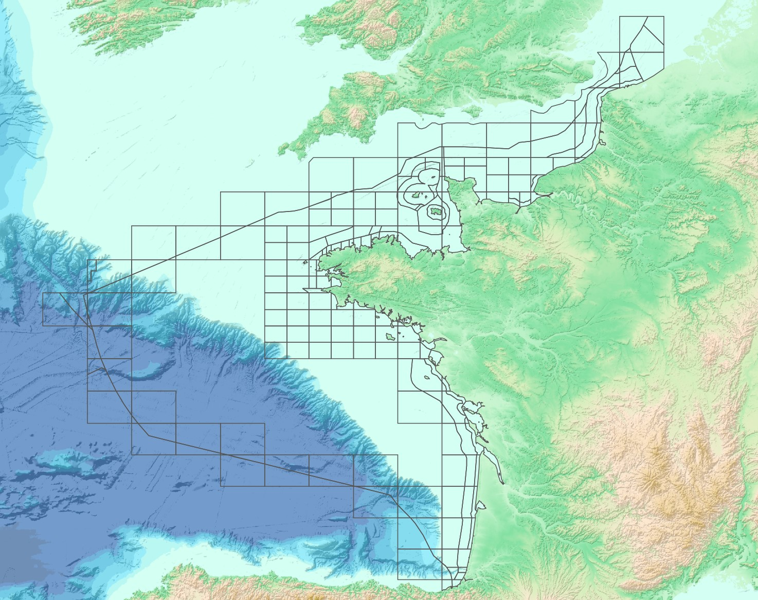
The “French sub-rectangles of the ICES fishery statistical rectangles” product contains 2D areas vector objects representing a sub-rectangle division of ICES statistical rectangles. Each product polygon belongs to an unique ICES rectangle. This subdivision enables distinction between overlapping areas in two or more EEZs, areas of functional interest and areas of regulatory interest.
-
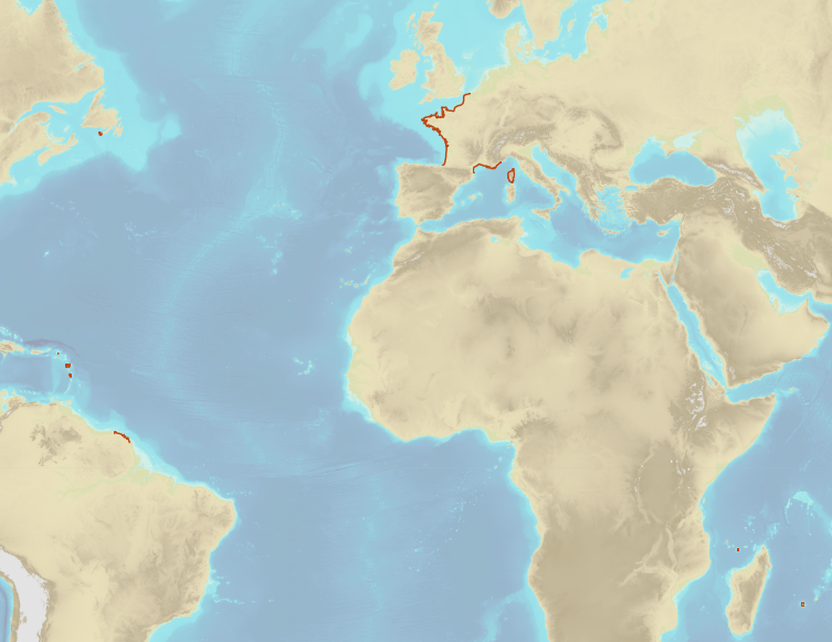
French Ministry of Culture / DRASSM – Shom The product "Limit of preventive archeology licence fee" contains the limits for the preventive archeology licence fee (1 nautical mile) as defined in the French Heritage Code. This limit is managed by the Department of Underwater Archeological Research (DRASSM) of the Ministry of Culture. This limit, defined by the Heritage Code at 1 nautical mile from the low-water line, permits to delineate the areas where the licence fee for preventive archeology at sea is applied. In Mainland France in the Gironde estuary, the limit for the preventive archeology licence fee is stopped by the crosswise limit of the sea as defined by the decree of 26 August 1857. In French Guiana, the limit for the preventive archeology licence fee is stopped in Maroni and Oyapock rivers by the crosswise limits of the sea respectively defined the order of 30 January 1991 and the order No 863 of 26 May 1986, until meeting the land boundary which delineates the rivers with the neighbouring States. The product "Limit of preventive archeology licence fee" is to use in addition to the digital product “Maritime Limits and Boundaries” of Shom (French: “Délimitations maritimes”) which represents the limits of the French maritime spaces of sovereignty or jurisdiction through the World. The product “Maritime Limits and Boundaries” (French: “Délimitations maritimes”) can be viewed on data.shom.fr (Maritime boundaries Category) and downloaded on the French national portal of maritime limits (https://maritimelimits.gouv.fr).
-
Litto3D is a unique and continuous land-sea database which can provide 3D models of the shape and location of French coastal terrain. A line separates sea and land data acquisition zones, and the associated survey readings obtained using bathymetric lidar technologies or multibeam echosounders for sea readings and airborne lidar topographical surveys for land readings, with 300 m overlap. Litto3D digital models are available in two formats: a set of 3D points and a qualified terrain mesh.
-
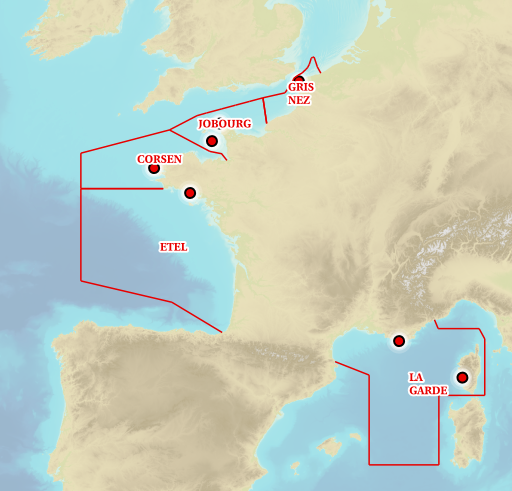
Information layer containing the SAR Zones (Search and Rescue). This layer contains a description of the French search and rescue (SAR) areas and the location of the associated Maritime Rescue Coordination Center (MRCC). it covers the areas of responsibility of France. The layer was produced by the Shom pursuant to the Circular Circular of the International Maritime Organization (IMO No. SAR.8 / Circ.4 of 1 December 2012).
-
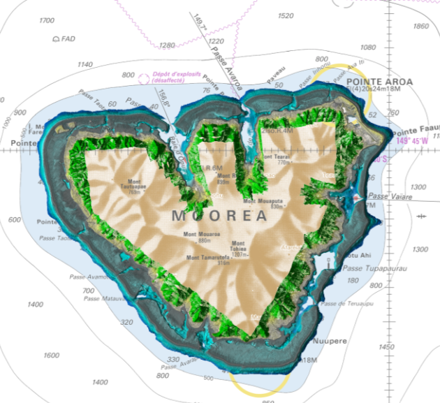
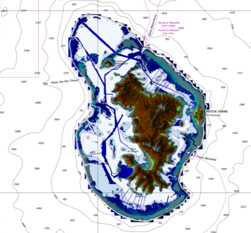
Lidar marine part is a unique and continuous land-sea database which can provide 3D models of the shape and location of French coastal terrain. A line separates sea and land data acquisition zones, and the associated survey readings obtained using bathymetric lidar technologies or multibeam echosounders for sea readings and airborne lidar topographical surveys for land readings, with 300 m overlap. Litto3D digital models are available in two formats: a set of 3D points and a qualified terrain mesh. The product Moorea 2015 v.20171015 covers the whole of Moorea.
-

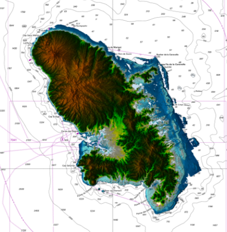
Litto3D Marine Part is an intermediate product of the Litto3D product containing only marine data.Litto3D is a unique and continuous land-sea database which can provide 3D models of the shape and location of French coastal terrain. A line separates sea and land data acquisition zones, and the associated survey readings obtained using bathymetric lidar technologies or multibeam echosounders for sea readings and airborne lidar topographical surveys for land readings, with 300 m overlap. Litto3D digital models are available in two formats: a set of 3D points and a qualified terrain mesh.