 Catalogue Shom
irregular
Type of resources
Available actions
Topics
Keywords
Provided by
Years
Formats
Representation types
Update frequencies
status
Scale
Resolution
-
The Tidal stream atlas netcdf product – Northern Brittany provides tidal current data for an area stretching from Tregastel at the east of the area to Porsguen at the west. The product consists of two gridded files with different spatial resolutions covering the Northern Brittany area (overall view at 500 m) and the geographical area of the port of Roscoff (250 m). The U and V velocities of the tidal currents depend on the tidal conditions considered at mean neap and spring tidal rates. The data are provided in m/s for the surface layer. The times are given in relation to high tide at the reference port chosen in the area and are provided from 6 hours before to 6 hours after that reference.
-
The Tidal stream atlas netcdf product – Strait of Dover provides tidal current data for an area stretching from the coast of Flanders east of Dunkirk to Saint-Valery-en-Caux. The product consists of four gridded files with different spatial resolutions covering the Strait of Dover area (overall view at 500 m) and the geographical areas of the ports of Dunkirk (250 m), Calais (250 m) and Boulogne-sur-Mer (250 m). The U and V velocities of the tidal currents depend on the tidal conditions considered at mean neap and spring tidal rates. The data are provided in m/s for the surface layer. The times are given in relation to high tide at the reference port chosen in the area and are provided from 6 hours before to 6 hours after that reference.
-

Litto3D is a unique and continuous land-sea database which can provide 3D models of the shape and location of French coastal terrain. A line separates sea and land data acquisition zones, and the associated survey readings obtained using bathymetric lidar technologies or multibeam echosounders for sea readings and airborne lidar topographical surveys for land readings, with 300 m overlap. Litto3D digital models are available in two formats: a set of 3D points and a qualified terrain mesh.
-
The Tidal stream atlas netcdf product provides tidal current data for an area stretching from the French coast, covering The English Channel and the Bay of Biscay. The product consists of gridded files with different spatial resolutions. The U and V velocities of the tidal currents depend on the tidal conditions considered at mean neap and spring tidal rates. The data are provided in m/s for the surface layer. The times are given in relation to high tide at the reference port chosen in the area and are provided from 6 hours before to 6 hours after that reference.
-
The Tidal stream atlas netcdf product – The Bay of Biscay provides tidal current data for an area stretching from Brittany to the northern coast of Spain. The product consists of a unique gridded file with 2 km spatial resolution covering the Bay of Biscay. The U and V velocities of the tidal currents depend on the tidal conditions considered at mean neap and spring tidal rates. The data are provided in m/s for the surface layer. The times are given in relation to high tide at the reference port chosen in the area and are provided from 6 hours before to 6 hours after that reference.
-
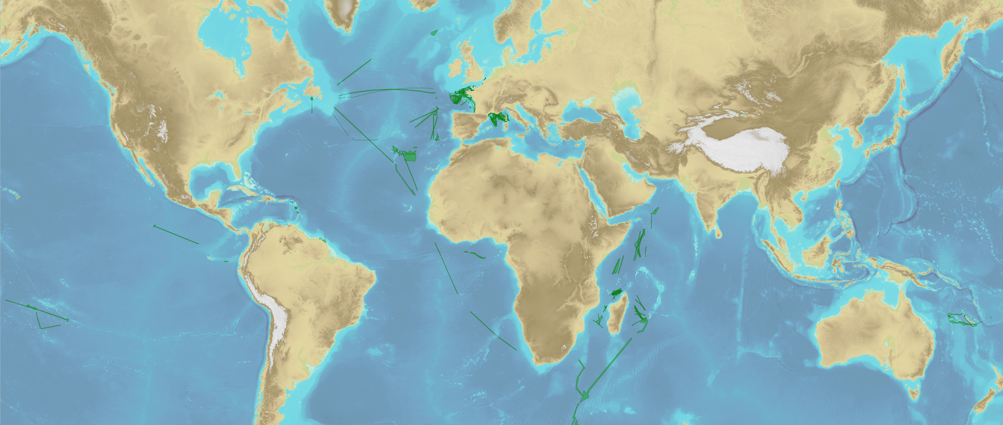
Bathymetric datasets are an extraction of surveys belonging to the Shom public database. For depth up to 50m, the vertical precision of soundings varies from 30cm to 1m and the horizontal precision varies from 1 to 20m. In deep ocean, the vertical precision is mainly around 1 or 2% of the bottom depth. It is sometimes more, it depends on the technology used. The data are referenced to ZH which is assimilated to LAT. Data are corrected for sound velocity variations. <br /> October 27 2025 version
-
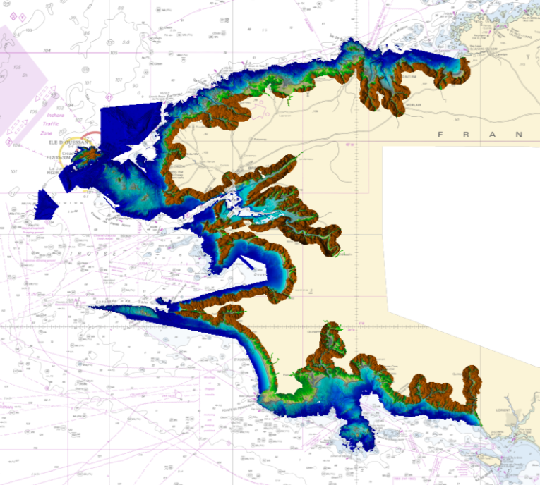
Litto3D is a unique and continuous land-sea database which can provide 3D models of the shape and location of French coastal terrain. A line separates sea and land data acquisition zones, and the associated survey readings obtained using bathymetric lidar technologies or multibeam echosounders for sea readings and airborne lidar topographical surveys for land readings, with 300 m overlap. Litto3D digital models are available in two formats: a set of 3D points and a qualified terrain mesh.
-
This service allows users to view surface tidal current predictions calculated from the analysis of a high-resolution hydrodynamic simulation projected onto a 30 m grid. This service was built by Shom and funded by French CCI Métropolitaine Bretagne Ouest in the frame of the Atlantic Blue Port project of <a href="https://www.atlanticarea.eu" target="_blank">Interreg Atlantic Area</a> european program.
-
This service allows users to view surface tidal current predictions calculated from the analysis of a high-resolution hydrodynamic simulation projected onto a 100 m grid. This service was built by Shom and funded by French CCI Métropolitaine Bretagne Ouest in the frame of the Atlantic Blue Port project of <a href="https://www.atlanticarea.eu" target="_blank">Interreg Atlantic Area</a> european program.
-
The Tidal stream atlas netcdf product – Western Brittany provides tidal current data for an area stretching from the northern coast of Brittany (Porsguen) to the south of Penmarc'h. The product consists of four gridded files with different spatial resolutions covering the Finistère area (overall view at 500 m) and the geographical areas of the Iroise Sea (250 m), Brest bay (100 m) and Brest harbour (30 m). The U and V velocities of the tidal currents depend on the tidal conditions considered at mean neap and spring tidal rates. The data are provided in m/s for the surface layer. The times are given in relation to high tide at the reference port chosen in the area and are provided from 6 hours before to 6 hours after that reference.