 Catalogue Shom
150000
Type of resources
Available actions
Topics
Keywords
Provided by
Years
Formats
Representation types
Update frequencies
status
Scale
-
Seamless Shom nautical charts - West Africa - EAtHC is a product composed of digital images taken from Shom nautical charts, with no additions, legends or georeferencing information. At a given scale, it is possible to view only the maps with a scale that allows a correct display. The footprint of all the maps composing this product are shown. Unless exceptional circumstances apply, this product is updated on a monthly basis and the modified grid squares are re-published, replacing the previous versions. All corrections, publications and editions with an effect on the reference nautical charts are taken into consideration.
-
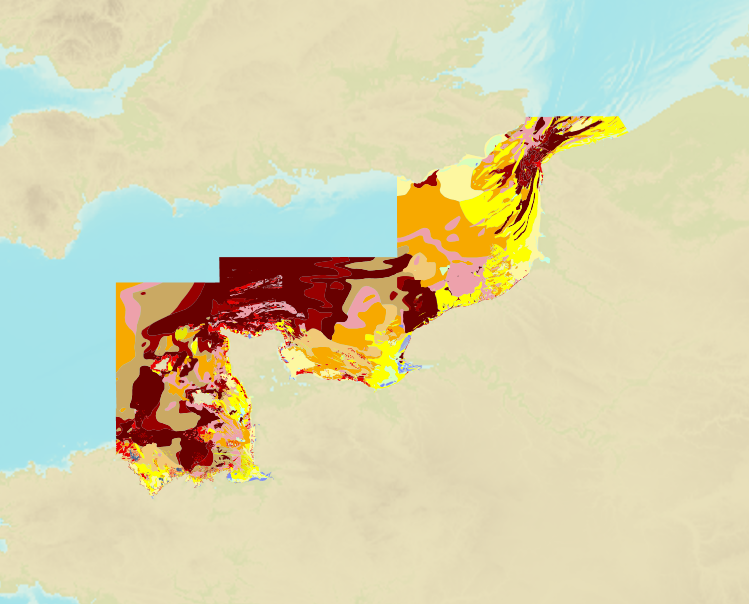
The product is a digital solution showing superficial sediments on the sea floor along coasts in mainland France.
-
Seamless Shom nautical charts - West Africa is a product composed of digital images taken from Shom nautical charts, with no additions, legends or georeferencing information. At a given scale, it is possible to view only the maps with a scale that allows a correct display. The footprint of all the maps composing this product are shown. Unless exceptional circumstances apply, this product is updated on a monthly basis and the modified grid squares are re-published, replacing the previous versions. All corrections, publications and editions with an effect on the reference nautical charts are taken into consideration.
-
Image numérique scannée non géoréférencée de la 2682 Date d'édition : 1955 Date de publication : 1868 Date de révision : 1960 Support de l'original: papier Dimensions : 820mm x 1061mm Description : Carte levée de 1839 à 1844 par M.M. Monnier, Le Bourguignon-Duperré et Bégat, ingénieurs hydrographes.
-
Portefeuille de complément, carte GB1503 Outer Dowsing to Smiths Knoll including Indefatigable Banks
Outer Dowsing to Smiths Knoll including Indefatigable Banks; England - East Coast; Cartes de cabotage; Édition 15 du 03/09/2026
-
Ra's Sharatib to Juzur Ashrafi; Red Sea - Egypt - Gulf of Suez; Cartes de cabotage; Édition 7 du 28/03/2024
-
Le produit Image numérique géoréférencée de carte marine est un fichier numérique, image de la carte marine imprimée correspondante du Shom ou de son (ses) cartouche(s), avec indications de géoréférencement et comprenant les mentions hors cadre.
-
Nísoi Voreioi Sporades; Aegean Sea - Greece; Cartes de cabotage; Édition 3 du 19/03/2020
-
Ra's Sharatib to Juzur Ashrafi; Red Sea - Egypt - Gulf of Suez; Cartes de cabotage; Édition 6 du 25/09/2019
-
Image numérique scannée non géoréférencée de la Spatiocarte 1997_11_01 Date de création : 1997 Support de l'original: Film polyester Dimensions : 743mm x 1040mm Description : BTI 150, rapport particulier 3/97 n° 262 EPSHOM/CH/GG/NP du 12/02/1997.