Assembled nautical charts (RasterMarine)
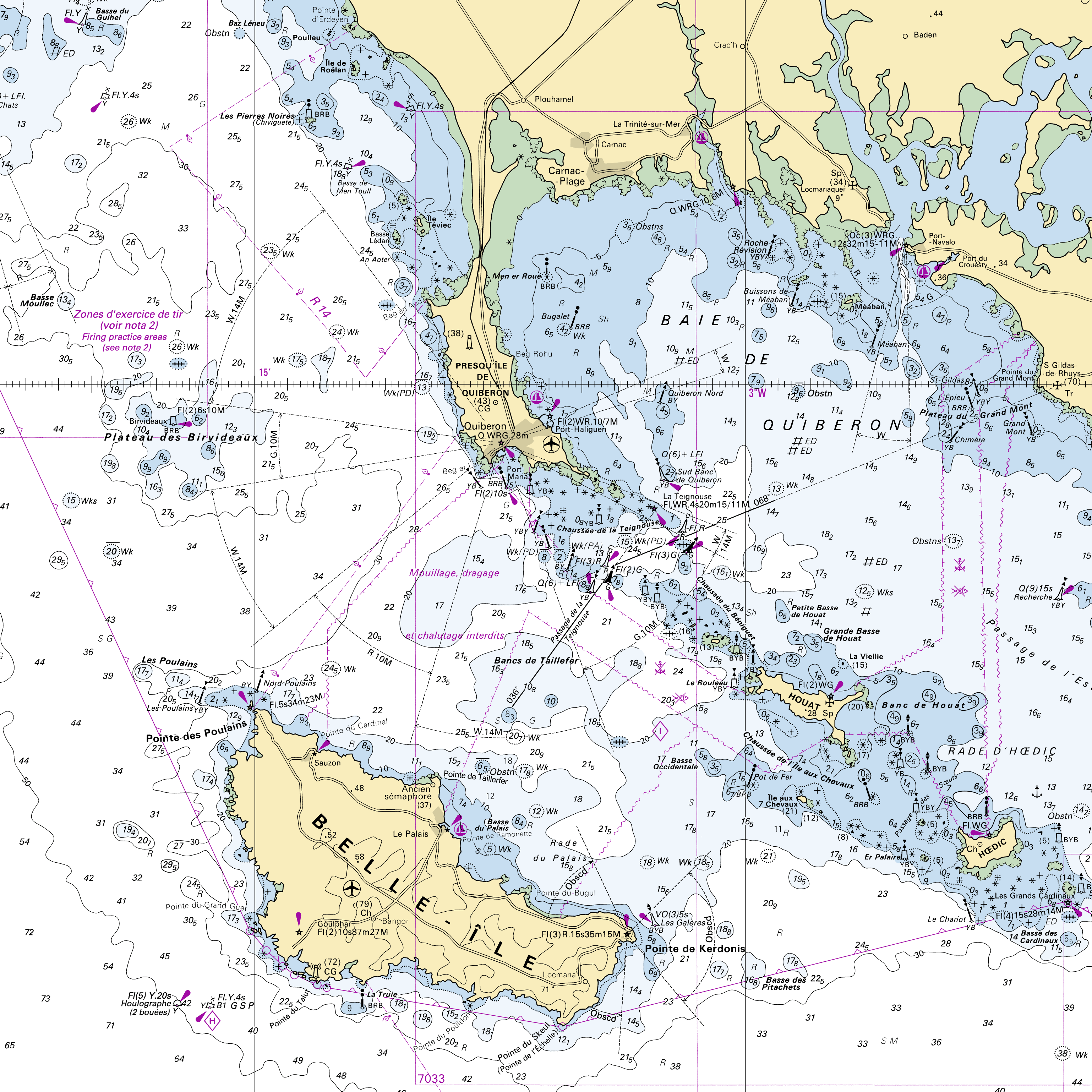
RasterMarine is a series of digital images taken from nautical charts, with no additions, legends or georeferencing information. The RasterMarine range is available at six sets of scales:
- RasterMarine10 1:10,000
- RasterMarine25 1:25,000
- RasterMarine50 1:50,000
- RasterMarine100 1:100,000
- RasterMarine350 1:350,000
- RasterMarine1M 1:1,000,000.
Unless exceptional circumstances apply, the RasterMarine range is updated on a weekly basis and the modified grid squares are re-published, replacing the previous versions. All corrections, publications, editions and suppressions with an effect on the reference nautical charts are taken into consideration.
<br />
16/07/2026 version
<br />
|
|
Citation proposal
. Assembled nautical charts (RasterMarine). https://services.data.shom.fr:/geonetwork/upload/api/records/CARTO_RASTER_MARINE.xml |
Simple
- Date ( Revision )
- 2026-07-16
- Identifier
- Credit
-
©Shom
Point of contact
- Maintenance and update frequency
- Weekly
- Keywords ( Theme )
-
-
nautical chart
-
raster
-
RasterMarine
-
Product
-
- Use limitation
-
Do not use for navigation.
- Use limitation
-
Fees apply to user rights for this data. A specific contract must be signed for the commercial re-use of data.
- Use limitation
-
Fees apply to user rights for this data. A specific contract must be signed for the commercial re-use of data.
- Access constraints
- Restricted
- Use constraints
- Restricted
- Other constraints
-
Decree No. 2016-1617 of 29 November 2016 on the categories of public information of the State and its public administrative institutions liable to be subject to the payment of a reuse fee (Art D. 324-5-1 ).
- Classification
- Unclassified
- Spatial representation type
- Grid
- Denominator
- 10000
- Denominator
- 25000
- Denominator
- 50000
- Denominator
- 100000
- Denominator
- 350000
- Denominator
- 1000000
- Metadata language
- fre French
- Character set
- ut8 UTF8
- Topic category
-
- Oceans
- Imagery base maps earth cover
))
- Supplemental Information
-
The RasterMarine range is broken down into 0.1° x 0.1° grid squares for the RasterMarine10, 0.2° x 0.2° grid squares for the RasterMarine25, 0.4° x 0.4° grid squares for the RasterMarine50, 0.8° x 0.8° grid squares for the RasterMarine100, 4° x 4° grid squares for the RasterMarine350 and 20° x 20° grid squares for the RasterMarine1M.
- Distribution format
-
-
GeoTIFF
(1.0
)
-
Distributor
- OnLine resource
-
Shom geoportal
Shom geoportal
- OnLine resource
-
Shom marketplace
Shom marketplace
- Hierarchy level
- Series
- Statement
-
The RasterMarine range comprises raster solutions, based on georeferenced nautical charts at a coherent range of scales, assembled for each selected geographic scope and grid square size.
Metadata
- File identifier
- CARTO_RASTER_MARINE.xml XML
- Metadata language
- fre French
- Character set
- UTF8
- Hierarchy level
- Series
- Hierarchy level name
-
Collection de données
- Date stamp
- 2026-07-16T07:22:46
- Metadata standard name
-
ISO 19115:2003/19139
- Metadata standard version
-
1.0
Point of contact
Overviews
Provided by