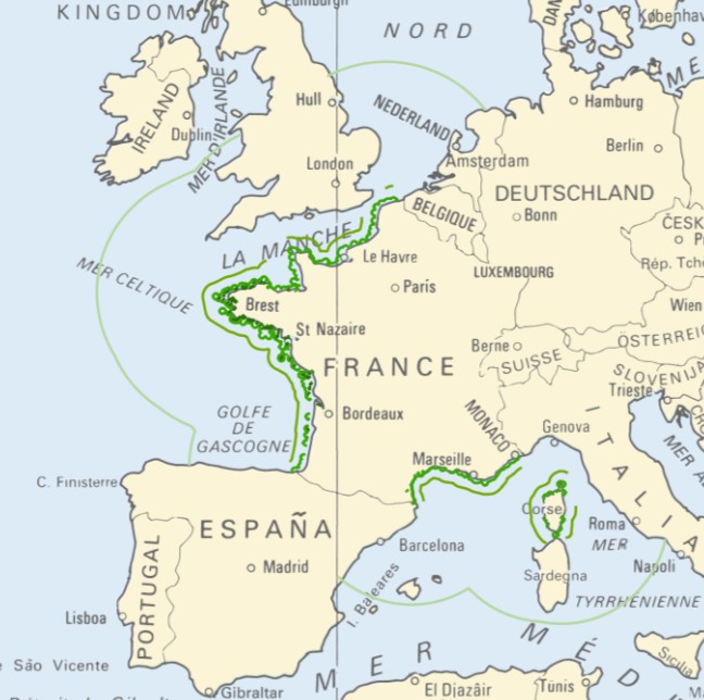
Navigation categories for professional ships
<strong>This data is not up to date with the order dated 30 August 2021 amending the order dated 23 November 1987 on ship safety, which now raises the limit for category 4 ships to 5 miles from the nearest coast.</strong> The navigation category allocated to a ship is indicated on its shipping license, together with any applicable restrictions. This limit was produced by Shom in application of section II.14 of article 1 of decree no. 84-810 amended on 30 August 1984. Navigation categories are defined in article 110.10 of the rules appended to the order of 23 November 1987 on shipping safety.
|
|
Citation proposal
(2016) . Navigation categories for professional ships. https://services.data.shom.fr:/geonetwork/administration/api/records/BDML_DAM_LIMITE_CAT_NAVIGATION.xml |
Simple
- Date ( Publication )
- 2016-07-29
- Credit
-
©Shom
- Maintenance and update frequency
- As needed
- Keywords ( Theme )
-
-
navigation category
-
limit
-
regulation
-
product
-
open data
-
- Use limitation
-
Data free of use by acknowledging its source. Open licence Etalab v. 2.0 avril 2017.
- Use limitation
-
Do not use for navigation
- Use limitation
-
Data free of use by acknowledging its source. Open licence Etalab v. 2.0 avril 2017.
- Use limitation
-
Do not use for navigation
- Access constraints
- License
- Use constraints
- Other restrictions
- Other constraints
- Licence Ouverte version 2.0 Open Licence version 2.0
- Access constraints
- Other restrictions
- Other constraints
- Pas de restriction d'accès public. No public access restrictions.
- Classification
- Unclassified
- Spatial representation type
- Vector
- Denominator
- 25000
- Metadata language
- fre French
- Character set
- utf8 UTF8
- Topic category
-
- Boundaries
- Oceans
- Description
-
France
))
- Distribution format
-
-
SHP
(-
)
-
Distributor
- OnLine resource
-
Shom Geoportal
Shom Geoportal
- OnLine resource
- DAM_LIMIT_CAT_NAVIGATION_WMSR
- OnLine resource
- DAM_LIMIT_CAT_NAVIGATION_WFS:categorie2_lines_3857
- OnLine resource
- DAM_LIMIT_CAT_NAVIGATION_WFS:categorie3_lines_3857
- OnLine resource
- DAM_LIMIT_CAT_NAVIGATION_WFS:categorie4_lines_3857
- OnLine resource
- DAM_LIMIT_CAT_NAVIGATION_WFS:categorie5_lines_3857
- OnLine resource
- Download service
- Hierarchy level
- Series
- Statement
-
The digitalised geographic data was produced in application of section II.14 of article 1 of decree no. 84-810 amended on 30 August 1984. Navigation categories are defined in article 110.10 of the rules appended to the order of 23 November 1987 on shipping safety.
Metadata
- File identifier
- BDML_DAM_LIMITE_CAT_NAVIGATION.xml XML
- Metadata language
- French
- Character set
- UTF8
- Hierarchy level
- Dataset
- Hierarchy level name
-
Produit
- Date stamp
- 2021-10-19T17:10:15
- Metadata standard name
-
ISO 19115:2003/19139
- Metadata standard version
-
1.0
Publisher
Overviews
Provided by
