Maritime ship classes
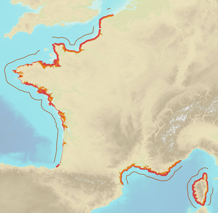
Limits defining ship classes based on their assigned operating maritime zones. These limits were produced by CEREMA in application of section II.14 of article 1 of decree no. 200945 amended on 30 August 1984. Navigation categories are defined in article 223.2 of the rules appended to the order of 23 November 1987 on shipping safety.
|
|
Citation proposal
(2016) . Maritime ship classes. https://services.data.shom.fr:/geonetwork/WebService/api/records/BDML_DAM_CLASS_ZONES_MAR.xml |
Simple
- Date ( Publication )
- 2016-07-29
- Identifier
- Credit
-
@CEREMA
- Maintenance and update frequency
- As needed
- Keywords ( Theme )
-
-
maritime classes
-
limit
-
regulation
-
product
-
open data
-
- Use limitation
-
Data free of use by acknowledging its source. Open licence Etalab v. 2.0 avril 2017.
- Use limitation
-
Do not use for navigation
- Use limitation
-
Data free of use by acknowledging its source. Open licence Etalab v. 2.0 avril 2017.
- Use limitation
-
Do not use for navigation
- Access constraints
- License
- Use constraints
- Other restrictions
- Other constraints
- Licence Ouverte version 2.0 Open Licence version 2.0
- Access constraints
- Other restrictions
- Other constraints
- Pas de restriction d'accès public. No public access restrictions.
- Classification
- Unclassified
- Spatial representation type
- Vector
- Denominator
- 25000
- Metadata language
- fre French
- Character set
- utf8 UTF8
- Topic category
-
- Boundaries
- Oceans
- Description
-
France métropolitaine
))
- Distribution format
-
-
SHP
(-
)
-
Distributor
- OnLine resource
-
Shom Geoportal
Shom Geoportal
- OnLine resource
- DAM_CLASS_ZONES_MAR_WMSR
- OnLine resource
- DAM_CLASS_ZONES_MAR_WFS:classeb_lines_3857
- OnLine resource
- DAM_CLASS_ZONES_MAR_WFS:classec_polygone_3857
- OnLine resource
- DAM_CLASS_ZONES_MAR_WFS:classed_polygone_3857
- OnLine resource
- Download service
- Hierarchy level
- Series
- Statement
-
The digitalised geographic data was produced in application of directive 2009/45/EC. Maritime zone classes are defined in article 223.2 of the rules appended to the order of 23 November 1987 on shipping safety.
Metadata
- File identifier
- BDML_DAM_CLASS_ZONES_MAR.xml XML
- Metadata language
- French
- Character set
- UTF8
- Hierarchy level
- Dataset
- Hierarchy level name
-
Produit
- Date stamp
- 2019-09-16T17:10:15
- Metadata standard name
-
ISO 19115:2003/19139
- Metadata standard version
-
1.0
Publisher
Overviews
Provided by