 Catalogue Shom
Type of resources
Available actions
Topics
Keywords
Contact for the resource
Provided by
Years
Formats
Representation types
Update frequencies
status
Service types
Scale
Resolution
-

Bathymetric datasets are an extraction of surveys belonging to the Shom public database. For depth up to 50m, the vertical precision of soundings varies from 30cm to 1m and the horizontal precision varies from 1 to 20m. In deep ocean, the vertical precision is mainly around 1 or 2% of the bottom depth. It is sometimes more, it depends on the technology used. The data are referenced to 003 France - Brest (ZH) which is assimilated to LAT. Data are corrected for sound velocity variations. Data are acquired during the campaign S201504200 (http://dx.doi.org/10.17183/S201504200). // Instruments: Sondeur Multifaisceaux Simrad EM710 // Number of soundings: 1929939 // DOI: http://dx.doi.org/10.17183/LOTS_BATHY#S201504200-005
-

Bathymetric datasets are an extraction of surveys belonging to the Shom public database. For depth up to 50m, the vertical precision of soundings varies from 30cm to 1m and the horizontal precision varies from 1 to 20m. In deep ocean, the vertical precision is mainly around 1 or 2% of the bottom depth. It is sometimes more, it depends on the technology used. The data are referenced to 057 France - Sein (ile) Nord (ZH) which is assimilated to LAT. Data are corrected for sound velocity variations. Data are acquired during the campaign S196900100 (http://dx.doi.org/10.17183/S196900100). // Instruments: Sondeur KELVIN-HUGHES // Number of soundings: 1005 // DOI: http://dx.doi.org/10.17183/LOTS_BATHY#S196900100-017
-

Bathymetric datasets are an extraction of surveys belonging to the Shom public database. For depth up to 50m, the vertical precision of soundings varies from 30cm to 1m and the horizontal precision varies from 1 to 20m. In deep ocean, the vertical precision is mainly around 1 or 2% of the bottom depth. It is sometimes more, it depends on the technology used. The data are referenced to 057 France - Sein (ile) Nord (ZH) which is assimilated to LAT. Data are corrected for sound velocity variations. Data are acquired during the campaign S198400400 (http://dx.doi.org/10.17183/S198400400). // Instruments: Perche topographique // Number of soundings: 1 // DOI: http://dx.doi.org/10.17183/LOTS_BATHY#S198400400-003
-

Bathymetric datasets are an extraction of surveys belonging to the Shom public database. For depth up to 50m, the vertical precision of soundings varies from 30cm to 1m and the horizontal precision varies from 1 to 20m. In deep ocean, the vertical precision is mainly around 1 or 2% of the bottom depth. It is sometimes more, it depends on the technology used. The data are referenced to 254 Nouvelle Caledonie - Poro (ZH) which is assimilated to LAT. Data are corrected for sound velocity variations. Data are acquired during the campaign S201402600 (http://dx.doi.org/10.17183/S201402600). // Instruments: Sondeur monofaisceau Simrad EA400, Sonal type cmax-cm2 // Number of soundings: 1395317 // DOI: http://dx.doi.org/10.17183/LOTS_BATHY#S201402600-02
-
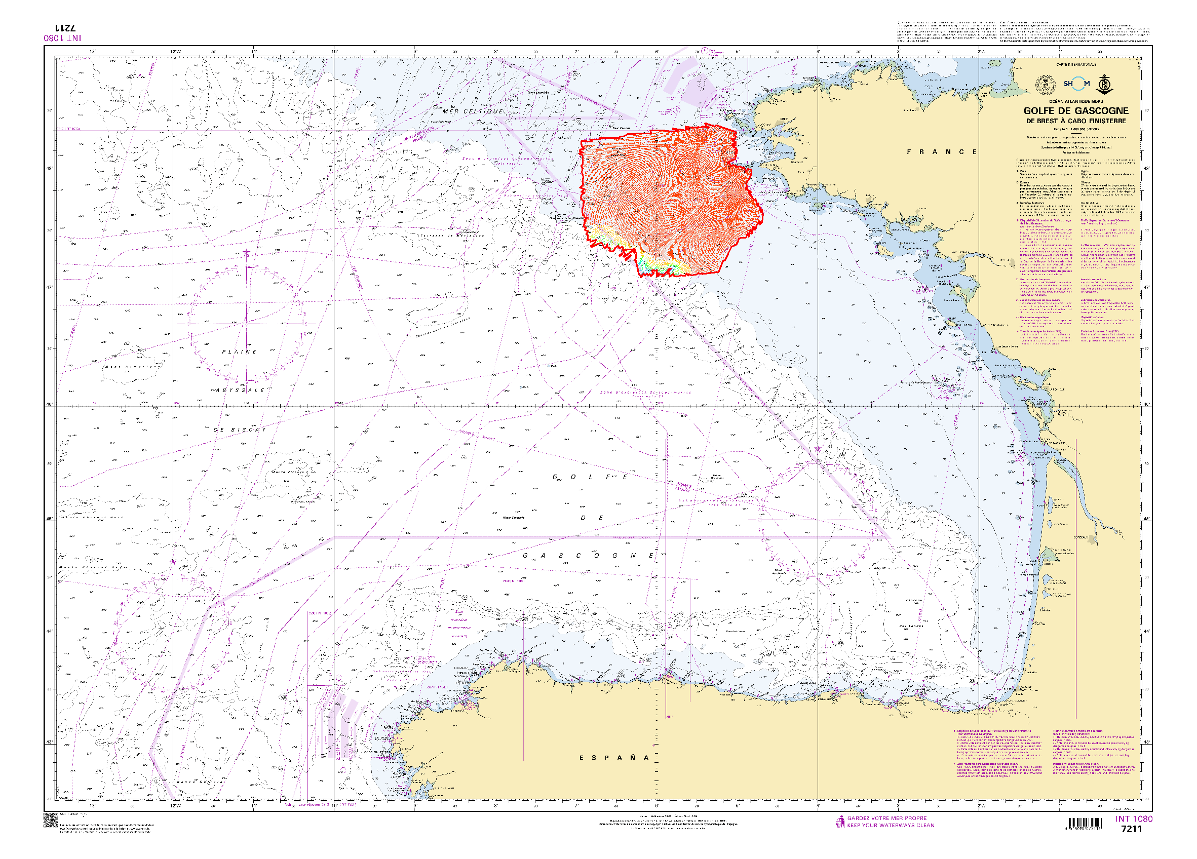
Bathymetric datasets are an extraction of surveys belonging to the Shom public database. For depth up to 50m, the vertical precision of soundings varies from 30cm to 1m and the horizontal precision varies from 1 to 20m. In deep ocean, the vertical precision is mainly around 1 or 2% of the bottom depth. It is sometimes more, it depends on the technology used. The data are referenced to ZH which is assimilated to LAT. Data are corrected for sound velocity variations. Data are acquired during the campaign S196500200 (http://dx.doi.org/10.17183/S196500200). // Instruments: sondeur kelvin-hughes // Number of soundings: 109078
-

Bathymetric datasets are an extraction of surveys belonging to the Shom public database. For depth up to 50m, the vertical precision of soundings varies from 30cm to 1m and the horizontal precision varies from 1 to 20m. In deep ocean, the vertical precision is mainly around 1 or 2% of the bottom depth. It is sometimes more, it depends on the technology used. The data are referenced to 068 France - Toulon (ZH) which is assimilated to LAT. Data are acquired during the campaign S201500400 (http://dx.doi.org/10.17183/S201500400). // Instruments: Lidar HawkEye III // Number of soundings: 1589105 // DOI: http://dx.doi.org/10.17183/LOTS_BATHY#S201500400-005
-

Bathymetric datasets are an extraction of surveys belonging to the Shom public database. For depth up to 50m, the vertical precision of soundings varies from 30cm to 1m and the horizontal precision varies from 1 to 20m. In deep ocean, the vertical precision is mainly around 1 or 2% of the bottom depth. It is sometimes more, it depends on the technology used. The data are referenced to 057 France - Sein (ile) Nord (ZH) which is assimilated to LAT. Data are corrected for sound velocity variations. Data are acquired during the campaign S192900600 (http://dx.doi.org/10.17183/S192900600). // Instruments: Sondeur ultra-sons // Number of soundings: 1873 // DOI: http://dx.doi.org/10.17183/LOTS_BATHY#S192900600-10
-
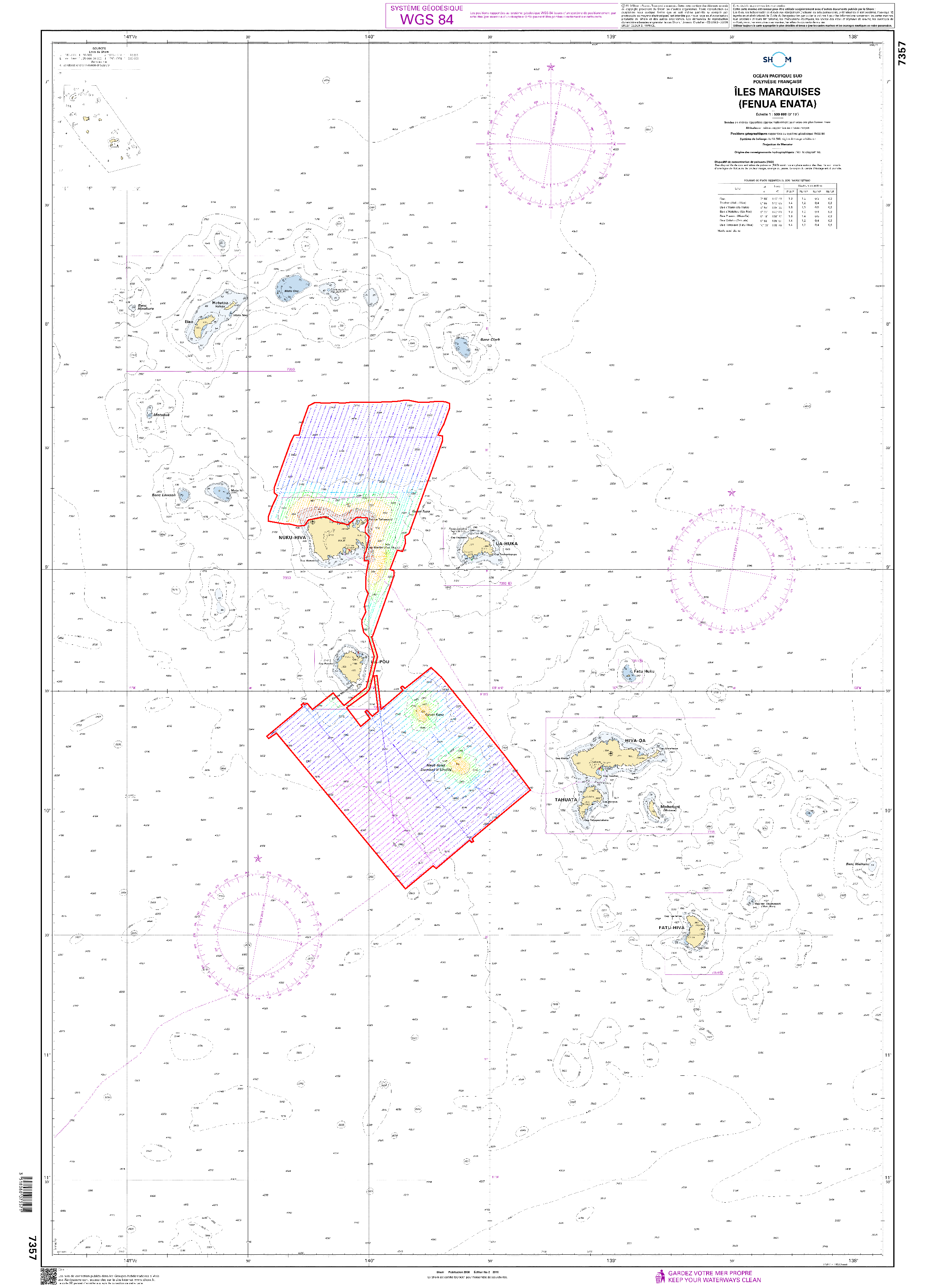
Bathymetric datasets are an extraction of surveys belonging to the Shom public database. For depth up to 50m, the vertical precision of soundings varies from 30cm to 1m and the horizontal precision varies from 1 to 20m. In deep ocean, the vertical precision is mainly around 1 or 2% of the bottom depth. It is sometimes more, it depends on the technology used. The data are referenced to ZH which is assimilated to LAT. Data are corrected for sound velocity variations. Data are acquired during the campaign S199202900 (http://dx.doi.org/10.17183/S199202900). // Instruments: sondeur raytheon // Number of soundings: 9327
-

Bathymetric datasets are an extraction of surveys belonging to the Shom public database. For depth up to 50m, the vertical precision of soundings varies from 30cm to 1m and the horizontal precision varies from 1 to 20m. In deep ocean, the vertical precision is mainly around 1 or 2% of the bottom depth. It is sometimes more, it depends on the technology used. The data are referenced to 057 France - Sein (ile) Nord (ZH) which is assimilated to LAT. Data are corrected for sound velocity variations. Data are acquired during the campaign S192400100 (http://dx.doi.org/10.17183/S192400100). // Instruments: Plomb de sonde, Perche topographique // Number of soundings: 498 // DOI: http://dx.doi.org/10.17183/LOTS_BATHY#S192400100-013
-

Bathymetric datasets are an extraction of surveys belonging to the Shom public database. For depth up to 50m, the vertical precision of soundings varies from 30cm to 1m and the horizontal precision varies from 1 to 20m. In deep ocean, the vertical precision is mainly around 1 or 2% of the bottom depth. It is sometimes more, it depends on the technology used. The data are referenced to 057 France - Sein (ile) Nord (ZH) which is assimilated to LAT. Data are corrected for sound velocity variations. Data are acquired during the campaign S198400300 (http://dx.doi.org/10.17183/S198400300). // Instruments: Sondeur DESO 10 // Number of soundings: 1117 // DOI: http://dx.doi.org/10.17183/LOTS_BATHY#S198400300-003