 Catalogue Shom
500000
Type of resources
Available actions
Topics
Keywords
Provided by
Years
Formats
Representation types
Update frequencies
status
Scale
-
The “World Seabed Sediment Map” product contains geo-referenced digital data, describing the nature of the sediment encountered in different seas and oceans of the world. The objects are all surface areas and the description of an object includes in particular the nature of the sediment including rock-type bottoms.
-
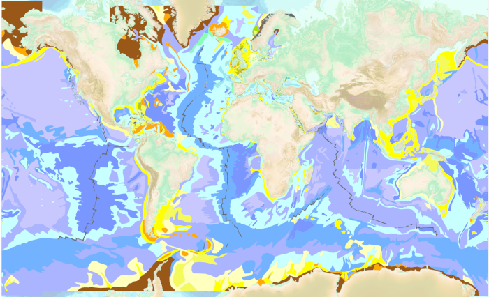
The “World Seabed Sediment Map” product contains geo-referenced digital data, describing the nature of the sediment encountered in different seas and oceans of the world. The objects are all surface areas and the description of an object includes in particular the nature of the sediment including rock-type bottoms.
-
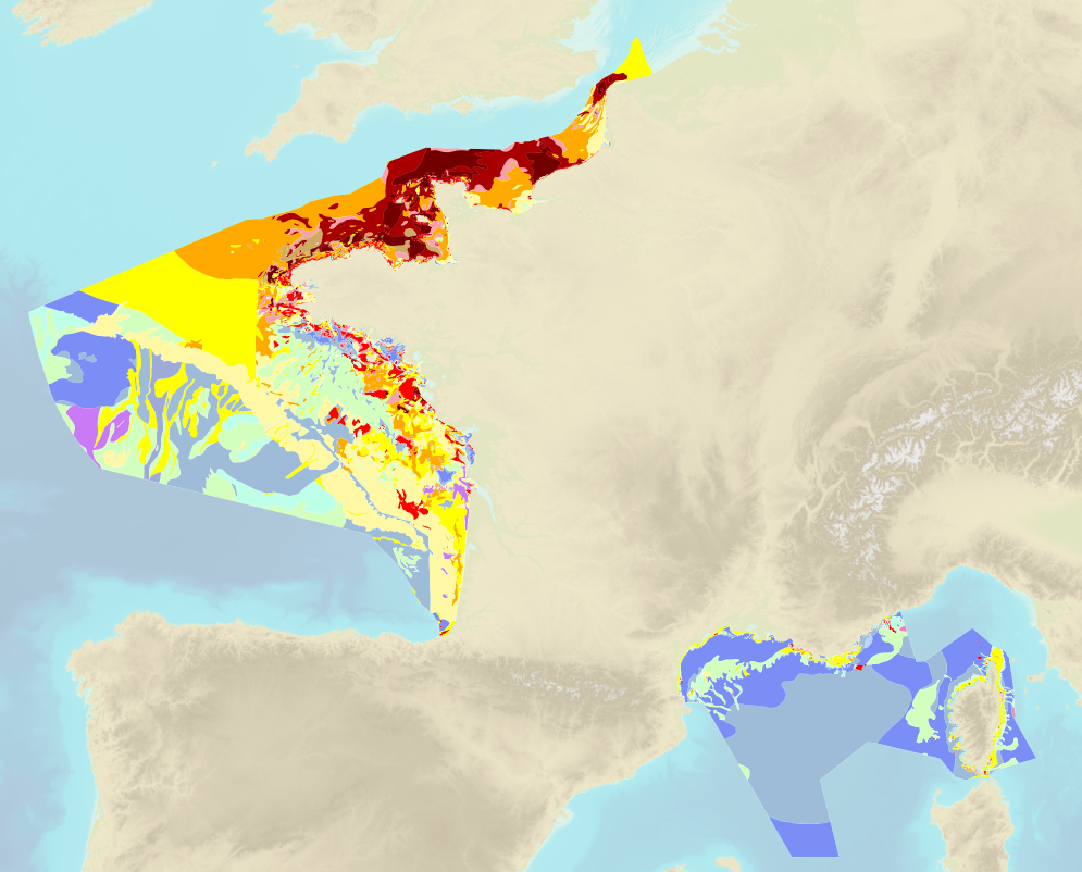
Sea bed sediment maps for the 4 marine sub-regions prepared as part of the initial evaluation of the MSFD (Marine Strategy Framework Directive).
-
Luzon Strait; Philippine Islands and Taiwan; Édition 2 du 09/10/2019
-
Cap Afrique to Misratah; Mediterranean Sea - Tunisia and Libya; Routiers et planisphères; Édition 5 du 04/04/2014
-
Le produit Image numérique géoréférencée de carte marine est un fichier numérique, image de la carte marine imprimée correspondante du Shom ou de son (ses) cartouche(s), avec indications de géoréférencement et comprenant les mentions hors cadre.
-
Irish Sea with Saint George's Channel and North Channel; United Kingdom and Ireland; Cartes d'atterrissage; Édition 8 du 02/01/2020
-
Amami-O Shima to Kagoshima Wan; Japan - Nansei Shoto; Cartes d'atterrissage; Édition 4 du 30/07/2026
-
Punta Francés to Punta Maria Aguilar including Cayman Ridge; Cuba - South Coast; Cartes d'atterrissage; Édition 1 du 15/06/2017
-
Pulau Rondo to Tanjung Jamboaye; Indonesia and Thailand; Cartes d'atterrissage; Édition 2 du 12/06/2019